Flysch and Tafoni in Tarifa
Bienvenido a Tarifa!
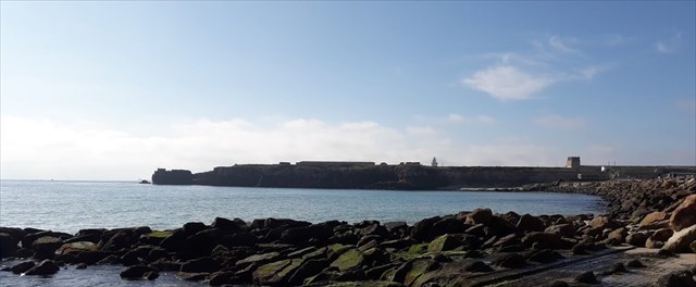
Mientras caminas hacia el punto más al sur de Europa, también puedes tomarte tu tiempo para visitar este rincón de la Tierra. Ve a las coordenadas dadas (puede que tengas que vadear allí, dependiendo de la marea). Encontrará una meseta con filas de "rocas". Ahora es su momento para investigar esta área!
“Flysch” es una secuencia de capas de roca sedimentaria que progresa desde depósitos de flujo de agua profunda y turbidez hasta pizarras y areniscas de aguas poco profundas. Se deposita cuando una cuenca profunda se forma rápidamente en el lado continental de construcción de una montaña. Un flujo de turbidez es típicamente un flujo subacuático de agua que normalmente se mueve rápidamente, cargada de sedimentos, bajando por una pendiente. Pueden ser descritas como el equivalente submarino de las avalanchas. A medida que los sedimentos transportados se depositan en las capas (o Flysches - esta palabra es la asesina en Scrabble! ).
"Tafoni" (singular: Tafone) se definen comúnmente como pequeños (menos de 1 cm) a grandes (más de 1 metro) rasgos similares a cuevas que se desarrollan en forma natural, vertical a muy inclinada, exposiciones de roca granular (es decir, granito, arenisca) con paredes cóncavas lisas, y a menudo con bordes redondeados y aberturas. El origen de estos Tafoni aún no está claro, pero se pueden encontrar en zonas ricas en sales que alternan entre condiciones húmedas y secas.
Sus tareas a responder:
A. ¿Cuál es la distancia entre las filas de Rocas Tafoni?
Sólo forma un promedio entre las líneas de las rocas. ¿Cuál es la más ancha, cuál la más estrecha?
B. ¿Cuál es el grosor de las capas dentro de los Flyschs?
Tome una regla y mida estas, de lo contrario tome una moneda o algo similar, colóquela ^ en las capas y tome una foto. Compárelo con una regla más adelante y dígame el grosor.
C. ¿Por qué crees que estas rocas sobresalen de la caliza sedimentaria?
Haga una pequeña investigación, Wikipedia podría ayudar, si no fuera suficiente podría ser un buen recurso consultar también Wikipedia en inglés.
D. Describa la superficie del Tafoni.
Describa la textura, el tamaño y el color
E. Siéntete libre de añadir una foto tuya, de tu GPS o de tu mascota en las coordenadas.
Primero envíeme las respuestas, luego puede escribir su registro de inmediato!
Espero que lo disfruten!
Welcome to Tarifa!
As you are walking to the most southern Point of Europe you may also take your time to visit this EarthCache. Go to the given coordinates (you may have to wade there, depending on the Tide). You'll find a plateau with rows of "rocks". Now it is your term to investigate this area!
Flysch is a sequence of sedimentary rock layers that progress from deep-water and turbidity flow deposits to shallow-water shales and sandstones. It is deposited when a deep basin forms rapidly on the continental side of a mountain building episode. A turbidity flow is most typically an underwater flow of usually rapidly moving, sediment-laden water moving down a slope. They can be discribed as the submarine Equivalent of Avalanches. As the carried sediments settle the layers (or Flysches - this word is the killer in Scrabble!

) are formed.
Tafoni (singular: Tafone) are commonly defined as small (less than 1 cm) to large (greater than 1 meter) cave-like features that develop in natural, vertical to steeply sloping, exposures of granular rock (i.e., granite, sandstone) with smooth concave walls, and often round rims and openings. The origin of these Tafoni is still unclear, yet they can be found in salt-rich areas which are alternating between wet and dry conditions.
Your tasks to answer:
A. What is the distance between the rows of Tafoni-Rocks?
Just form an average between the lines of rocks. What is the widest, which the narrowest?
B. What is the thickness of the layers within the Flyschs?
Take a ruler and measure is, otherwise take a coin or something similar, place it on the layers and take a picture. Compare it with a ruler later on and name me the thickness.
C. Why do you think these rocks are standing out from the sedimentary limestone?
Make a little research, the English Wikipedia might be a good resource.
D. Describe the surface of the Tafoni.
Describe the texture, the size and colour
E. Please add a Picture of yourself, your GPS or your mascot at the coordinates.
Please send the answers to me via my profile! Afterwards you can log right away!
I hope you enjoy this EarthCache!