Coastal Range, and adjacent Woakwine Range, situated 10–15 km inland, are the most southwesterly and youngest of a series of parallel, low altitude, beach-dune barriers formed by changes in sea level during the Pleistocene age, 2.6 MYA to 12,000 YA. These older coastal barriers lie roughly parallel to each other and to the modern coastline, increasing in age inland away from the coast.
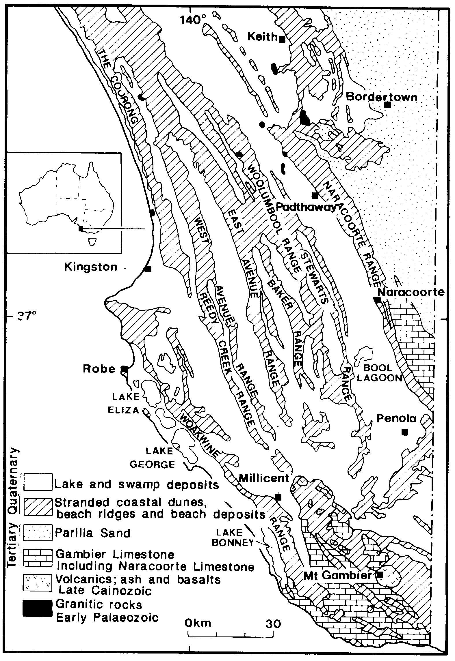
Woakwine Range was formed in several stages, the last and most significant of which was during the Last Interglacial, about 125,000YA. The eastern (seaward) sides of the range are former coastal sediments, the main ‘range’ landforms comprising beach-dune barriers, with back-barrier lagoon sediments on the western (landward) sides.
The Woakwine Range blocked natural rainfall from draining to the coast, resulting in swamp and marshland inland of the range. The Woakwine Cutting was created in 1957 as a drainage cut through the range, draining into Lake George near Beachport. To prevent erosion of the sides of the cutting, pieces of rock were placed by hand to form a more resistant surface. Such a protective surface is termed ‘rip-rap’.
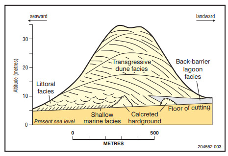
At the listed coordinates you will a view of the McCourt Cutting. Please examine the exposed southern face of the cutting and prepare answers for the following questions. You can log a find immediately if you wish, however you should send your answers within a reasonable period to confirm your understanding of the earthscience lesson.
-Can you see any variation in the cut surface condition, colour, sand size, gravel or rock from top to bottom?
-Can you see any variation in the cut surface condition, colour, sand size, gravel or rock from seaward (west) to landward (east)?