注意事項 (Please note)
①この甌穴は国の天然記念物です。保全に注意してください。
②水量が多い場合にはGZへ近寄れない時があります。
①The Seki-no-o Potholes are a "Japanese Nationally Designated Important Natural Heritage". Please pay attention to protect vulnerable geosites.
②When the river has a large amount of water, you may be difficult to approach GZ.
甌穴とは、川の流れが渦巻き状になることより石や砂が同じところを循環し、川底の岩盤と接触して侵食されてできた丸い穴でポットホールとも言います。
A pothole are round hole that is made by circulating stones and sand in the same place as the flow of the river becomes swirly and in contact with the bedrock of the riverbed.
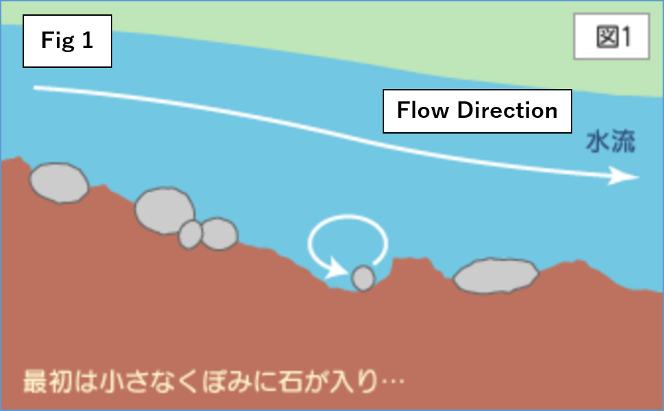
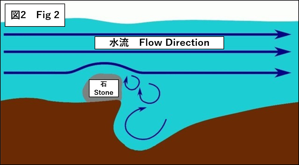
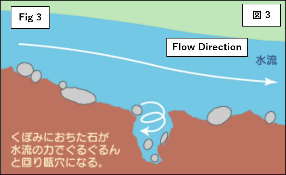
ポットホールは、急流の場所で川底の岩石に割れ目や節理という割れがあったり(図1)、川底に障害物となる石がある(図2)と川の流れによって軟らかい部分がけずられてくぼみができます。このくぼみに小石が入り込むと、渦によって小石がくぼみの中を転がって円形の穴に成長します。(図3)
The pothole is a hollow at the soft River bottom made by the water flow . It is due to the presence of a crevice at the soft river bottom location (Figure 1), and the stone at the soft river bottom as an obstacle (Figure 2).
When a pebble enters this depression, the vortex rolls the pebble in the depression and grows into a circular hole. (Figure 3)
出典:出典:埼玉県立川の博物館HP
Source: Saitama Museum of Rivers HP
出典:森のカフェKISEKI HP(一部)
Source: KISEKI mori no cafe HP(two parts)
1. 以下のTASKを実行してください。
2.キャッシュ名と解答をキャッシュオーナー(hikohohodemi)にメールしてください。
3. 答えはログに記入しないでください。
4.メールを送信したらファウンドログを上げてください。私の承認を待つ必要はありません。
1. Please carry out following TASK.
2. Please send e-mail this cache name and the answer to following questions to cache owner.(hikohohodemi)
3. Do not include this answer in your on-line log.
4. You do not need to wait for confirmation from me before posting online.
TASK
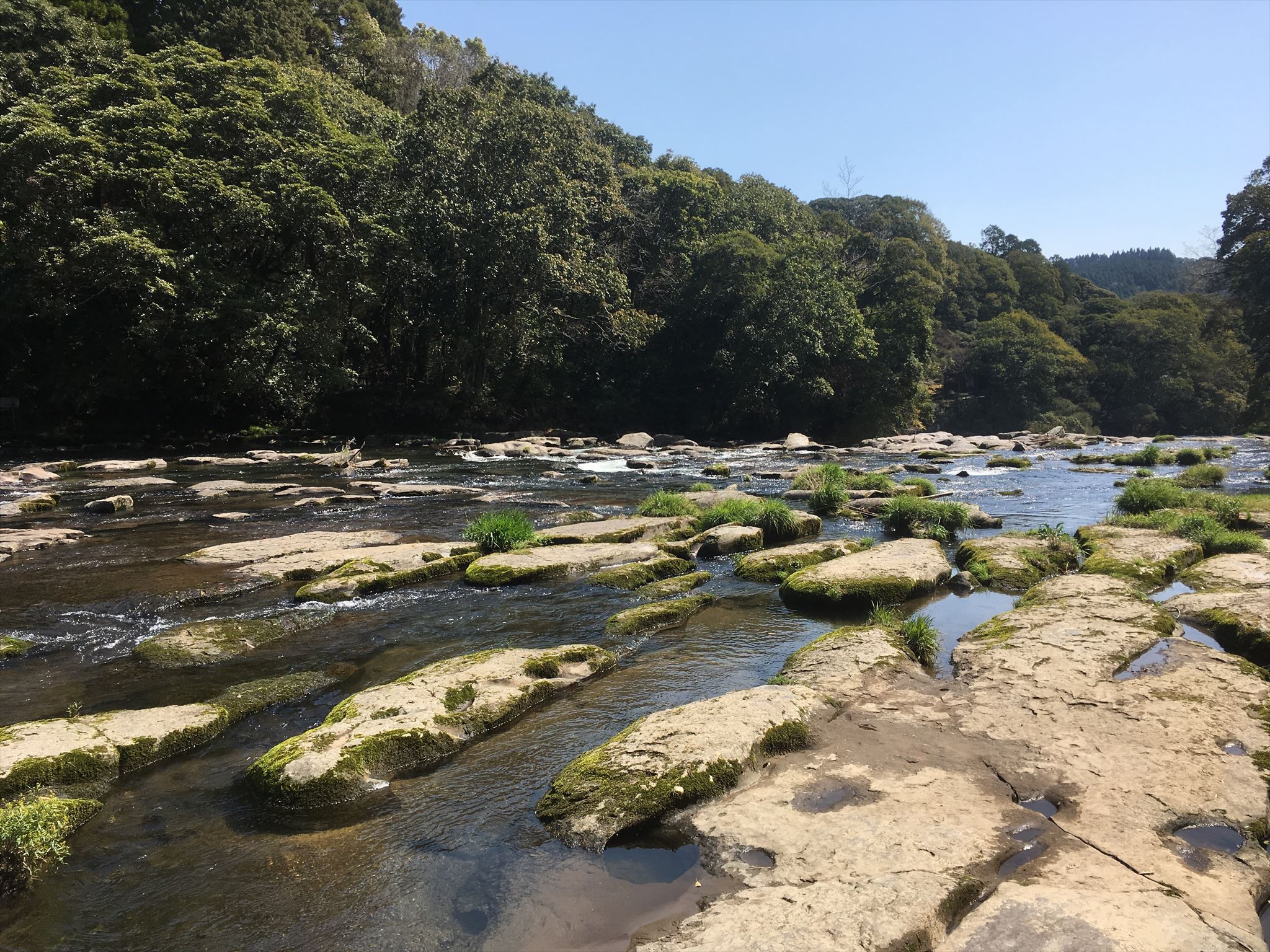
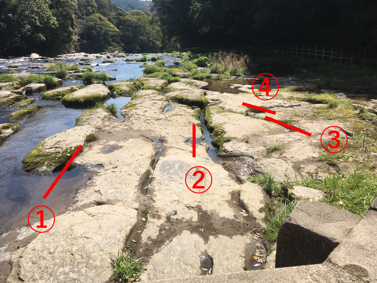
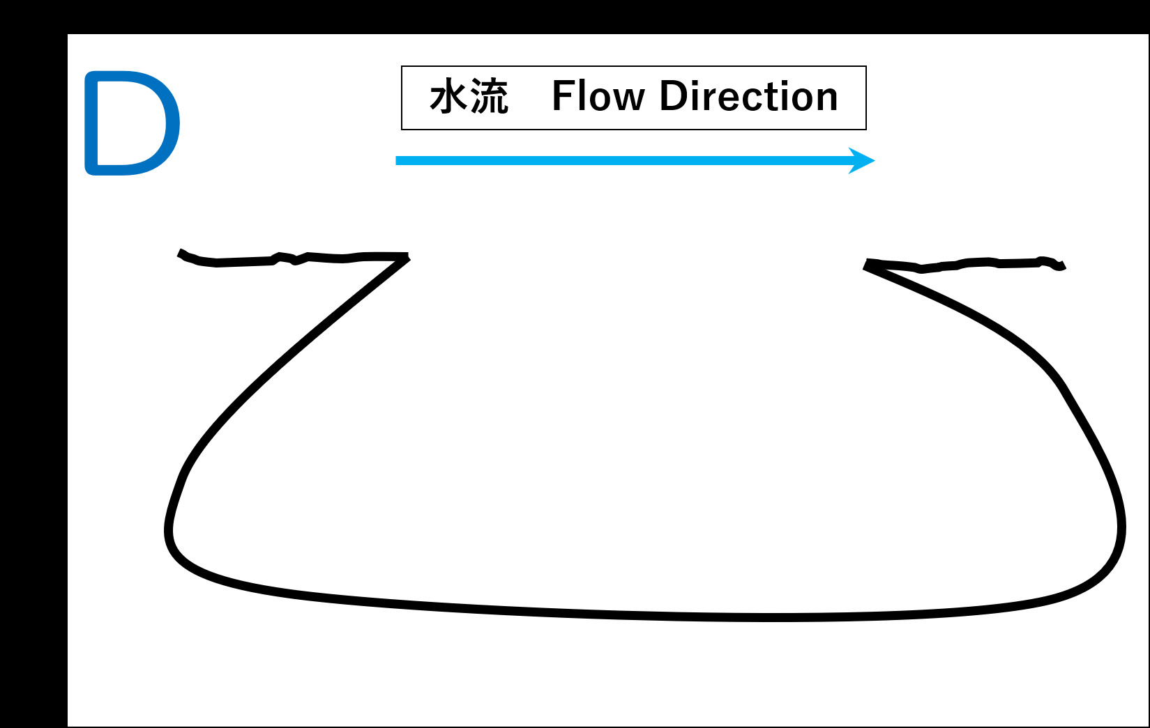
GZ(上の写真参照)で赤線①,②,③,④で示した穴を観察してください。
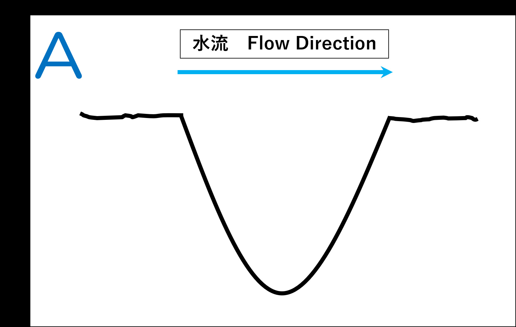
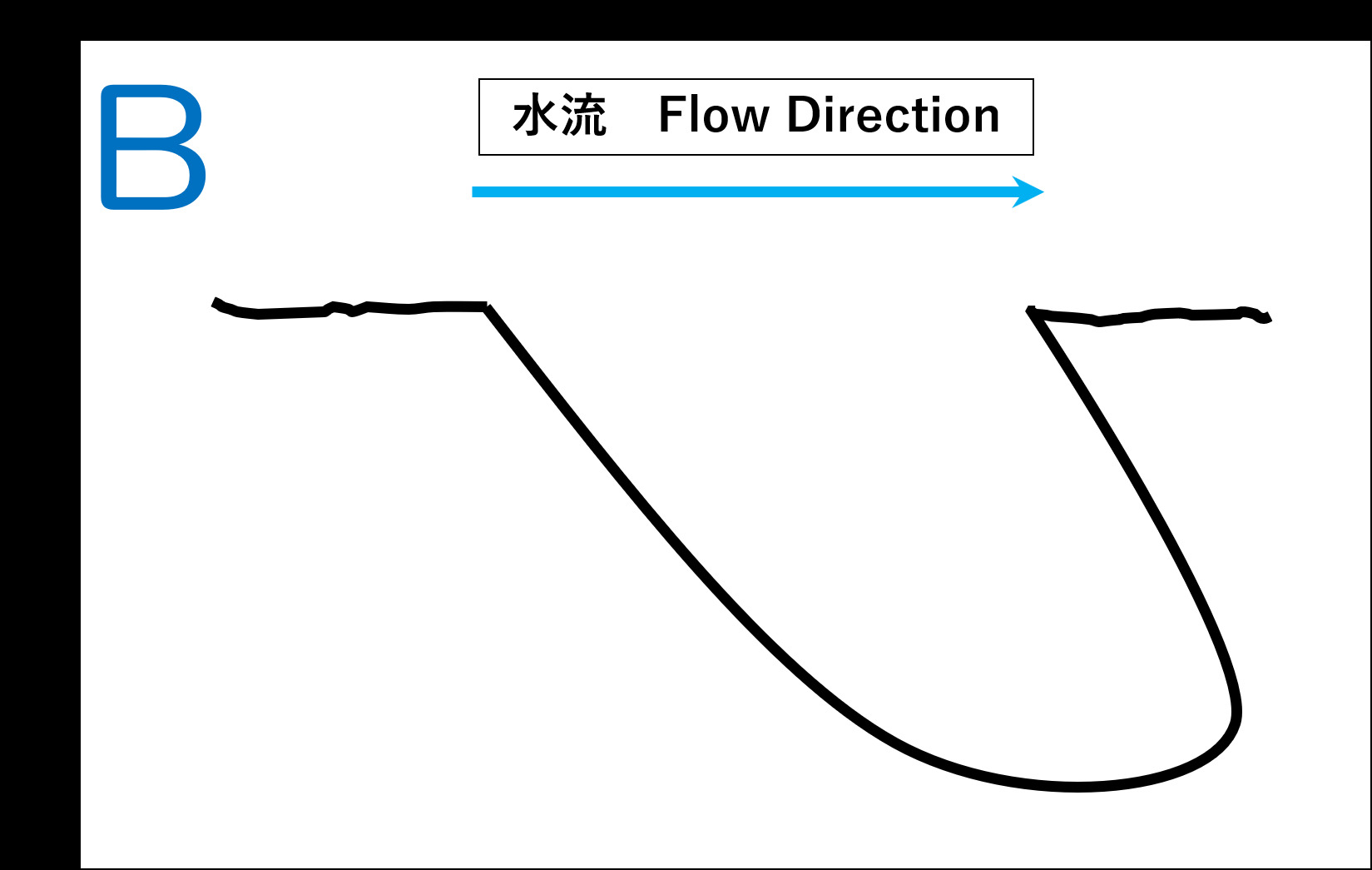
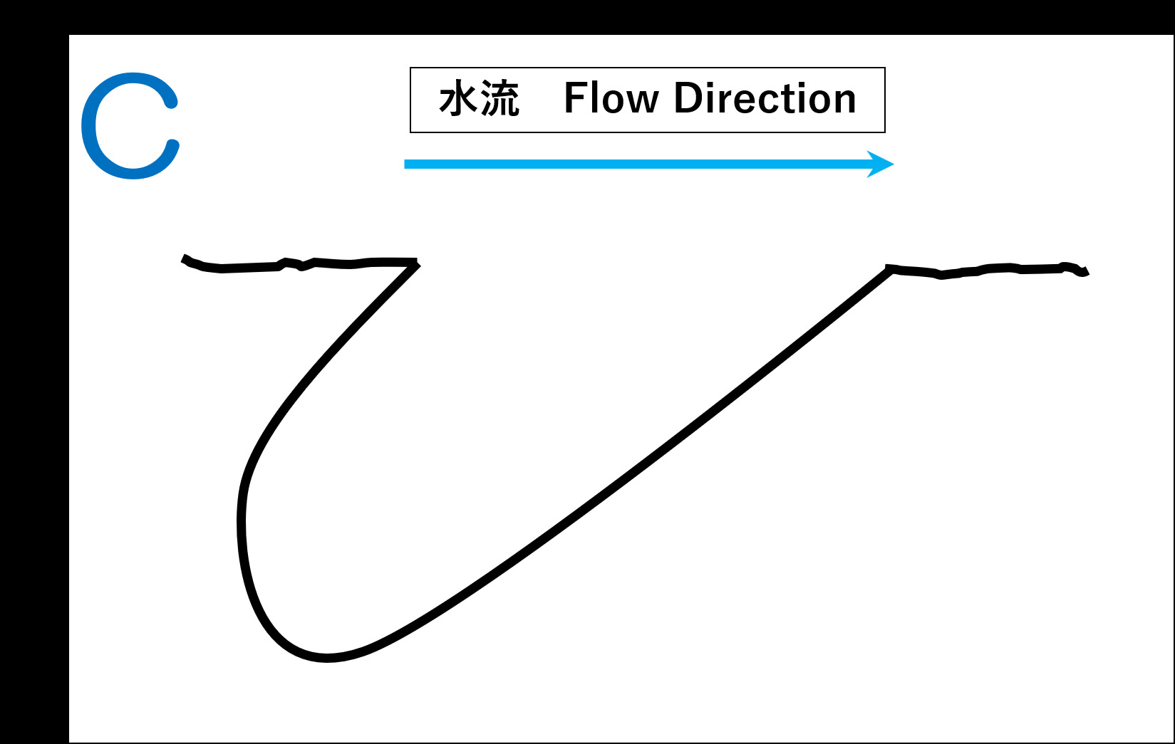
穴の形状はA~Dの中でどれが一番多いですか?
また、何故このような形になったのか?あなたの考えを述べてください。
Please Observe the holes indicated by red lines ①,②,③,④ at the GZ (see photo above).
Which type of pothole shape are most many among A to D?
And why did these holes was made formed this shape? Please explain your thoughts.
OPTION
GZ近くの橋の上で川とあなた、またはあなたのGPS機器の写真を撮り、ログにアップロードしてください。
Please upload the photo(you or your GPSr and river on the bridge around GZ) to the log.