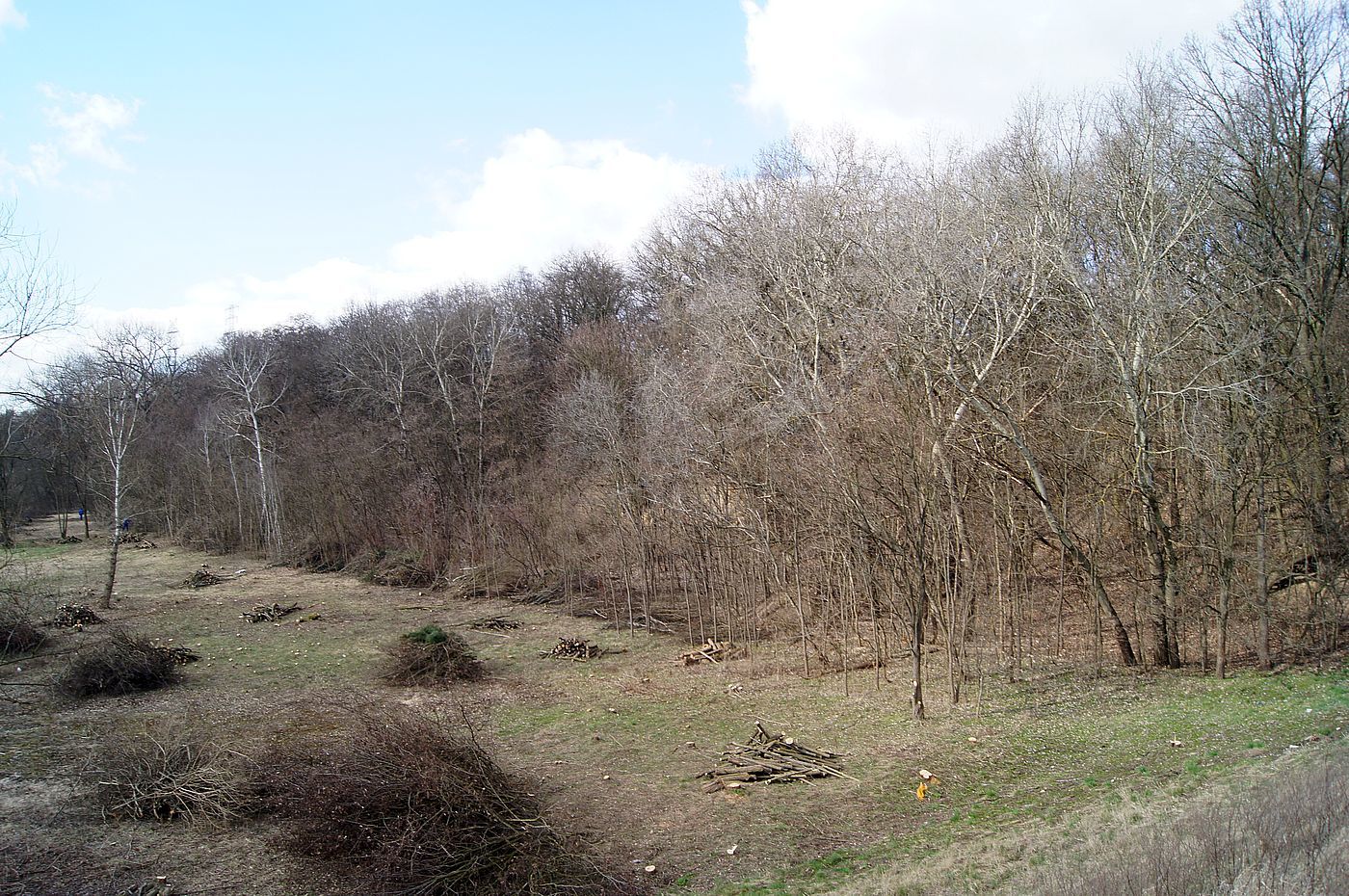
Widok poniżej zapory w Dębem, 03.2019
[PL]
Osady plejstoceńskie w ciekawym odsłonięciu możemy znaleźć na skraju Wysoczyzny Ciechanowskiej, w pobliżu zapory na rzece Narwi w Dębem. Skarpa na prawym brzegu Narwi ukryta jest za drzewami i niewidoczna dla osób postronnych, nawet dla korzystających z dzikiej plaży u jej podnóża. Na odcinku około 300 m w dół rzeki znajduje się stanowisko geologiczne, będąca pretekstem do założenia tego kesza. Odsłonięcia takie są też widoczne za zaporą, ale dostęp do nich jest tylko z wody z Zalewu Zegrzyńskiego.
Występujące tu osady lodowcowe zostały tu przeniesione 170-120 tysięcy lat temu w czasie Zlodowacenia Warty (stadiał Warty), czyli w czasie chłodniejszego okresu w czasie zlodowacenia. W tym okresie lodowiec się rozszerzał niosąc materiał. Po tym okresie nastąpiło ocieplenie (interglacjał), topnienie lodowca i kolejne odkładanie materiału w formie moreny czołowej. Możemy tu mówić o dwudzielności moreny – denna warstwa zbudowana jest z gliny zwałowej z pewną ilością głazów noszących ślady lodowca i górna zbudowana z tego, co było na powierzchni lodowca i opadło po stopnieniu – piaski i większe głazy.
Dolna warstwa widoczna na skarpie to glina zwałowa w formie zwartej ze spękaniami ciosowymi. Częściowo warstwa ta jest zakryta przez osuwisko materiału wypłukanego ze skarpy.
Dobrze widoczną warstwą jest bruk morenowy. Rozmycie drobnego materiału moreny, w której pierwotnie w starszych osadach tkwiły nieregularnie rozmieszczone głazy nazywane jest denudacją. Pojedyncze kamienie wypłukane z tej warstwy i leżące u nasady skarpy noszą często ślady płużenia – czyli z jednej strony są wypłaszczone na skutek ścierania skały w czasie pchania materiału przez lodowiec.
Powyżej bruku znajduje się materiał związany z topnieniem lodowca – piaski i żwiry ułożone są warstwowo, co wskazuje na sedymentację z udziałem wody. Następnie w odsłonięciu widoczne są iły warwowe (warstwowe), które są osadem zastoiskowym osadzającym się w kolejnych sezonach w istniejącym tu kiedyś zbiorniku wodnym. Iły te są charakterystyczne z uwagi na występowanie warstw ciemnych i jasnych naprzemiennie, przy czym jasna odpowiada osadom w porze letniej, a ciemna w zimowej.
Teren skarpy podlega procesom erozyjnym i nawet w obrębie roku można zauważyć zmiany w krajobrazie. Z uwagi na ten fakt:
- uwaga na spadające gałęzie
- glina bywa śliska po deszczu – zachowaj ostrożność
- teren wciąż podlega procesom erozyjnym – uważaj na głazy sterczące w skarpie – każdy z nich może się obsunąć.
Pytania:
- Iły warwowe, widoczne najlepiej w pkt IL, są tu na przemian jasne i ciemne. Z czego wynika taki układ warstw?
- Denudacja – jak swoimi słowami opiszesz to zjawisko?
- W punkcie BU znajdziesz odsłonięcie z widocznym brukiem morenowym. Jak sądzisz czy warstwa z brukiem jest najmłodsza czy najstarsza i dlaczego?
- Zlodowacenie Warty – jaka to epoka geologiczna? Podaj nazwę (zobacz w tekście).
- Zdjęcie pod furtką przy wylocie wąwozu w pkt FY albo z głazem na zboczu w tle w pkt GL – wybór należy do ciebie. Zdjęcie zamieść w swoim logu i postaraj się żeby zawierało jakiś element, który pozwoli rozpoznać, że to ty (GPS, xWG, dziennik geokeszera, TB, twoja uradowana twarz lub coś podobnego).
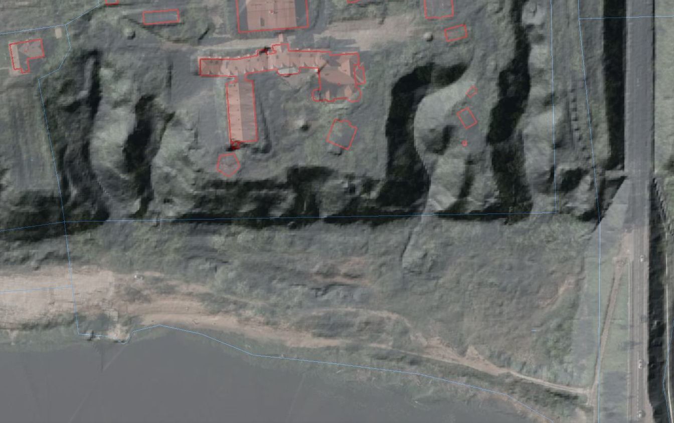
Widok skarpy na modelu opracowanym na podstawie lotniczego skanowania laserowego LIDAR
 [PL]
[PL]
Skrzynka typu EarthCache, nie posiada fizycznego pojemnika. Aby zalogować znalezienie tego EarthCache, musisz udać się pod wskazane współrzędne, odpowiedzieć na powyższe pytania.
Odpowiedzi proszę wysyłać za pomocą mojego profilu. Nie trzeba czekać na moją odpowiedź, można od razu logować. Jeśli coś będzie nie tak, zgłoszę się sam. W razie potrzeby pomogę w rozwiązaniu zadań. Logi bez podesłanych odpowiedzi będą kasowane.
[EN]
Pleistocene sediments in an interesting setting can be found on the edge of the Ciechanów Upland, near the dam on the Narew River in Dębe village. Escarpment on the right bank of the Narew river is hidden behind trees and invisible to bystanders, even for those enjoying the wild beach at its foot. On the section about 300 m down the river there is a geological site, which is an excuse to make this cache. Such exposures are also visible behind the dam, but access to them is only from the water of the Zegrze Lake.
The glacial deposits occurring here were transferred 170-120 thousand years ago during the Warta Glaciation (Warta stadium), i.e. during the colder period during the glaciation. During this period, the glacier expanded carrying material. After this period, there was warming (interglacial), melting of the glacier and subsequent deposition of the material in the form of a frontal moraine. We can call it a moraine split - the bottom layer is made of boulder clay with a number of boulders bearing traces of the glacier and the upper one is made of what was on the surface of the glacier and fell after melting - sands and larger boulders. The bottom layer visible on the embankment is dumped clay in compact form with chipping. This layer is partly covered by a landslide of material washed out of the escarpment.
A well visible layer is moraine pavement. The blurring of the small moraine material that originally contained the older deposits of irregularly distributed boulders is called denudation. Individual stones washed out of this layer and the escarpment lying at the base often have traces of slag - on the one side they are flattened due to abrasion of the rock when the material is pushed by the glacier.
Above the pavement there is material related to the melting of the glacier - sands and gravels are arranged in layers, which indicates water sedimentation. Then, uncovered are layered (layered) clays, which are a reservoir sediment that settles in subsequent seasons in the water reservoir that once existed here. These clays are characteristic due to the occurrence of dark and light layers alternately, with light ones corresponding to sediments in summer and dark ones in winter.
The escarpment area is subject of erosion processes and changes to the landscape can be seen even within a year. Due to this fact:
- Beware of falling branches
- Clay can be slippery after rain - be careful
- The area is still undergoing erosion processes - watch out for the boulders protruding from the escarpment - each of them may slip.
Tasks:
- Layered loams, best seen in point IL, are alternately light and dark here. What does this arrangement of layers result from?
- Denudation - how do you describe this phenomenon with your words?
- At point BU, you will find an exposure with visible moraine pavement. Do you think the paving layer is the youngest or the oldest and why?
- Warta glaciation - what is the geological age? Enter the name (see in the text).
- Take a photo under the gate at the gorge outlet in point FY or with a boulder on a slope in the background in point GL - the choice is yours and publish it in your log with something, that will be recognized as yours (GPS, wooden coin, personal diary, TB, your face or something).
 [EN]
[EN]
EarthCache not have a physical container. To log in finding EarthCache, you must go to the provided coordinates and answer these questions.
Please send answers via my profile. No need to wait for my answer, you can immediately log. If something is wrong, I will send you a message. If you need help in solving tasks just ask me. Logs without answers will be deleted.