Chignecto Boars Back EarthCache
-
Difficulty:
-

-
Terrain:
-

Size:  (other)
Please note Use of geocaching.com services is subject to the terms and conditions
in our disclaimer.
Chignecto Boars Back
Entering the Boar N45° 37.735' W64° 22.073'
Second View N45° 37.612' W64° 22.009'
Third View N45° 37.592' W64° 21.995'
The Chignecto Game sanctuary was enlarged over the years and the total area is now 22,082 hectares, of which 500 hectares are privately owned, with the remainder owned by the Province. The sanctuary is made up of 19,778 hectares of woodland, with 1864 hectares of water and wetlands, 125 hectares of barrens, and 316 hectares of roads, utility corridors and other miscellaneous land classifications. There is still plenty of forest, which means there is also a lot of habitat for species such as the endangered mainland moose and other species-at-risk like the wood turtle.
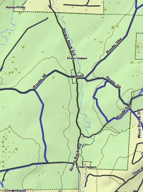
On the East end, running from River Hebert to Halfway River is the public road called the Boar’s back. It is on an Esker that runs from the northeast end to the southwest end of the Chignecto Game sanctuary. The Esker is 11 kilometers long but has a few broken spots where it merges with the ridge or only appears on the one side or the other. You can drive the road that is built on top of the Esker with a car through the sanctuary.
This earthcache will take you to the part of the Esker that is steep on both sides so be careful.

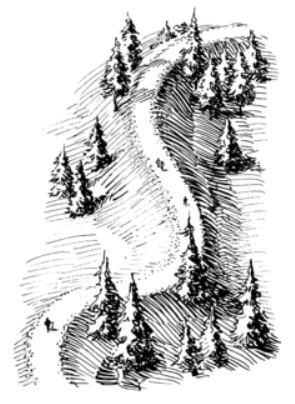
Eskers vary in shape and size. Most are sinuous, with a height of a few to several tens of metres. The longest continue for several km but most are shorter or discontinuous. Eskers can be broad and flat-topped, or have a single crest or split into parallel ridges. A beaded esker has broad hillocks strung out at intervals along its length. Eskers may locally rise up-slope, a clear indication of water moving under pressure in a pipe-like conduit.

Eskers are casts of sub-glacial tunnels or ice-walled canyons near to an ice margin. Meltwater in glaciers may collect to flow through networks of large tunnels and the water is often highly charged with debris. Where and when velocity falls sediment may be laid down on the floor of the tunnel. If the tunnel is developed on the base of the ice then the sediments in the esker will be preserved with little disturbance. In contrast, if the tunnel lies within the ice then the sediments will be considerably disturbed as the ice melts and the thread of sediment is let down on the valley floor

Some eskers are discontinuous because sedimentation may not take place along the entire length of the sub-glacial tunnel. Blocks of the overlying ice may fall into the tunnel, later melting to give kettle-holes along the esker. Alternatively, an esker ridge may become segmented by erosion, either by meltwater during deglaciation or by the action of post-glacial rivers.

To log this Earthcache please answer the following questions and send in a timely manner to my geocaching profile or email. Answers not received will result in deleted logs. Take the time to drive the full length of the Esker, 11 kilometers. Be careful the sides are steep.
1. What is the height of the Esker at this point?
2. What is the width of the Esker at this point?
3. How long is this piece of Esker, between the earthcache location and the third viewing point.
( earthcche N45° 37.649' W64° 22.035' ; third viewing point N45° 37.592' W64° 21.995')
4. What is the material the Esker is made of ?
5. Post a picture of the area.
[REQUIRED] In accordance with the updated guidelines from Geocaching Headquarters published in June 2019, photos are now an acceptable logging requirement and WILL BE REQUIRED TO LOG THIS CACHE. Please provide a photo of yourself or a personal item in the picture to prove you visited the site.
Additional Hints
(No hints available.)