Problem soils in the vicinity of Adelaide were first recognised by early settlers who referred to them as ‘Bay of Biscay’soils, a reminder of their rough sea passage to South Australia. Investigations during the 1960s indicated that clay layers underlying the surface soils were causing long and short-term cracking of buildings and their foundations through settlement and heave. Fieldwork commenced in 1980 with drilling, core logging, sampling and laboratory testing. From 170 drillholes across the Adelaide plains, 1,510 m of core was obtained. Samples were tested for physical and mineral/chemical characteristics.
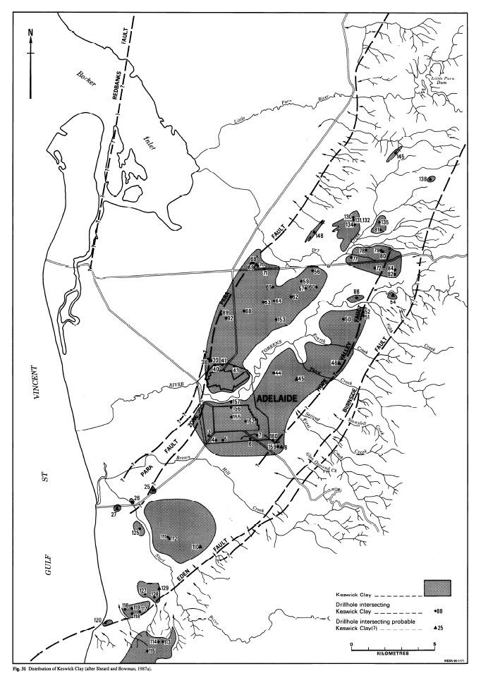
A revised near-surface geology emerged with the formal recognition of one previously informally named unit, Keswick Clay. Testing has demonstrated that the majority of Adelaide’'s reactive soils are composed of clays with a high affinity for water. The most reactive substrate is the Keswick clay formation.
And the worst most reactive soil location in Adelaide? Hole #56, Blacks Road, Gillies Plains. At a 2.5m deep there is 4m section of stiff plastic Keswick clay. Changes in water content have a significant effect on the expansion and contraction of the clay deposit. The condition is demonstrated by surface cracking. If you live in a Keswick clay area your house will have cracks.
At the listed location you are immediately adjacent to Hole #56. At this location you will see evidence of surface cracking. Your earthcache task is to estimate the length of the cracks.
A. What does the length of these cracks indicate about the soil condition?
B. What other features do you see that are consistent with soil movement? If you arrived in a car you may have seen or felt these features.
C. How do these features indicate changes in soil condition? Note these features are typical of Keswick Clay. If you are an Adelaide resident does your own street have similar features?
Please send your answers by email or message. Free to log immediately, but you need to follow up with answers within a reasonable time period.