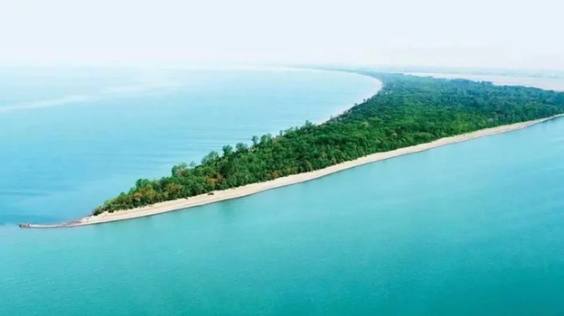
Point Pelee National Park is Canada’s second smallest National Park. It is positioned just below the 42nd Parallel, making the park the southernmost point of mainland Canada. The spit is slightly more than seven kilometers long by 4.5 kilometers wide at the northern base and consists of mature swamp forest and savannah, mixed dry forest that includes Chinquapin oak, marshlands, and beaches that stretch along both the east and west sides of the park.
Point Pelee is a haven for migratory birds and butterflies and became popular with naturalists in the late part of the 19th century. Prior to the creation of the National Park, the Great Lakes Ornithological Club was established to study bird migration and through the efforts of their members including naturalist W.E. Saunders and Jack Miner, they lobbied the Federal Government to turn the former Naval Reserve into a National Park. Point Pelee National Park was officially created in 1918 and recently celebrated its 100th Anniversary.
Things to do at Point Pelee
Logging Requirements
You will need to enter Point Pelee National Park and visit a number of locations within the park to answer questions to complete this virtual cache. Park admission is required. The Park is open year-round with hours posted on their website.
Waypoint # 1 Orientation - Indigenous Welcome Sculpture
Look at the sculpture mounted on the rock in front of you. A 3-dimensional turtle symbolizes the Ojibwe legend of Turtle Island - The homeland of First Nations People. Answer the following questions from the sign beside the sculpture.
1 What is the name of the artist?
2 What does the sculpture represent?
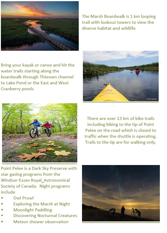
Waypoint # 2 - The Boardwalk and Marsh
3 Climb to the top of the Observation Tower and take an original photo with the marsh boardwalk in the background. No need to show your face in the photo, a GPS or thumbs up will do. Attach the photo to your found log.
4. From the sign on the top of the lookout, what is resting on the Beaver's hat? ( Note: if you are unable to climb to the top of the Observation Tower while it is closed for COVID-19 restrictions, this question can be waived.
Waypoint # 3 - DeLaurier Homestead
5. Ed DeLaurier lived in the house from _ _ _ _ to _ _ _ _? The answer is the two years? Note: the sign is located on the enclosed porch of the home behind glass and is visible from the deck.
Waypoint # 4 - Leaving Home
6. Up until the 1920s, members of the Caldwell First Nation lived at Point Pelee. What year were they evicted from the park?
Waypoint # 5 Visitor Centre - Miniature Marsh
7. Looking at the sign posted at this mini marsh, name two types of flowering plants that can be spotted here? Note: there are 6 plants listed on the sign.
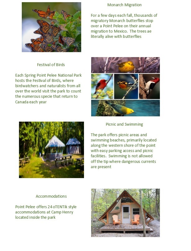
Waypoint # 6 - Tip Exhibit Area
8. At the tip Exhibit area while waiting for the shuttle, find the display under the shelter that shows the migration routes for North American Birds, Butterflies, Bats and Dragonflies. How many kilometres do Monarch's travel to reach the mountains of Central Mexico?
Waypoint # 7 - The signpost
9. On your walk to the point, you will pass a signpost indicating the direction and distance to the most northern, eastern, and western National Parks in Canada. What is the distance to Quttinirpaaq National Park, Canada's most northern park?
Waypoint # 8 - The Tip
10. At the tip of the point estimate the width of the sandy spit beyond the bench where the tree line ends and the sandspit begins.
11. Take an original photo of you or your party. No need to show your face in the photo, a GPS or thumbs up will do. Attach the photo to your found log.
Send the answers to my profile at the top of the page. Found logs without proof of visiting Point Pelee National Park will be removed.
Point Pelee is a magical place for me as I have been coming here since the 1960s with family and friends in all seasons. I visited with my grandparents who were avid bird watchers and I am pretty sure my sister and I had our first canoe paddle on the marsh with my father. I remember going for a bike ride in September with monarch butterflies landing on me to hitch a ride, and of course all of the trips to visit the sandspit point with friends and family. I hope you enjoy this park as much as I have over the years.
Virtual Rewards 2.0 - 2019/2020
This Virtual Cache is part of a limited release of Virtuals created between June 4, 2019, and June 4, 2020. Only 4,000 cache owners were given the opportunity to hide a Virtual Cache. Learn more about Virtual Rewards 2.0 on the Geocaching Blog.