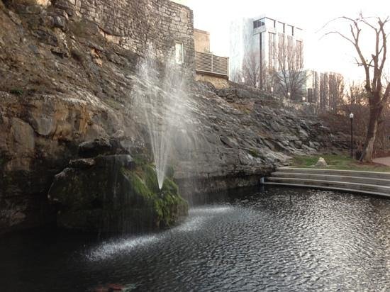
This virtual cache will take you on a short tour of the most historic part of Big Spring Park. If you follow these in order, the tour should only take you 15 – 30 minutes to complete ... and is completely wheelchair accessible.
Waypoint 1 (posted coordinates) N 34° 43.723 W 086° 35.244
Did you know that Huntsville was the first town in Alabama to be incorporated and the first Alabama Constitution was drafted here as well. This sign lists a number of firsts for Huntsville.
Before you leave this spot, look at the side of the closest metal box between this sign and Church Street. The first logging requirement: What is the number on the side of the box?
It’s a short walk from Waypoint 1 to Waypoint 2 [N 34° 43.765 W 086° 35.213]. Huntsville became an agricultural and economic center due to the surrounding area’s rich soil being able to produce an abundance of cotton, its close proximity to the Tennessee River, and the engineering ingenuity depicted on this marker.
Remember to get the answer for the Waypoint 2 logging requirement: What is the code on the Madison County Marker Challenge tag on the post under the marker? **The tag (JXU) has gone missing, so no answer required for now**
Waypoint 3 [N 34° 43.772 W 086° 35.197] is only a little over a hundred feet away. This sign explains the namesake for this geocache. Big Spring is where Huntsville started. This sign will give you all the rest of the glorious details about how The Big Spring factored into Huntsville’s growth and economic importance for well over 150 years.
On the wall of the small square structure just Northeast of this marker is a plaque about Huntsville’s Downtown Mall. Just a reminder to get the answer for the Waypoint 3 logging requirement: What is the number of the project under which Huntsville’s Downtown Mall was funded?
The final waypoint [N 34° 43.782 W 086° 35.151] takes you to the commemorative marker for Huntsville’s namesake. There’s not a lot of info on the sign but it does include a couple of interesting tidbits.
As you are looking at the sign, there is a bench behind you with a plaque on it. For the Waypoint 4 logging requirement, answer the following question: What is the nickname of the person honored on the bench’s plaque?
Once you’ve gathered all the answers for the logging requirement, send them to me in either a Geocaching message or via the email link on the page. Go ahead and log the cache once you sent the answer. I will let you know if there are any issues with any of the answers. Also, you are encouraged (but not required) to post a picture of yourself, your GPS, or your group with something you like in the park. Please do not post any pictures or a log which reveals any of the logging requirement answers. Logs with either will be deleted.
To help you remember, here is are the four logging questions again:
- What is the number on the side of the box?
- What is the code on the Madison County Marker Challenge tag on the post under the marker?
- What is the number of the project under which Huntsville’s Downtown Mall was funded?
- What is the nickname of the person honored on the bench’s plaque?
If you liked this geocache, Favorite Points are appreciated and will attract other cachers.

Although not part of the requirement for this cache, there are some additional nearby historical markers which you might find interesting also. Check them out if you have the time.
* Major General H.N. Toftoy, USA marker [N 34° 43.799 W 086° 35.147]
* First Bank In Alabama marker [N 34° 43.788 W 086° 35.137]
* Erected in 1835 marker [N 34° 43.776 W 086° 35.127]
* Confederate Monument marker [N 34° 43.799 W 086° 35.120]
* Harrison Brothers Hardware marker [N 34° 43.796 W 086° 35.067]
* Tallulah Bankhead / I. Schiffman Building marker [N 34° 43.813 W 086° 35.059]
* The Huntsville Inn marker [N 34° 43.829 W 086° 35.066]
* Madison County marker [N 34° 43.839 W 086° 35.099]
I hope you enjoyed this virtual cache, learned a little about, and got a better appreciation of our proud and growing city.
Congratulations to Gray Bat on the FTF!
Virtual Rewards 2.0 - 2019/2020
This Virtual Cache is part of a limited release of Virtuals created between June 4, 2019 and June 4, 2020. Only 4,000 cache owners were given the opportunity to hide a Virtual Cache. Learn more about Virtual Rewards 2.0 on the Geocaching Blog.