
SANI PASS – ONE OF MY MOST FAVOURITE PLACES IN SOUTHERN AFRICA.
Found in the Souther Drakensburg region of South Africa, and within the World Heritage site of the Ukhahlamba (Barrier of Spears) Drakensburg, the Sani Pass is one of the most scenic, adventurous roads you will find in Southern Africa.
At a maximum altitude of 2876m, Sani Pass was up until recently South Africa’s highest road / pass. It was recently taken down to second highest, after the Ben Macdhui pass in the Eastern Cape was established, which reaches an elevation of 2995m. However, this pass is not a thoroughfare.

Sani is still the only road connecting Lesotho to South Africa from the Kwazulu Natal side. Sani connects the towns of Underberg and Himeville in KZN with Mokhotlong in Lesotho.
The name Sani is originates not from the San people, previous nomadic inhabitants of the area, but from the name of a Basotho chief who once lived in the region. In the book, ‘The Saga of the Sani Pass and Mokhotlong’, author Michael Clark explains that the term Sani derives from the name Rafolatsane who was the son of Paramount Chief Letsie.
In 1890, the chief appointed Rafolatsane as District Chief in the Mokhotlong region. Colonial settlers arriving in Underberg would have looked at the gap in the mountains that led to the top of the escarpment, and ask local people where it went.
As Michael writes, the answer would have been, ‘Ha Rafolatsane,’ which means ‘to the Chief Rafoloatsane.’ The settlers, being unfamiliar with the indigenous languages, probably abbreviated the chief’s name to ‘Sani.’
The pass, once only a bridle path traversed by mules and donkeys, was a vital trading route. It was so steep towards the top, that mules and donkeys sometimes had to be dragged up! It was eventually conquered by a vehicle in 1948 by Godfrey Edmond, in what is thought to have been a Willys Jeep. It is thought that the ascent took between 5 and a half hours to around 14 hours (Sources differ). By 1952, the pass was made more navigable, though strictly by 4x4, and remains pretty much the same today (With some recent upgrades, especially around the switchbacks, making the pass far safer).
The pass attracts visitors from near and far, thanks to its stunning mountain vistas and views, waterfalls, and the adventure of driving one of South Africa’s most toughest of roads.
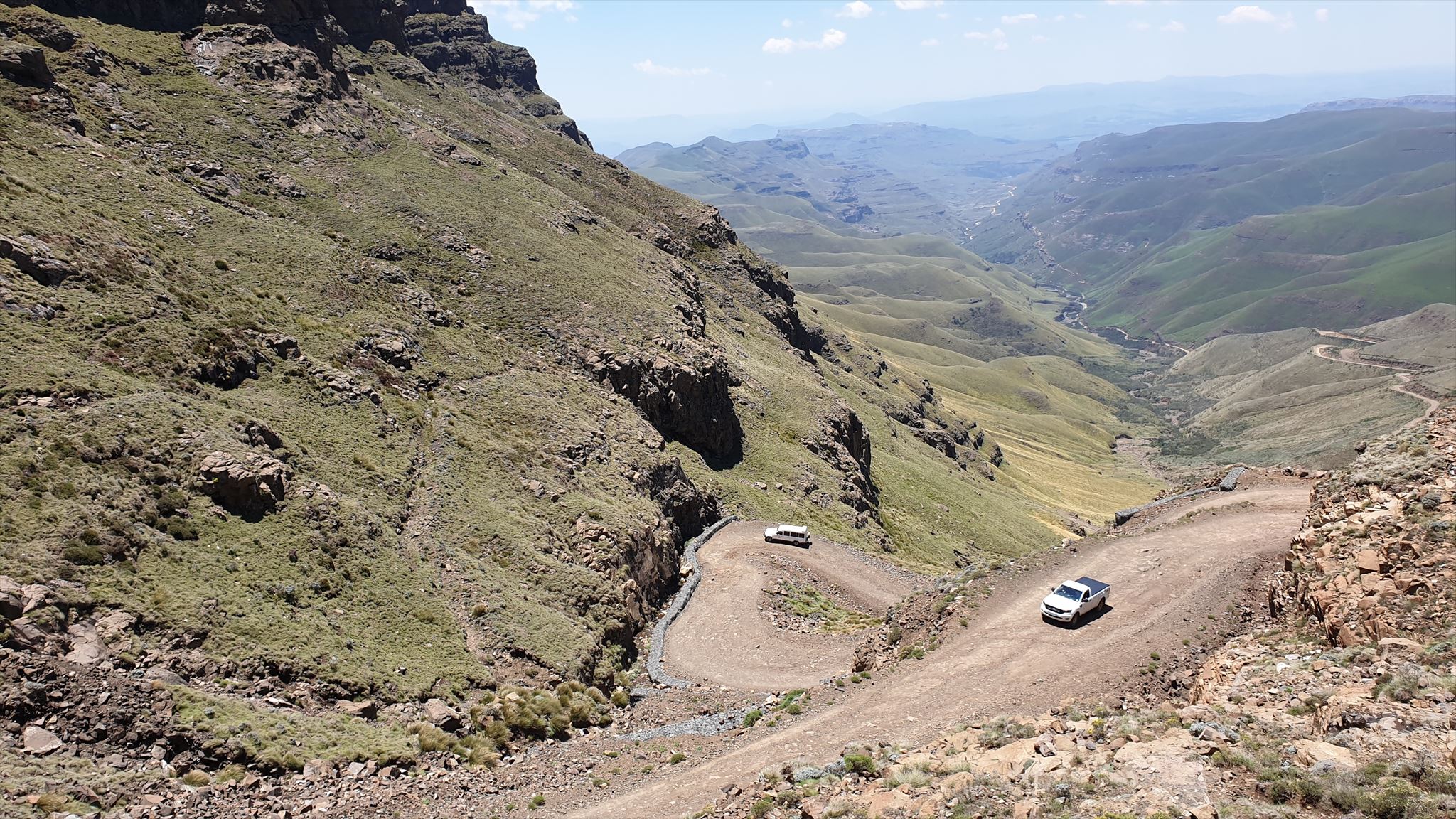
The pass begins just after one comes across the Sani Pass Hotel, found at its base, but doesn’t really begin until one crosses through the South African border control point (1544m).
From the SA border post, for the moment, only 4x4 vehicles are allowed to continue their ascent. Over the nearly 9km stretch between the border posts, the altitude changes by 1332m!! At times, around the infamous switchbacks (Some almost 180 degrees!), the gradient can be as steep as 1:3, though the average gradient over the entire pass is around 1:20.
Of interest – Sani Pass exists in its entirety within the borders of South Africa. Due to the obvious logistical challenges, the border post is situated in an area more suitable for the establishment of the required buildings and facilities.
Descending non-4x4 vehicles are permitted by Lesotho officials at times, though high clearance and a good knowledge of steep descent driving is still very highly recommended, and not at all recommended in adverse weather such as rain and snow.
Snow can happen at all times of the year, though usually only in the winter months between June and September. The weather, even in the middle of summer, can be bitterly cold, and completely different to conditions in KZN at its base. There is often a very strong wind blowing at the top.

TARRING OF SANI
There are plans to tar the entire length of the pass, and construction is already halfway on the section between the foot of the pass (the old Good Hope Trading post ruins) and the SA border post. The stretch between the border post and the Lesotho border at the summit will eventually be tarred once plans are finalised, but this is still between 4 and 10 years in the future (The project has already experienced significant delays, as it was meant to be complete by 2019).
Once the road is tarred, things will change significantly, and the pass will lose some of its allure. There has been some serious opposition to the pass being tarred, due to the loss of its attraction and appeal to the offroading community, as well as to the numerous tourists that visit each year to experience the adventure that is Sani. Many operators rely on revenue derived from visitors looking to experience the pass, both local and foreign.
It is also feared that once the pass is traversable in traditional vehicles (ie. sedans etc), it will actually become more dangerous, owing to higher speeds that tarring will allow.
Sedan vehicles can currently make it to Sani Top if coming from other parts of Lesotho and South Africa, as the entire road is now tarred between Mokhotlong and Sani Top .Up until around 2012, one required a 4x4, especially between the nearby Black Mountain / Kotisephola Pass (3240m) – Separated from Sani by a 6km flat plateau.
Black Mountain Pass very steep in places, again as much as 1:3, and averaging at 1:11, and is very dangerous in wet and snowy conditions. Over its entire length, one experiences 139 bends, corners and turns, of which 8 are over 90 degrees, 6 of which are very tight hairpin bends. All are found on the Sani side of the pass, and experienced before reaching its summit from Sani. It is highly recommended to visit the summit of this pass, as the views are nothing short of spectacular! There are two caches to be found in the Black Mountain area , one a short, relatively easy hike from the road (Along the old 4x4 track) and another around 800m from the road in the same direction. Be warned that the combination of steepness and altitude is very energy sapping!
MY HISTORY WITH SANI PASS
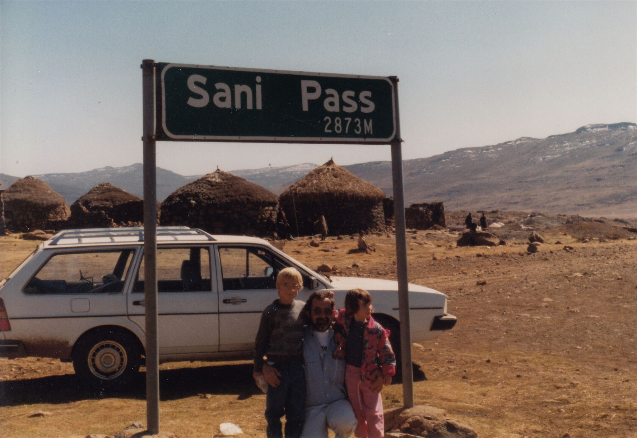
Pictured: Left: Myself; Centre: My dad, TechnoNut; Right: My sister, Killer Midget
I first visited this spectacular place in the winter of 1995, at the tender age of 8. During this visit, I also got to experience snow (albeit old icy snow…) for the first time! Since then, I have visited the pass twice when covered in snow, among many visits.
My late father (AKA TechnoNut, a well known local geocacher) was a big fan of Sani, and it was with him that I visited the pass for the first time in 1995, and a number of times thereafter. I now try and visit whenever I can.
In 2018, what was intended to be a leisurely drive up the pass to see the snow (And host a geocaching event) became a much bigger adventure and journey than originally anticipated. The adventure epitomised everything that makes the game of Geocaching so unique and special, and the memories taken from this experience will last the remainder of our lives.
You can read the many stories of our adventures at the following listing: https://coord.info/GC7QDB9

REQUIREMENTS FOR LOGGING THE VIRTUAL
- Take a photo, and include it in your log, or as a note, of your passport page against the Sani Pass sign next to the Lesotho border control showing either:
- Your entry stamp into Lesotho.
- Your exit stamp from South Africa at the Sani Pass post.
- Or both of the above
- An example can be seen below. Be sure to edit out any identifying features if necessary.
- If you happen to be a Lesotho native (Fairly unlikely), feel free to message me advising of the fact. We can take it from there!
- A short description of your adventure leading you up to the summit of Sani Pass. Logs stating TFTC are bland and boring

- Not mandatory - A team photo in front of the Sani Pass sign, as well as the other attractions at the top, is always great!!
Example of photo requirement:

Logs that do not fulfil the above criteria will be deleted.
IMPORTANT NOTES
Remember your passport!!
On Sani Pass, ascending vehicles have right of way. Stop and wait when safe and there is enough space for two vehicles to pass safely.
If approaching from Kwazulu-Natal, South Africa, a 4x4 is required. Sani Pass is not to be considered an easy road, and some 4x4 experience is highly recommended. If you do not have a 4x4, there are many tour operators in Himeville / Underberg that can provide a highly informative tour up and down the pass during a very rewarding daytrip.
If approaching from inside of Lesotho, and therefore other parts of SA (Via Maseru, Fouriesburg etc.), you will be able to drive a typical sedan car. However, be prepared for some very steep and winding passes, as well as altitudes in excess of 3200m at times.
If you are self-driving Sani Pass or into Lesotho from other border posts, remember to have some cash (At least R100) to pay at the Lesotho border post for your vehicle.
The weather at the top of Sani can vary vastly between the foot of the pass in KZN and the summit. Make sure that you are prepared for all weather types at all times of year. A good windbreaker is always a must.
Snow can make Sani Top virtually inaccessible at times. Snow and ice on the road from Mokhotlong during the winter, including treacherous black ice, are hazards you need to be aware of. Make sure you are current with weather forecasts, especially in the winter.
There is ample accommodation nearby (A few hundred metres from the border) as well as at the foot of the pass in KZN.

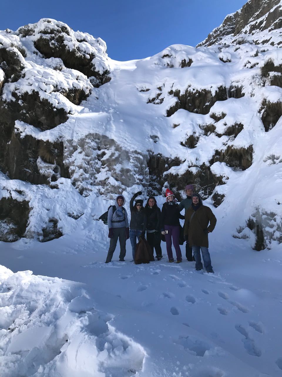
At the famous Ice Corner, 1995, with my sister.
--------------------------------------------------------------------------------------------------------------------------------------------
Virtual Rewards 2.0 - 2019/2020
This Virtual Cache is part of a limited release of Virtuals created between June 4, 2019 and June 4, 2020. Only 4,000 cache owners were given the opportunity to hide a Virtual Cache. Learn more about Virtual Rewards 2.0 on the Geocaching Blog.