OVERVIEW
This virtual cache is designed to take you to a few spots along the middle reaches of the Georges River around Picnic Point. It is intended to be completed on foot and should take approximately 35 minutes (one way) to access all the compulsory waypoints. Don’t be afraid to take advantage of the many seats along the way and admire that view. Whilst the compulsory waypoints are all on relatively flat ground alongside the river, I am not comfortable declaring them all wheelchair accessible. If you have any questions please don’t hesitate to contact me and I will do my best to answer them. The best parking is located in Lambeth Reserve (posted coordinates) in a dedicated parking area well off Henry Lawson Drive (gates close at sunset). There is limited parking along Alan Ashton Foreshore Reserve, and along Henry Lawson Drive near Yeramba Lagoon. There is also parking in Fitzgerald Park (the eastern end of Alan Ashton Foreshore Reserve) – This is a part of the Georges River National Park and access fees may apply (gates close at sunset).
GEORGES RIVER
The Georges River (known as the Toggerai or Tucoerah River before European settlement) is a tide dominated drowned valley estuary (over 26km2 in size) with an open entrance. Its catchment area is over 930km2.

The river is approximately 80/96/100/104km in length (depends on the reference source!), starts near Appin, NSW and is the main tributary of Botany Bay. It is divided into three main regions: the upper (freshwater section from Appin to Liverpool Weir); middle reaches (Liverpool Weir to Salt Pan Creek) and lower (Salt Pan Creek to Botany Bay). Welcome to part of the middle reaches.
The river was first explored by Bass and Flinders in 1795 on their first voyage on the Tom Thumb after their arrival in New South Wales. The exploration led to the establishment of Bankstown. The Georges River was named in honour of King George III, by Governor Arthur Phillip.
In the early 1800s, the Georges River was deeper than it is today, enabling river barges to travel as far as the weir (upstream at Liverpool), where there was a wharf and crane for handling cargo. Wheat and timber were often carried down to Sydney from Liverpool by river barge, though with the opening of the railway to Sydney in 1856 the importance of river transport declined.
The normal fresh water flow of the river is not large but, in 1901, the flow of water ceased completely. A prolonged drought resulted in the Georges River at Liverpool being reduced to a few stagnant pools. In the 2002 drought water again stopped flowing over the Liverpool Weir.
The water is fresh above Liverpool Weir and is tidal and saltier below the weir down to Botany Bay. The Georges River catchment is home to almost 1.4 million people, 454 species of fauna (including aquatic and land animals), 30 riparian or riverside vegetation communities and 29 Endangered Ecological Communities.
Swimming in Georges River is not advised because the submerged banks of the river are steep and uneven. Also, a number of shark attacks have been recorded in the area.
LAMBETH RESERVE (see waypoint 1 below)
The suggested / intended starting point for this virtual cache. This location has parking, playground equipment, toilet / bbq / picnic facilities. Near the water are (and in the bushland alongside the access road) are a number of breeding boxes in the trees. There are about 20 in the area, with each attracting a different species.

BOARDWALK (see waypoint 2 below)
Approximately 1.3km and allegedly wheelchair accessible (there are some uneven sections at the eastern / Alan Ashton Foreshore Reserve end of the track). The boardwalk traverses swamplands and reeds behind some lavish homes. You can view Sandy Point on the other side of the river – it takes 20-30 minutes to drive there from here (there is a foot bridge slightly upstream at East Hills). Continue along the boardwalk as it weaves in and out of the river’s edge between the rocky bushlands on your left (if coming from Lambeth Reserve) and the mangroves and river views on your right. At the end of the boardwalk, follow the dirt track through bushlands along the river to Alan Ashton Foreshore Reserve.
Dogs are allowed along this section so long as they remain on a leash. Bicycles are only allowed if wheeled (not ridden) and motorbikes prohibited.


PICNIC POINT RESERVE / ALAN ASHTON FORESHORE RESERVE (see waypoints 3, 4 and 5 below)
Alan Ashton was a teacher in southwestern Sydney, a councilor on the City of Bankstown Council from 1977 to 1995 and NSW Legislative Assembly Member for East Hills from 1999 to 2011. His biggest claim to fame was his opposition to the privatisation of the NSW electricity industry. He is a prominent member of the Padstow / Revesby / Panania / East Hills communities, with his family connected to this area of Sydney for over 80 years.

GEORGES RIVER NATIONAL PARK (see waypoints 6 and 7 below)
Georges River National Park is open from 6am to 7.30pm during daylight savings (6am – 6.30pm at other times) but may have to close at times due to poor weather or fire danger.
Pets and domestic animals (other than certified assistance animals) are not permitted. NSW national parks are no smoking areas.
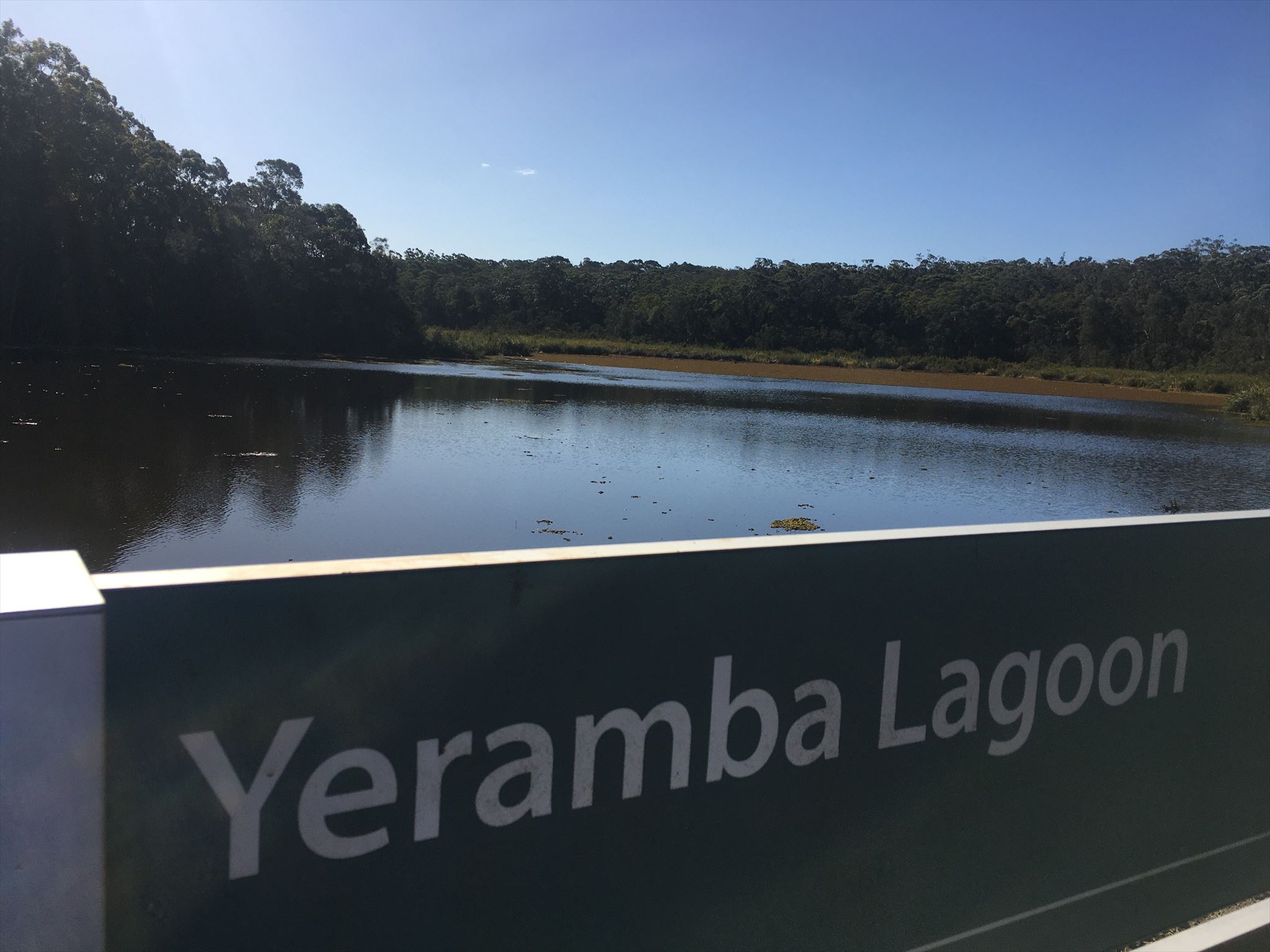
Georges River National Park is the traditional Country of the Dharug and Dharawal People and evidence of their long connection to this land, including shell middens, rock art and engravings, is evident throughout the park. The Georges River was an important transport route for Aboriginal people, linking Botany Bay to the inland areas. The park continues to be an important place for Aboriginal people today. The Yeramba Lagoon area (see below) has Aboriginal hand stencils.
For an overview of the area, a map can be located at this external link.
FITZPATRICK PARK (part of Georges River National Park)
Toilets, bbq facilities, picnic tables, drinking water, car parking (note as this is part of Georges River National Park, any Park fees are your responsibility. At the time of publishing this cache, the fee was $8/vehicle/day).

OPTIONAL EXTRA - YERAMBA LAGOON LOOP TRACK (will add about an hour - terrain rating 3/3.5)
There are two definitions that I could locate for yeramba – an Aboriginal instrument / throwing spear and an Aboriginal word for sugar ants.
The loop track is approximately 1.8km in total with a suggested time of 30min-1hr. It is graded 4 (“Bushwalking experience recommended. Tracks may be long, rough and very steep. Directional signage may be limited.”) – at the time of publishing this cache, the features of this track are recorded as:
- Time: 30min-1hr
- Quality of Markings: limited signage
- Gradient: short steep hills
- Steps: many steps
- Quality of path: formed track, some obstacles
- Experience required: some bushwalking experience recommended
Your safety is your responsibility. There are two main access points, numerous at the northern end and two at the southern end (closest to this cache). These are the only places you can leave the track so come prepared, remembering you are in a National Park and there may be wildlife encounters, including snakes.
Located on the other side of Henry Lawson Drive, more than 100 species of birds have been recorded here, from endangered pink robins and powerful owls to superb fairy wrens with vivid blue feathers, grey fantails or the more commonly sighted laughing kookaburra. You’re also likely to see crimson rosellas and rainbow lorikeets in the trees around you, along with black swans, white-faced herons and royal spoonbills by the water. There's also a great diversity of plant life around the lagoon, including impressive displays of banksia flowers, grassy woodlands and saltwater and freshwater wetlands. You may also notice small orchids, long-necked turtles and blue tongue lizards along this scenic walk.
Why not try the adventure lab located along the eastern side of the Yeramba Lagoon Loop Track?
INFORMATION SOURCES:
HOW TO LOG THIS CACHE
You will need to visit each of the waypoints listed below and take note of the answer to each waypoint's question. You will then use each answer to formulate an email address which, if correct, will respond with an automatic reply email confirming you can log the cache. Although unmonitored, the email address will be checked against found it logs to ensure compliance in accordance with logging requirements of this cache. TIP: consider taking photos at each waypoint should your answer/s be found to be incorrect!
- Waypoint 1 - Lambeth Reserve: The coordinates for this waypoint (S33 58.331 E150 59.799) will take you to a sculpture. How many human figures are carved into the rock? Take note of this number, it is your answer for this waypoint.
- Waypoint 2 - Boardwalk: At this waypoint (S33 58.551 E150 59.889) you should be near a warning sign advising you not to do something. How many people are shown on the sign? Take note of this number, it is your answer for this waypoint.
- Waypoint 3 - Picnic Point Reserve, vegetation: Here (S33 58.565 E150 59.871) is a sign about the vegetation within this reserve. How many different vegetation communities are listed on the sign? Take note of this number, it is your answer for this waypoint.
- Waypoint 4 - Picnic Point Reserve, environment: Another sign is located at this waypoint (S33 58.675 E150 59.742). How many distinct vegetation communities are contained within Bankstown's natural environment? Take note of this number, it is your answer for this waypoint.
- Waypoint 5 - Pete's Weekender: Here (S33 58.920 E150 59.868) you will see one of the many picnic tables in the area, this one called Pete's Weekender. How many times does the word 'Pete' appear on it? Take note of this number, it is your answer for this waypoint.
- Waypoint 6 - Water Fountain: This water fountain (at S33 58.816 E151 00.094) is one of very few man-made objects in this area. How many sides does it have? Take note of this number, it is your answer for this waypoint.
- Waypoint 7 - Lagoon Bridge: This bridge (located at S33 58.747 E151 00.150) traverses the overflow water from Yeramba Lagoon (located on the other side of Henry Lawson Drive) into the Georges River. How many of the smaller vertical bars are on one side (both sides are the same, you only need to count one side)? Take note of this number, it is your answer for this waypoint.
Write out your numbers in the order of the waypoints (for example, if there were only three waypoints and your answer at waypoint 1 was 7, your answer at waypoint 2 was 3 and your answer at waypoint 3 was 27, the number you have would be 7327). You should have nine digits. Now, substitute each number for the associated letter of the alphabet (eg, 1 = A, 2 = B etc, so in the 3 waypoint example, you would now have GCBG). Finally, using the ROT13 method, substitute each letter accordingly (again, using the 3 waypoint example, you would now have TPOT). These letters are your email address - (your final 9 letters) @gmail.com (no spaces - using the example (not the correct answer!) it would be tpot@gmail.com). If you have the email address correct, congratulations, you will almost instantly get an automatic reply.
As an optional extra, upload with your log a photo of your favourite place / view along this walk.
CONGRATULATIONS to Brewmaker and EverestHigh on joint FTF.
Virtual Rewards 2.0 - 2019/2020
This Virtual Cache is part of a limited release of Virtuals created between June 4, 2019 and June 4, 2020. Only 4,000 cache owners were given the opportunity to hide a Virtual Cache. Learn more about Virtual Rewards 2.0 on the Geocaching Blog.