FRANÇAIS
Une ancienne forteresse de l’évêque de Liège au nord des Ardennes belges
Le château de Franchimont (province de Liège, commune de Theux) était une des douze résidences et places-fortes de la principauté de Liège. Elle est citée pour la première fois dans les textes en 1155 mais ses premières constructions datent probablement du temps des évêques Henri de Verdun (1075-1091) et Otbert (1091-1119), ardents défenseurs de la principauté à l’époque de la féodalité.
Enclavé au milieu de territoires non liégeois (les duchés de Limbourg, de Luxembourg et la Principauté de Stavelot), le pays de Franchimont avait ainsi son système défensif mais aussi son centre administratif et judiciaire où résidait le représentant du prince. Le château défendait donc une forme de frontière, une « marche ».
En simplifiant, on peut diviser les ruines actuelles en trois enceintes concentriques qui correspondent, grosso modo, à l’évolution générale de la fortification du Moyen Age aux Temps modernes.
La première enceinte est le château proprement dit où se concentrent les vestiges, du château médiéval transformé à diverses reprises, principalement au XVI siècle.
Il reste peu de choses de la deuxième enceinte qui entourait une extension de la fortification à l’ouest et au nord, du côté des accès. Un des témoins les plus remarquables est le renforcement oriental – dit bouclier – du donjon de plus de 20 m de haut. C’est un exemple typique de fortification passive de la fin du Moyen Age (vers 1387) face aux progrès de l’artillerie.
La troisième enceinte, pentagonale, décrit une forme de bastion dont la pointe est orientée plein ouest. Elle date de l’époque d’Erard de la Marck. Avec ses moineaux d’artillerie et son balloir (= tour à canons) d’entrée, elle est un exemple typique de l’architecture militaire inventée par les ingénieurs au début du XVI siècle. Elle est comparable à des ouvrages que l’on peut trouver à Langres (F), au Mont-Saint-Michel (F) ou à Soleure (CH).
Malgré les démolitions au moment de la Révolution française à la fin du XVIII siècle, les ruines qui subsistent sont imposantes. Leur visite permet de comprendre l’évolution de l’architecture militaire en fonction de l’armement et, en particulier, son adaptation progressive face au développement de l’artillerie à poudre.
Source : https://chateau-franchimont.be/fr/historique/
NEDERLANDS
Een oude versterking van de bisschop van Luik in het noorden van de Belgische Ardennen
Het kasteel van Franchimont (provincie Luik, gemeente Theux) was één van de twaalf verblijfplaatsen en versterkingen van het prinsbisdom Luik. Het wordt voor het eerst vermeld in teksten uit 1155, maar de eerste gebouwen dateren waarschijnlijk uit de tijd van Hendrik van Verdun (1075-1091) en Otbert (1091-1119), beiden vurige voorvechters van het prinsdom tijdens de feodale periode.
Zodoende beschikte het land van Franchimont, dat een enclave vormde temidden van niet-Luiks grondgebied (de hertogdommen Limurg en Luxemburg en het prinsdom Stavelot), over zijn eigen defensief systeem, maar ook een administratief en juridisch centrum waar de vertegenwoordiger van de prins verbleef. Het kasteel verdedigde dus een bepaalde vorm van grens: een «mark».
We kunnen de huidige ruïnes ruwweg opdelen in drie concentrische ommuringen die grosso modo overeenkomen met de algemene evolutie van versterkingen in de Middeleeuwen tot de Moderne Tijd.
De eerste ommuring is de eigenlijke burcht waar we de resten terugvinden van het middeleeuwse kasteel dat verschillende verbouwingen onderging, voornamelijk in de 16de eeuw.
Van de tweede ommuring die een uitbouw bij de ingang, aan de westelijke en noordelijke zijde van de versterking omringde, is maar weinig meer overgebleven. Eén van de opmerkelijkste getuigen is de oostelijke versterking van de woontoren – het schild genaamd – van meer dan 20 m hoog. Het is een typisch voorbeeld van passive fortificatie op het einde van de Middeleeuwen (omstr. 1387), om het hoofd te bieden aan de vooruitgang van de artillerie.
De derde, vijfhoekige ommuring heeft de vorm van een bastion waarvan de punt voluit naar het westen wijst. Ze dateert uit de periode van Erard van der Marck. Met haar gekazematteerde capponières en zijn artillerie- of kanonnentoren die de ingang vormde, is het een typisch voorbeeld van de militaire architectuur, bedacht door de ingenieurs uit het begin van de 16de eeuw. Ze is vergelijkbaar met gebouwen te vinden in Langres (F), Mont-Saint-Michel (F) of nog Soleure (CH).
Ondanks de vernielingen tijdens de Franse Revolutie aan het einde van de 18de eeuw, blijft de ruïne nog steeds indrukwekkend. Een bezoek brengt u de evolutie van de militaire achitectuur bij. Deze volgde de ontwikkeling van de wapens en in het bijzonder de ingebruikname van vuurwapens.
http://chateau-franchimont.be/nl/historique-2/
ENGLISH
An ancient stronghold of the Liège bishop, north of the Belgian Ardennes.
Franchimont castle (Liège province, municipality of Theux) used to be one of twelve residences and strongholds of the principality of Liège.
It has been mentioned for the first time in written documents from 1155 but its first constructions probably date back to the time of bishops Henri de Verdun(1075-1091) and Otbert (1091-1119), fierce defenders of the principality during the feudal era.
Enclaved between the duchies of Limburg and Luxembourg and the principality of Stavelot, the principality of Franchimont therefore had its defensive system but also its administrative and judiciary center where the prince-bishop reprensentative resided. The castle thus defended a sort of a frontier, a « step ».
To simplify, the current ruins can be divided in three concentric perimeters which roughly correspond to the general evolution of fortifications from the Middle Age to the Modern Times.
The first perimeter is the castle strictly speaking, where are concentrated the vestiges of the medieval castle which has been transformed on various occasions, mostly throughout the 16th century.
Only little remains from the second perimeter which surrounded an expansion of the north and west fortification facing the access. One of the most remarkable remnants is the eastern reinforcement – also known as « the shield » (« le bouclier » in French) – of the more than 20 meter high dungeon. It is a thypical example of passive fortification of the late Middle Age (circa 1387) in order to counter the rise of the artillery.
The third perimeter, pentagonal this time, describes the shape of a bastion of which the tip is pointed due west. It dates back ton Erald de la Marck time. With its blockhouses and canon tower at the entrance, it is a prime example of the military architecture developed by engineers during the 16th century. It is comparable to constructions that can be found at Langres (France), in Mont-Saint-Michel (France) or in Soleure (Switzerland).
Despide the destruction that occurred during the French Revolution at the end of the 18th century, the ruins that remains are still impotent. Visiting them allow visitors to understand the evolution of military architecture and how it matched the armament, particularly the influence of black powder artillery.
https://chateau-franchimont.be/en/historic/
Comment loguer cette Virtual Cache ?
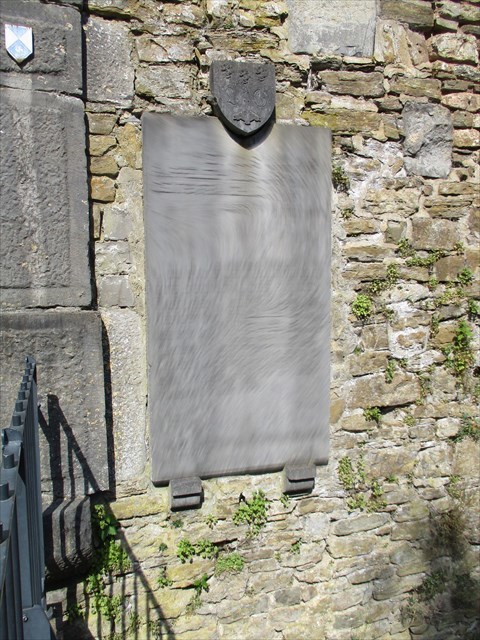
- Envoyer moi par mail (ou par le centre de Message de Geocaching), les dates et années reprises sur la pierre à droite de l’entrée du château.
- Prenez une photo de vous (pas nécessaire de montrer votre visage si vous ne voulez pas),de votre gps, de votre pseudo sur un papier, ou d’un élément personnel, devant les grilles du château et ajoutez là à votre log.
- Les logs qui ne répondront pas aux conditions seront supprimés.
Hoe log je deze Virtual Cache ?
- Mail me (of via het Message Centrum van Geocaching) de datums en jaren die op de steen rechts van de ingang van het kasteel staan.
- Neem een foto van uzelf (uw gezicht niet laten zien als je dat niet wilt), uw GPS, uw cacher naam op een papier of een persoonlijk item voor de kasteelpoort en voeg deze bij uw log.
- Logs die niet aan de voorwaarden voldoen zullen worden verwijderd.
How to log this Virtual Cache ?
- Send me by e-mail (or via the Geocaching Message Center), the dates and years written on the stone on the right of the castle entrance.
- Take a picture of yourself (not need to show your face if you don’t want it), your GPS, your cacher name on a piece of paper or a personal item, in front of the entrance of the castle and add it to your log.
- Logs that do not meet the requirements will be deleted.
Logbedingung
- Senden Sie mir per E-Mail (oder über das Geocaching Message Center) die Daten und Jahre, die auf dem Stein rechts vom Schlosseingang stehen.
- Machen Sie ein Foto von Ihnen (Sie müssen Ihr Gesicht nicht zeigen, wenn Sie es nicht wollen), Ihrem GPS, Ihrem Cachernamen auf einem Blatt Papier oder einem persönlichen Gegenstand vor dem Eingang des Schlosses und fügen Sie es Ihrem Log hinzu.
- Logs die die Anforderungen nicht erfüllen, werden gelöscht.
"> ">
Virtual Rewards 2.0 - 2019/2020
This Virtual Cache is part of a limited release of Virtuals created between June 4, 2019 and June 4, 2020. Only 4,000 cache owners were given the opportunity to hide a Virtual Cache. Learn more about Virtual Rewards 2.0 on the Geocaching Blog.