Mont Gargan – Virtual Reward 2.0

Le Mont Gargan, culminant à 731 m, offre un panorama exceptionnel sur le plateau de Millevaches et le massif des Monédières. Venez à la découverte des richesses naturelles, culturelles et historiques du site, et profitez de ce lieu à part !
Mont Gargan, culminating at 731 m, offers an exceptional panorama on the Millevaches plateau and the Monédières massif. Come and discover the natural, cultural and historical wealths of this site, and enjoy this special place!
L’allée des hêtres / Beech alley
Formée d’une soixantaine de hêtres formant une voûte végétale opaque en été, cette allée a été plantée par l’abbé Joyeux à la fin du XIXe siècle pour procurer ombre et protection aux pèlerins qui se rendaient à la chapelle.
Made up of around sixty beech trees forming an opaque vegetal vault in summer, this path was planted by Father Joyeux at the end of the 19th century to provide shade and protection for pilgrims who went to the chapel.

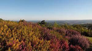
La lande / Moor
La lande du Mont Gargan a longtemps été pâturée par les troupeaux de moutons jusqu'au début des années 60. Cette pratique, accompagnée d'un usage de brûlis effectués tous les ans, a maintenu une végétation rase et plutôt éparse. Les travaux de restauration permettent année après année de stimuler le développement de la lande au sommet, et de gagner du terrain sur la friche forestière qui finissait par obstruer le paysage.
The moor of Mount Gargan was grazed for a long time by herds of sheep until the beginning of the 1960s. This practice, accompanied by the use of burns carried out every year, maintained a low and rather sparse vegetation. The restoration work allows year after year to stimulate the development of the moor at the top, and to gain ground on the forest wasteland which ended up obstructing the landscape.
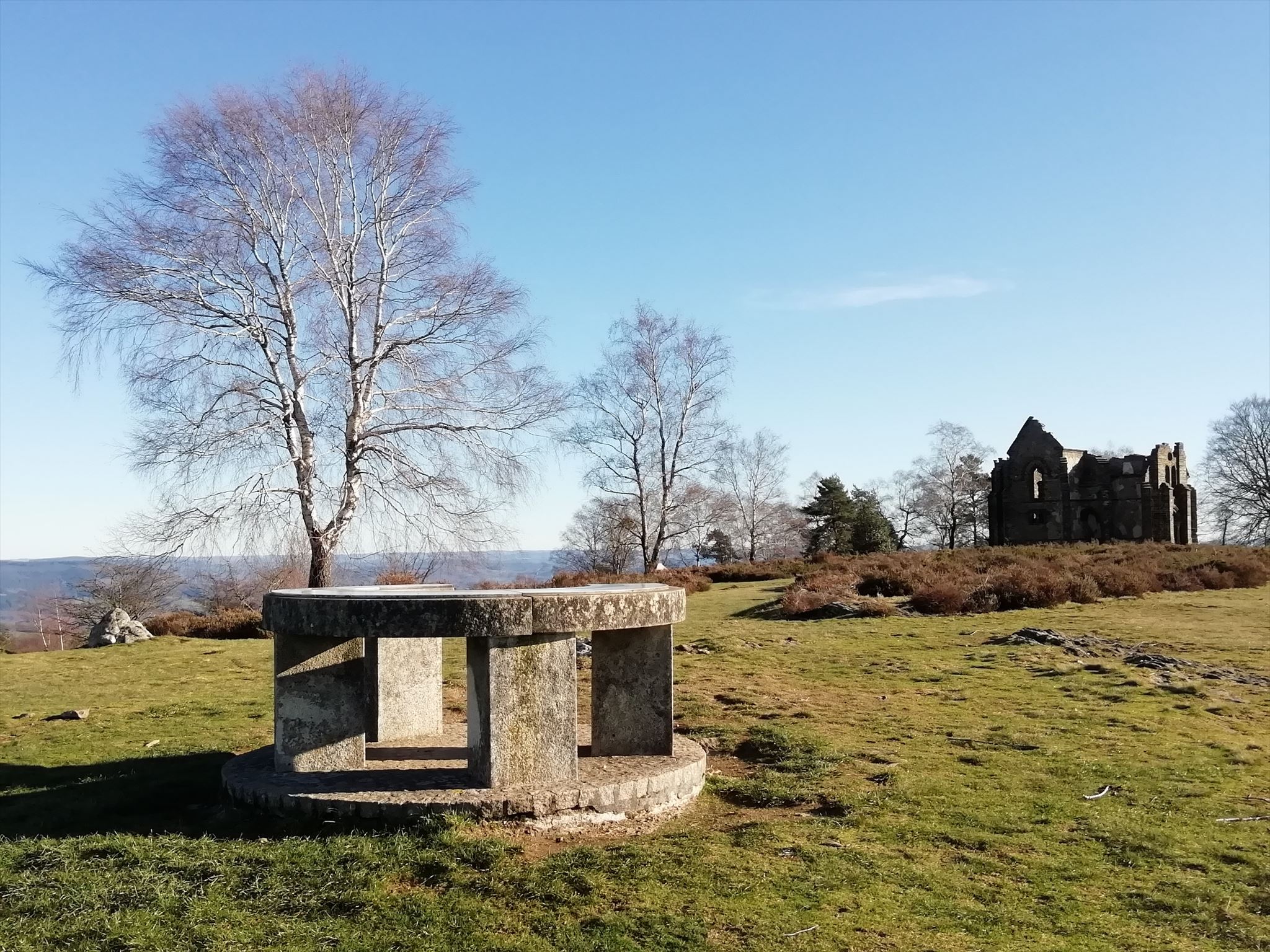
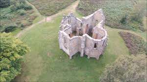
La chapelle Notre-Dame de bon Secours / the chapel
Situé sur un petit tertre au sommet, cet édifice dédié à Notre-Dame-de-Bon-Secours a été érigé entre 1868 et 1871 grâce à de généreux donateurs et bénévoles, sous la houlette du curé de Surdoux et de Saint-Gilles-les-Forêts, l'abbé Louis Joyeux. Les jours de pèlerinage, les fidèles assistaient à la messe dans la chapelle, puis se livraient à une procession à travers les landes en passant par la fontaine du buisson blanc. Cette tradition se perpétue de nos jours avec le festival du Mont Gargan qui a lieu tous les ans au 15 août depuis 1966.
Located on a small hillock at the top, this building dedicated to Notre-Dame-de-Bon-Secours was erected between 1868 and 1871 thanks to generous donors and volunteers, under the leadership of the parish priest of Surdoux and Saint-Gilles-les -Forests, Father Louis Joyeux. On pilgrimage days, the faithful attended Mass in the chapel, then engaged in a procession through the moors, passing by the fountain of the ‘buisson blanc’. This tradition continues today with the Mount Gargan festival which takes place every year on August 15 since 1966.
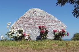
La pierre de mémoire / Memory stone
Pendant la seconde guerre mondiale, la région du Mont Gargan a été un haut lieu de la Résistance. Le 14 juillet 1944, en plein jour, 35 forteresses volantes alliées parachutent une très importante quantité d'armes aux abords du Mont Gargan pour le maquis du colonel Guingouin qui n'a cessé de se renforcer depuis le printemps et contrôle désormais tout son territoire.
Le 17 juillet 1944, les Francs-Tireurs et Partisans (FTP) de Georges Guingouin sont encerclés par une force ennemie lourde composée de plusieurs régiments. Face à l'ampleur de l'attaque, les maquisards pratiquent une stratégie d'opposition frontale puis de décrochage et parviennent à conserver la quasi-totalité des parachutages. Les combats sont particulièrement violents. Les maquisards perdent 43 hommes et on dénombre 54 blessés, contre 342 tués et blessés pour les Allemands. Cet épisode représente l'un des rares combats victorieux de la Résistance de l'intérieur dans une bataille rangée.
Des stèles en granit visibles à de nombreux endroits autour du Mont Gargan témoignent de ces combats et perpétuent la mémoire des Résistants qui ont perdu la vie et du colonel Guingouin.
During the Second World War, the region of Mount Gargan was a hotbed of the Resistance. On July 14, 1944, in broad daylight, 35 Allied flying fortresses parachuted a very large quantity of weapons on the outskirts of Mount Gargan for the maquis of Colonel Guingouin who has continued to strengthen since the spring and now controls all of its territory.
On July 17, 1944, Georges Guingouin's Francs-Tireurs et Partisans (FTP) were surrounded by a heavy enemy force made up of several regiments. Faced with the scale of the attack, the guerrillas practiced a strategy of frontal opposition then of stalling and managed to keep almost all the parachutes. The fighting is particularly violent. The maquisards lost 43 men and there were 54 wounded, against 342 killed and wounded for the Germans. This episode represents one of the few successful battles of the Resistance from within in a pitched battle.
Granite stelae visible in many places around Mount Gargan bear witness to these fights and perpetuate the memory of the Resistance fighters who lost their lives and of Colonel Guingouin.
Pour pouvoir loguer cette virtuelle, il va falloir trouver les caches virtuelles du Limousin que l’on peut apercevoir (virtuellement) depuis ce point culminant ! Les questions auxquelles vous devez répondre :
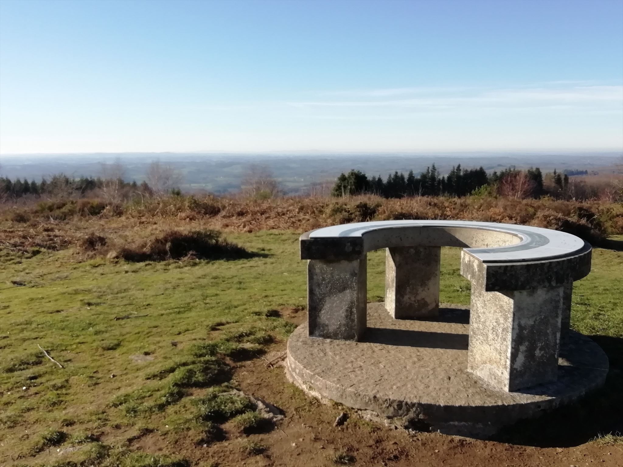
- Petite table d’orientation : à quelle distance se trouve le pylône du Mont-Bessou ?
- Grande table d’orientation : à quelle distance se trouve Oradour-sur-Glane (GC7B87P) ?
- Grande table d’orientation : à quelle distance se trouve Limoges (GC7B9TR) ?
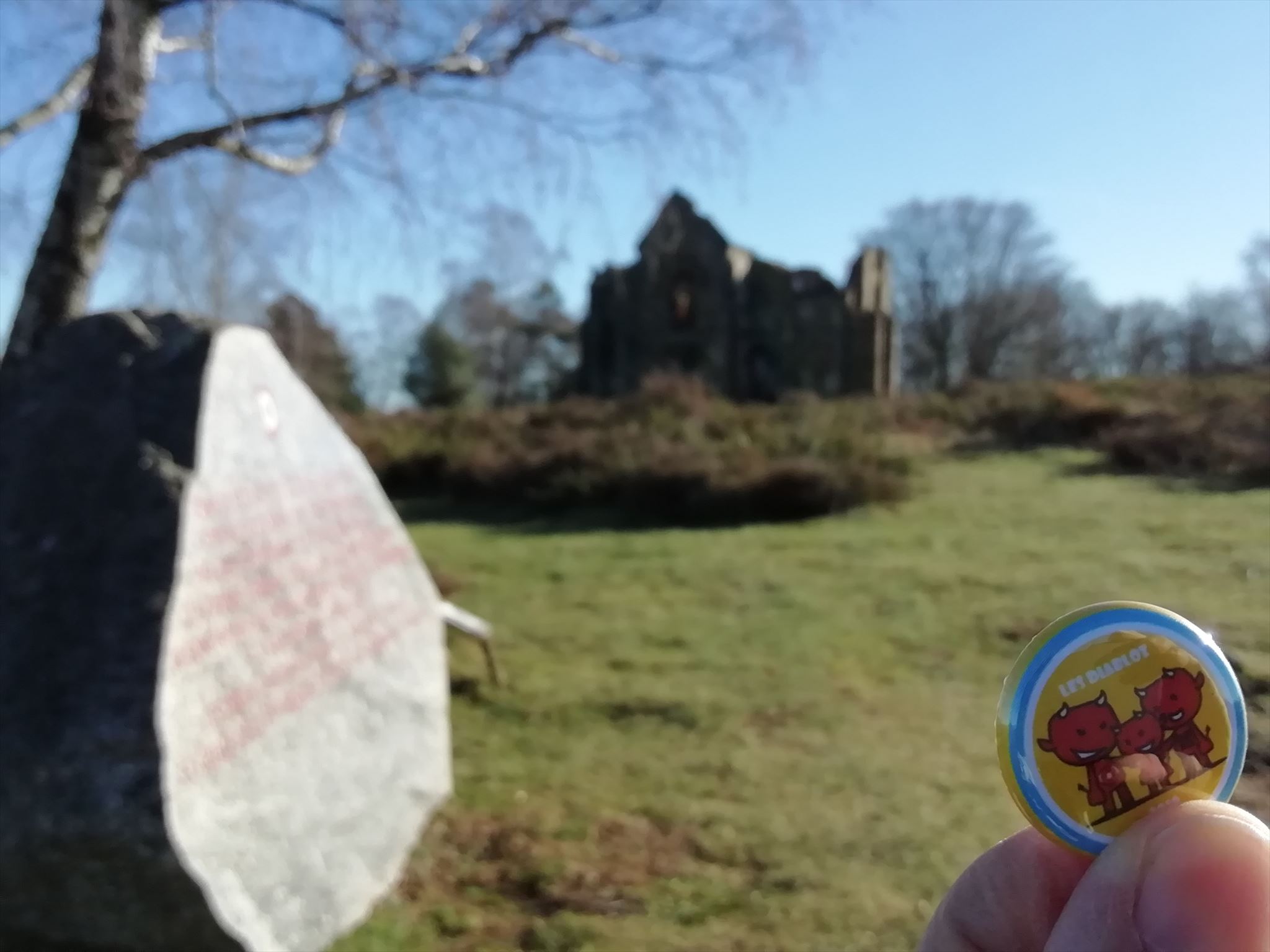
- Pierre de Mémoire : prenez une photo de la pierre de mémoire, avec la chapelle, et votre pseudo 😊
Vous pouvez m'envoyer les réponses par mail ou via la messagerie géocaching, je vous contacterai en cas de problème.
Tout log sans envoi de réponses sera supprimé.
To be able to log this virtual one, you will have to find the virtual caches of Limousin that can be seen (virtually) from this highest point! The questions you need to answer:
- Small orientation table: how far away is the Mont-Bessou pylon?
- Large orientation table: how far away is Oradour-sur-Glane (GC7B87P)?
- Large orientation table: how far is Limoges (GC7B9TR)?
- Stone of Memory: take a photo of the stone of memory, with the chapel, and your nickname 😊
You can send me the answers by email or via geocaching messaging, I will contact you in case of problem.
Any log without sending responses will be deleted.
Virtual Rewards 2.0 - 2019/2020
This Virtual Cache is part of a limited release of Virtuals created between June 4, 2019 and June 4, 2020. Only 4,000 cache owners were given the opportunity to hide a Virtual Cache. Learn more about Virtual Rewards 2.0 on the Geocaching Blog.