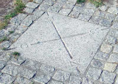
Denne cache er gemt 22 meter syd for det geografiske knudepunkt, hvor den 55. breddegrad skærer den 15. længdegrad. Der ligger i dag en sten som markerer knudepunktet. Tidligere lå stenen placeret ifølge ED50 datum (N54°59.965' E014°59.932' ifølge WGS84), men er altså nu flyttet til sin "rette" plads. Når du har fundet cachen, er den nærliggende gamle vandmølle "Slusegården" et besøg værd.
*** The cache is placed within 22 meters south of the confluence point where the 55th latitude crosses the 15th longitude. Today, the place is marked with a stone. Previously, the stone was placed according to ED50 datum (N54°59.965' E014°59.932' according to WGS84), but has now been moved to its "right" place. When you have found the cache, be sure to visit the old watermill, "Slusegården", nearby.
See photographs of this and other Danish confluence points (thanks, Gundrup!).