A series of caches of various sizes and types along the footpaths or entrances to the Netherfield Lagoons.
Slippery slopes and thorns are present with some caches, so please take extra care.
Tweezers or tools may be required for some
****** This Cache has been placed with the kind permission of the Gedling Conservation Trust ******
A Local Nature Reserve in Nottinghamshire

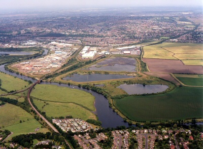
Aerial View of Netherfield Lagoons, Local Nature Reserve, Nottingham
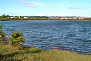
The Netherfield Lagoons, Local Nature Reserve is situated on the Trent Valley Flood Plain in Nottinghamshire and has been partly used as a dump for coal slurry but with two remaining gravel ponds. The two slurry pits are separated by a raised causeway, which is elevated some 50 feet (15 m) above the pits, giving a commanding view of the area. The largest tank is virtually full but retains some water, with muddy edges attractive to waders and roosting gulls and terns. The smaller tank is mainly deep water, attracting good numbers of wildfowl, with smaller birds, especially warblers, feeding and breeding around the tank edges. The site consists roughly of three compartments, the Slurry Lagoon, the Deep Pit and the two Gravel Pits.

The Slurry Lagoon
The Slurry Lagoon at Netherfield is where the slurry pumped from Gedling pit arrived and was spread out to settle and the water drain off. The pit is virtually full and the surface of dark grey slurry is slowly being covered as plants gain a hold. Recently a large reed bed has developed and this is now accelerating and will eventually probably cover most of the area. Other parts of the slurry surface have been colonised by Southern Marsh, Spotted and Bee Orchids. The southwest end of the slurry has a permanent shallow water body, which attracts waders, gulls and ducks and has a good population of Black-tailed Skimmers. The reed beds often hold Bittern during the winter and have been visited by Bearded Tits on several occasions.

The Deep Pit
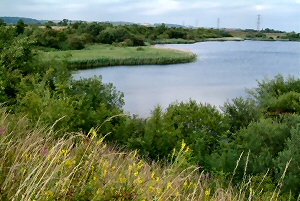
The Deep Pit has very steep banks and deep water at the bottom. There are tern rafts floating on its surface, which are used by a small colony of Common Terns. The banks are covered by a mixture of scrub and grassy areas and have a rich diversity of floral and insect interest. There are nine species of warbler that regularly nest around this pit.