Heustis/Houston Beach Glacial Sand Deposit EarthCache
Heustis/Houston Beach Glacial Sand Deposit
-
Difficulty:
-

-
Terrain:
-

Size:  (other)
Please note Use of geocaching.com services is subject to the terms and conditions
in our disclaimer.
Heustis/Houston Beach, Annapolis Valley
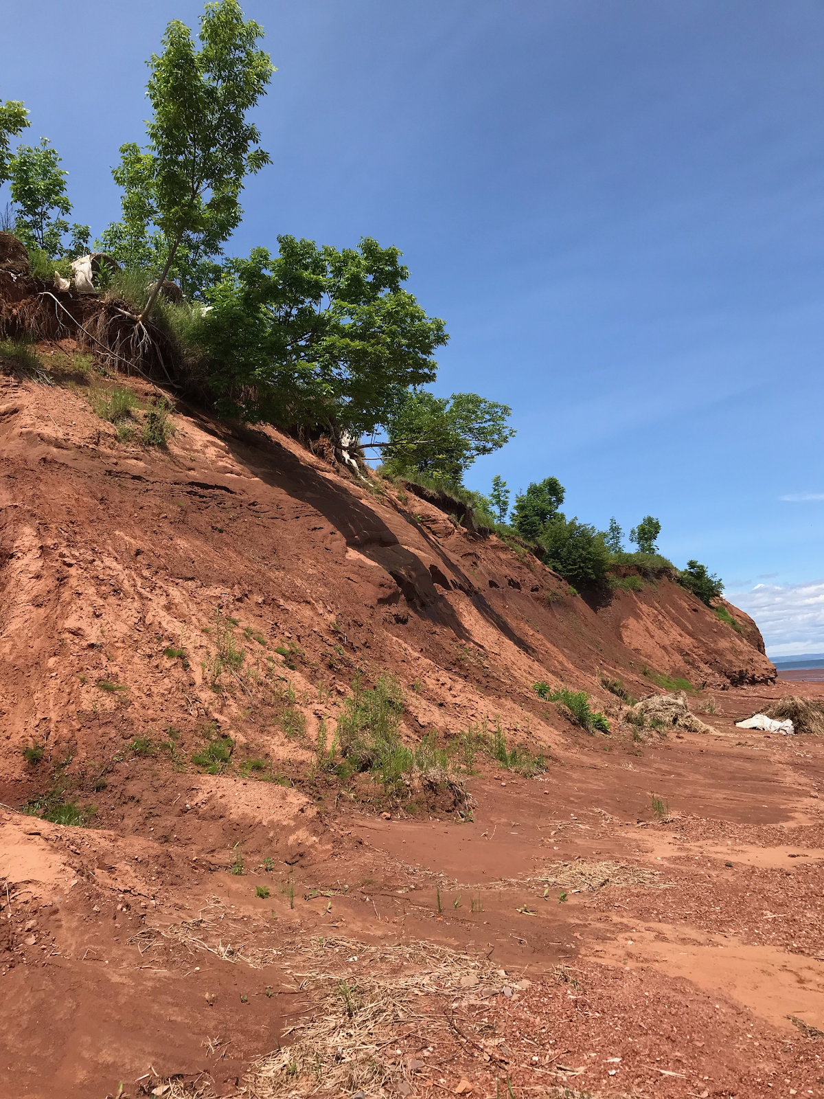
Some people call it Heustis, others call it Houston. No one seems to know which one, as it isn’t signposted. Heustis Beach is a lovely red rocky/sandy beach near the base of Blomidon. It’s a great place for a bonfire, or to swim in the Minas Basin.
At low tide take a walk along the shore and explore the sedimentary cliffs and various rock formations. Even at the highest tide, there is still a small beach area, and several tidal pools to explore. The tide goes out (or comes in) very quickly, so be aware!

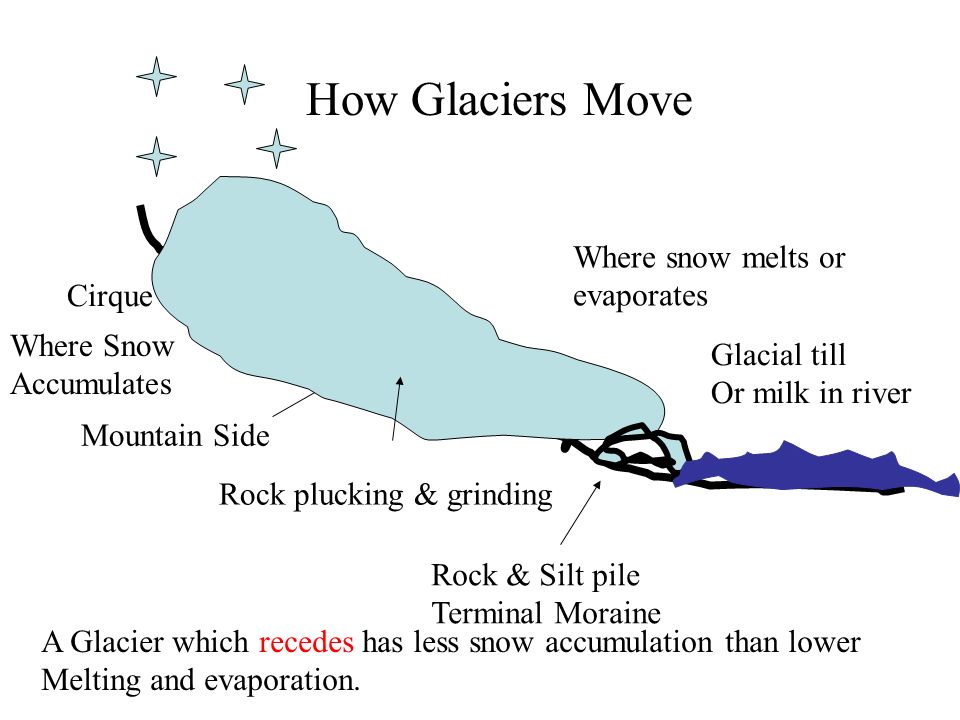
For the last 1.8 million years, a continental ice sheet originating in northern Canada has advanced and retreated over North America. Around 20,000 years ago, a warming climate put the glaciers in retreat, bringing the Northeast to its current interglacial period. Deposits associated with the massive, moving and melting ice remain today as valuable non-mineral resources in the Northeast.

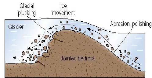
Perhaps the most important resource left to the Northeast by the glaciers is sand and gravel. At this location you will find a very large deposit of sand as a result of a glacial grinding. As the glaciers advanced over the landscape, their vigorous scraping action incorporated boulders, gravel, sand, silt and clay from the underlying bedrock and already loose sediment into the moving ice.
Basal sliding erodes the rock surface underlying a glacier. Meltwater freezes in cracks, and pieces of bedrock are pried loose and incorporated into the ice (similar to frost wedging). These pieces of rock grind against each other and the bedrock underneath. The intensity of the grinding is proportional to the weight and pressure of the glacier.

Glacial sand and gravel are easily mined because the glacial deposits are all at the surface and there is little if any processing involved. This being one of the largest deposits of sand it would have been mined and used for resources in construction if it was not part of the coastline.
To log this Earthcache visit the viewing location. Please answer the following questions and send in a timely manner to my geocaching profile or email. Answers not received will result in deleted logs.
1. How wide is this sand deposit at posted Coordinates?
2. How high is the sand deposit at posted Coordinates?
3. What is the consistency of the sand here?
4. Do you see any signs of erosion?
5. [REQUIRED] In accordance with the updated guidelines from Geocaching Headquarters published in June 2019, photos are now an acceptable logging requirement and WILL BE REQUIRED TO LOG THIS CACHE.
Additional Hints
(No hints available.)