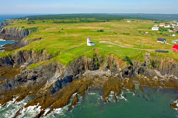
** Be very careful when approaching this earthcache. The rocky terrain can be slippery, and some areas on sharp inclines. The footing is uneven and very unfriendly so please use all care when exploring the area, and don't go beyond the ground zero for the cache. For this reason, I have increased the terrain level of this cache.
To log this earthcache, please don’t stress about answering the questions. Simply send your best attempts in a private message to me, (the cache owner), and then go ahead and log it as found.
You don’t need to wait for my approval. All attempts will be accepted.
Go ahead and have fun learning! 
- [REQUIRED] Please post a photo in your log of yourself or a personal item with the lighthouse to prove you visited the site.
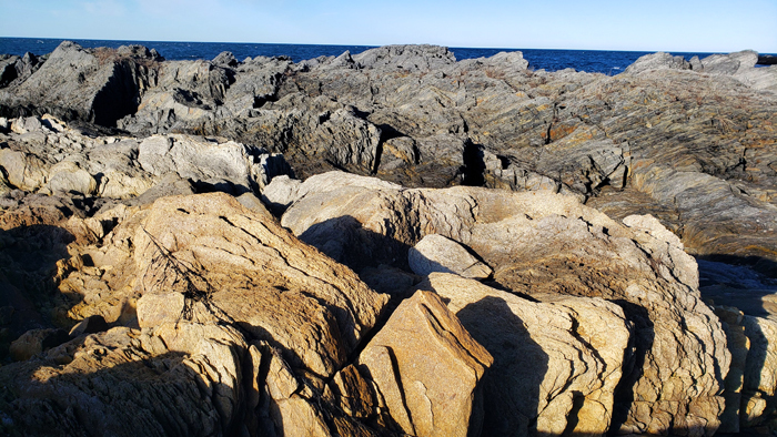
- At low tide, face seaward and look for the dark grey slate on the right. Compare the dark slate outcrop to the lighter tuff outcrop next to it and describe the differences in terms of consistency, texture and hue.
- Compare the folding and tilt. How do the layers differ in angle degrees and direction of tilt?
- Why are the rocks surrounding the two outcrops so different from them?
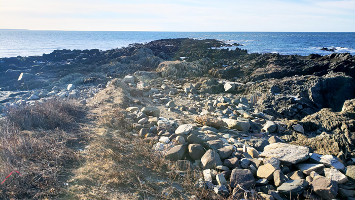
Low tide ONLY!
Ordovician Meguma
During the Ordovician Period between 488.3 million years ago and 443.7 million years ago, Nova Scotia was almost entirely ocean, and most of the world's land was collected into the southern supercontinent Gondwana. The Ordovician is best known for its diverse marine invertebrates, including graptolites, trilobites, brachiopods, and the conodonts (early vertebrates).
The Meguma terrane, is a terrane exposed in southern Nova Scotia, that became joined to the present North American landmass as part of the Appalachian orogeny.
The rock layers here are part of the early Ordovician Meguma. Throughout the rest of the Ordovician period, the arrangement of Earth’s tectonic plates changed rapidly and dramatically, The Rheic Ocean grew thousands of miles wide, creating a complex, ever-changing collage of ocean tracts and microcontinents. By the time Ganderia collided with Laurentia early in the Silurian period, Meguma had begun to rift away from Gondwana at last.
At Cape St. Marys, you can see both the old and the new environment of Meguma side by side. Between them is a fine line, an unconformity, representing a 30-million-year gap in Earth’s record-keeping. On one side, the slate warehouse; on the other, Meguma’s innovation: layers of much younger volcanic ash. Explosive eruptions marked the onset of new conditions.
The contact between the slate and the tuff is the unconformity that makes this site so significant. The rocks right beside it are broken and weathered because later on, a shear zone formed along the unconformity. All the rocks here – both slate and tuff – were metamorphosed and deformed during the Devonian period. They all have well-defined, near-vertical cleavage as a result.