
***THIS IS AN EARTHCACHE***
***There is no container at the posted coordinates***
***You will need to submit answers to the questions below in order to claim this geocache as a find.***
Please obey all rules & regulations at the site and stay within the designated areas for public visitation. There is no need to leave the trail to successfully claim this EarthCache. And, as always, please practice CITO: Cache In, Trash Out!
Colonists of European descent first settled in Fryeburg in 1762/63 on the site of the former Abenaki Indian village of Pequawket, and the town was incorporated in 1777.
Located on the east end of Fryeburg and originally thought to be a glacial erratic, Jockey Cap is a granite pegmatite dome, part of the Sebago Pluton formed during the Carboniferous geologic period of the Paleozoic Era, sometime between 300 and 360 million years ago.
As glaciers advance over such domes, abrasion can occur on the stoss side (the side of the dome facing the flow of the glacier). As the glacier moves over the dome, plucking (also called quarrying) can occur, in which cracks or crevasses form in the glacier ice above, allowing intermittent periods of thawing and freezing which can cause boulders and rocks of various sizes to break free from the dome on the lee side and be pushed or carried forward away from the dome—some for short distances and others much further. A number of such boulders can be seen at the bottom of the south-facing side of Jockey Cap.
The surfaces of such domes can also sometimes contain shallow basins or depressions called "panholes" (or "weathering pits" or "solution pits") which form when water and sand collect in slightly lower areas. Over time, the depressions eventually grow larger, allowing the collection of more debris, and eventually enough biological detritus may collect to allow simple plant growth, which then in turn helps to break down the material further. Finally, even shrubs or small trees may gain a foothold in the depressions and become established.
Admiral Robert Peary (the celebrated explorer most often credited as being the first person of European descent to reach the North Pole in 1909), born in 1856, moved with his mother to Portland, Maine after the death of his father in Pennsylvania in 1859. After graduating from Bowdoin College in Brunswick, Maine in 1877 with a civil engineering degree, he lived in Fryeburg from 1878-79. During this period he made a survey from the top of Jockey Cap, encompassing 360° of the surrounding mountain peaks visible from the summit. After Peary’s death in 1920, his boyhood friend Alfred E. Burton made a suggestion that Peary’s survey be incorporated into a monument, which was commissioned by Peary’s widow and daughter and installed in 1938. The bronze monument remains atop Jockey Cap to this day.
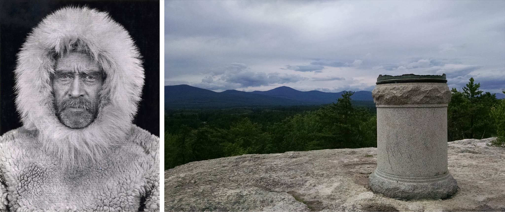
ABOVE: Robert Peary (self-portrait, 1909) and the Peary Monument atop Jockey Cap (2019).
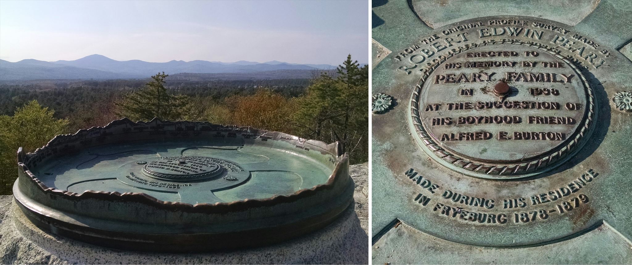
ABOVE: Close-up images of the Peary Monument (2019). (The bumps and ridges around the edge of the monument represent and identify the mountain peaks as seen in the distance).
The summit towers 200 feet above the surrounding area and the views are quite inspiring. The trail is fairly short—approximately ¼ mile to the top, or a little over ½ mile round trip—but the ascent is somewhat steep. Wear sensible footwear when visiting the site, and use caution while on the summit.
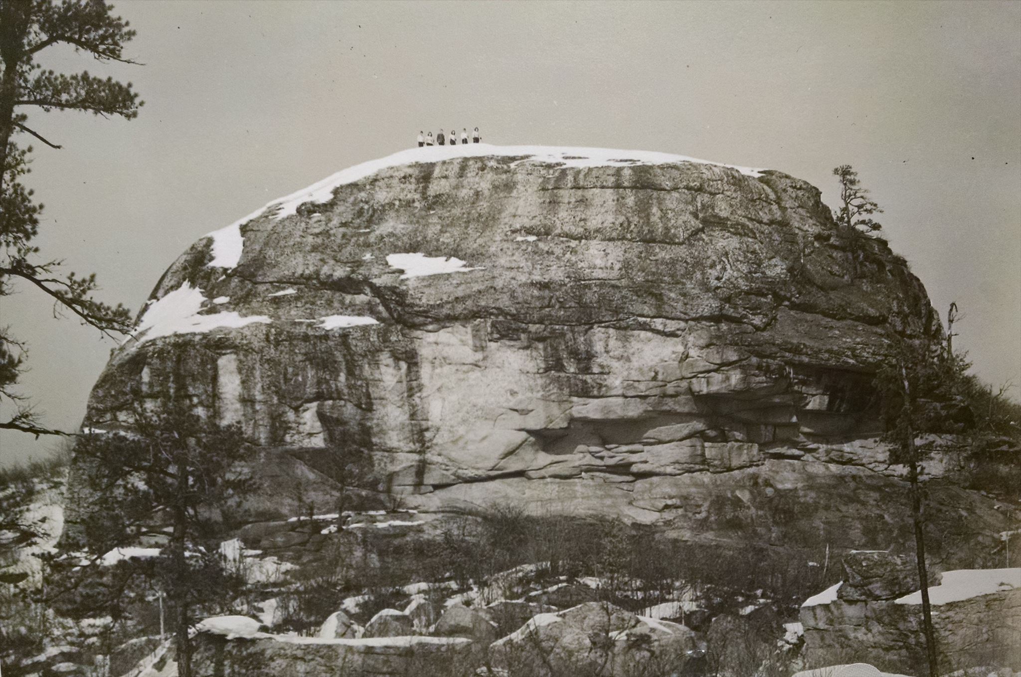
ABOVE: Jockey Cap, ca. 1940. (Photo courtesy of the Fryeburg Historical Society).
After you arrive at the coordinates and enjoy the surrounding views, take a look at the surface area around you.
In order to claim this cache as a "find," please perform/answer the following:
1). Send me an email or message with "Jockey Cap" or "EarthCache" as the Subject, and tell me how many are in your group.
2). Observe the characteristics of the material of which the Jockey Cap “dome” is comprised and consider what natural materials or processes may have had an effect upon it. Are there any depressions ("panholes") in the base material where water might collect or is the area entirely smooth?
3). Do you see much evidence of erosion? If so, how do you think it occurred? Is weather involved?
4). How much plant life is there growing in the immediate area on top of the rock itself? If any, how do you think it became established, and is it enough to contribute to any significant changing of the surface?
5). (Optional) When you post your log below, include a photo of you, your group, your GPS, or something you find interesting on or near the coordinates, (such as the Peary monument), or even the fantastic views as seen from the top). I enjoy seeing your photos and am sure others will as well!
Answers to EarthCache questions should be sent to the Cache Owner BEFORE you log the cache. If you are unable to send the answers remotely, then technically you should wait until after you do send the answers before logging the cache. However, I'm willing to be flexible, providing you still send the answers within a reasonable amount of time. Logs without an accompanying email or message having been sent to the Cache Owner (or without responding to pending questions from the C.O.) will be deleted with no further notice.
I've noted the cache as being "Seasonal Access Only," but those who are experienced with cold and/or snowy/icy conditions may choose to venture here during the winter months. I have no experience with the trail in winter time and would not suggest it unless you are used to such conditions. (Keep in mind if there is snow on the surface you may not be able to sufficiently answer the questions).
Down at the base of Jockey Cap, if you venture around to the “front” (south-facing) side you will see a number of large boulders as mentioned above, some of which form what’s known as “Molly Ockett’s Cave.” A member of the Native American tribe who resided at Pequawket, Molly Ockett lived from ca. 1740 – 1816 and is said to have periodically resided in the cave. (The school located across the side road bears her name).
The area is also quite popular with rock climbers, so you may see a few on your visit.
There are a couple of picnic tables and a porta-potty at the trailhead next to the parking area.
As of Summer 2024: The parking area and the official trail entrance have moved. The former Jockey Cap/Quinn's convenience store no longer allows parking for the hiking trails. Instead of being just west of the convenience store, designated parking is now a short distance east of the Dollar General on US 302. I have updated the parking coordinates accordingly. (Thanks, Pamstah & Hapitok, for letting me know!) From the rear of the parking lot, at the trail entrance sign, the trail should head west past the front/face of Jockey Cap mountain, and then curve to the right, heading toward the back where it will begin the major part of the incline.
- - - - - - -
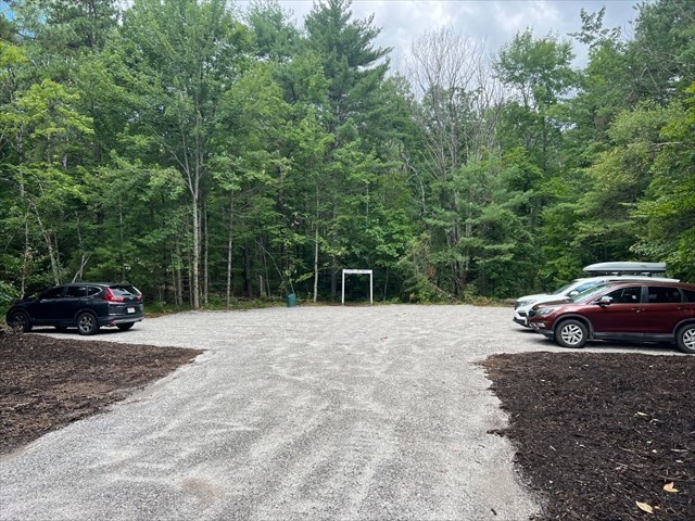
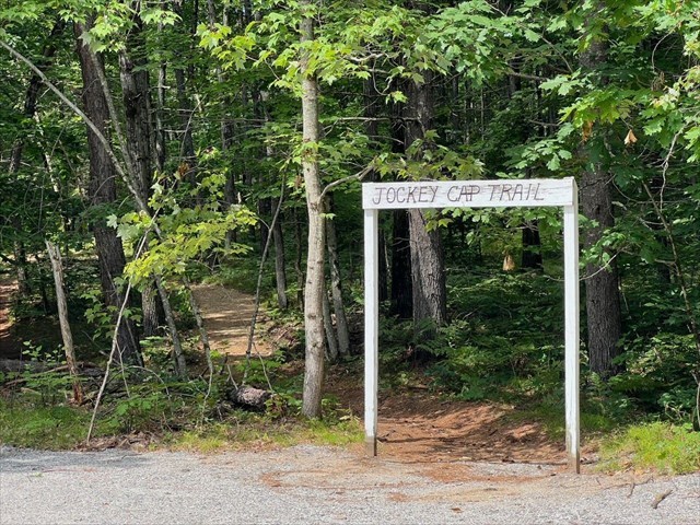
ABOVE: Jockey Cap parking lot and trailhead (2024) (Courtesy of Pamstah).
Also, while here don't forget to do the nearby traditional (container-type) Jockey Cap geocache (GCH8J3), one of the oldest in this area! It's only about 230 feet away!
Thanks for taking the time to visit this EarthCache! Grateful acknowledgement is given to the Fryeburg Historical Society, the Bethel Historical Society, and Karen L. Webber, William B. Simmons, Alexander U. Falster, and Sarah L. Hanson, authors of the paper “Anatectic pegmatites of the Oxford County pegmatite field, Maine, USA” (2019), from which information was gathered for the description above. Thanks, also, to the town of Fryeburg and Arizona Zipper, co-landowners of the property which includes Jockey Cap. 😀
- - - - - - - - - -
| I have earned GSA's highest level: |
 |
- - - - - - - - - -
* * * Congratulations to Trail Mongers and ajcdlc4 for being co-FTF!! * * *