11W Series - Sullivan County
About This Series
Welcome to the 11W Series - Sullivan County! We hope you enjoy finding this series and visiting the area!
Here are some things you need to know before you begin this series:
- Each cache has an adequate shoulder to pull off on. Please park as close to the far edge of the shoulder as possible for safety.
- Be vigilant when exiting your car to search for the cache.
- The original cache containers are either pill bottles or centrifuge tubes. This may change as the series is found by different cachers.
- Please bring extra logs with you. You never know when you'll find a wet log. We have no problem with you replacing a log in any of these caches.
- None of these caches require bushwhacking or hiking.
- If you're having trouble finding it, check the hint.
- These containers are NOT meant to be swapped or jumped. Many are specifically made to fit their hiding spot.
The Original 11W Series
Published in June 2012, the original 11W Series was hidden by VAtechnoteacher and 3doxies. Their plan was to have a series of caches that spanned multiple counties from Bristol, TN to Knoxville, TN along the 11W Highway.
With the help of cachers in each county, they were able to complete a great deal of the series (201 caches). Published under the name 11W_Roundup, the caches have been found by over 300 cachers throughout the years.
Sadly, in 2016 in 3doxies and VAtechnoteacher passed away. Since then, the caches along the trail have fallen into disrepair due to lack of maintenance and upkeep.
History of U.S. 11
The U.S. numbered highways are the original interstate highways and date back to 1926 and numbered in a grid. The even-numbered route was for east-west routes (with the lowest numbers along Canada) and odd-numbered for north-south routes (with the lowest numbers along the Atlantic Ocean).
Three-digit highways were known as 'child routes' and branched off their main one or two-digit parents like U.S. 11. U.S. Route 11, created in 1926, is a north-south highway extending 1,645 miles across the eastern United States. The most southern point of the road begins in Bayou Sauvage National Wildlife Refuge in eastern New Orleans, Louisiana. The most northern point actually crosses the Canadian border as Quebec Rt. 233.
The Maestri Bridge, which crosses Lake Ponchatrain, served as the only route to New Orleans from the east for six weeks after Hurricane Katrina due to its sturdy construction. Route 11, parallels Interstate 81 in many areas and is joined by Interstates 59, 40, 75, and 24.
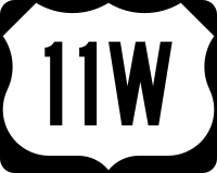
U.S. Route 11 enters Tennessee west of Chattanooga and exits Tennessee south of Bristol as it heads into Virginia. In Knoxville, the route splits into U.S. Route 11W and U.S. Route 11E. This series of 'park and grab' geocaches will focus on the most northern end of U.S. 11W in the state of Tennessee--focusing on the different counties of the area.
The route extends 120 miles between Knoxville to Bristol--with a bike route alongside the highway which expands the pull-off area alongside both sides of the road.