
What are you doing in my swamp?
A famous line from a famous movie, but at this location, what is the relevance to this quote?
Well it would have to be geological relevance, after all, this is an earthcache. You know the drill…
- read through my drivel
- answer my questions
- claim your smilie
- don’t forget to send me your answers and a photo
- I don’t delete your log
If you’re standing at GZ, quotes about swamps at first may not make much sense. You should be standing in the middle of the small town of Cardinia, just outside the Presbyterian Church, across the road from the Cardinia Primary School. At first glance it doesn’t seem like an area of geological significance, so why would there be an earthcache here?
Well, nearby to where you are standing is a red marker in the ground. It marks the highest point on the landscape for quite a few kilometres in every direction. From where you are standing, looking north up Cardinia Rd, just past the 80 sign, you can see where this raised bit of land drops off suddenly to meet the plain that is the farmland below. To the east, along Ballarto Rd, just past the 60 sign, you can see a fence visibly change contour as the land drops slightly to again meet the plain below. To the west, the other way along Ballarto Rd, you can see at the edge of the township, near Beazly Rd, where again the landscape drops slightly, but suddenly, to meet the plain of the surrounding farmland.
Question 1 – Walk up to the corner and look down Dalmore Rd to the south. How far behind the church to the south, do you estimate the raised land also drops off to meet the plain below?
What’s caused this strange landform that the sleepy town of Cardinia has been built upon? Would you believe me if I told you a large ancient creature was buried here, and the township is built on its grave? Perhaps it’s a dormant volcano that may spring back into life at any moment. Or maybe it was the result of the nearby Cardinia Creek that runs just to the north of the town (see map below).
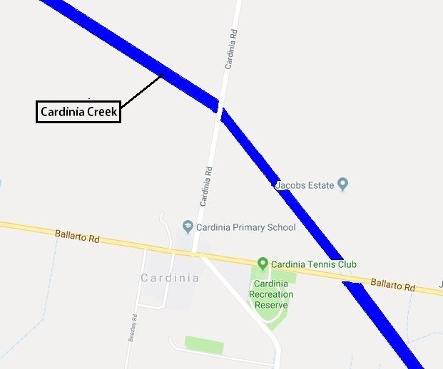
More likely the later of those options, but how does this innocuous looking creek, that runs 500 meters to the north of the township, cause this pronounced hump in the landscape? Let’s figure that out….
Question 2 – Looking at the map above, does the path of the Cardinia Creek look man made, or natural?
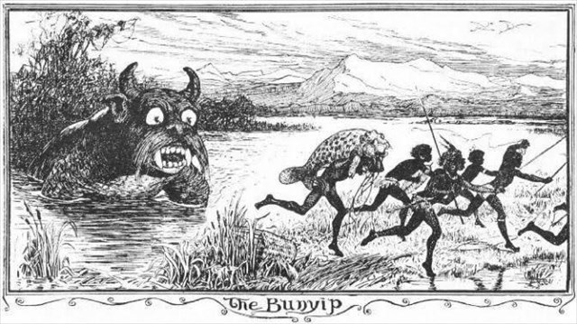
Hopefully you got the answer to the above question correct (if not then the rest of this is not going to make much sense). You see to fully understand what is happening here, we need to look back in time. Not too far back in time (in a geological sense) but back to the years before colonial settlement. Look around you and imagine the plains of farmland as thick, impenetrable swamp. Visualize waist deep water, reeds and bullrushes so thick that a person couldn’t physically push their way through, stretching out for 40,000 hectares. This vast, impenetrable swamp was fed from the hills to the north by the Cardinia Creek and the Bunyip River, as well as many smaller creeks. Even the aborigines didn’t try and enter the swamp, as they feared a mythical creature call the bunyip which supposedly lived within (see picture below).
As European settlers began arriving, they wanted more and more land for farming, and I guess they thought that the Koo Wee Rup swamp looked like an ideal spot to put farms, except, or course for…
- The thick impenetrable waist deep water, reeds and bullrushes.
- The constant, unpredictable flooding
- The strange mythical creature that supposedly liked to eat farmers children.
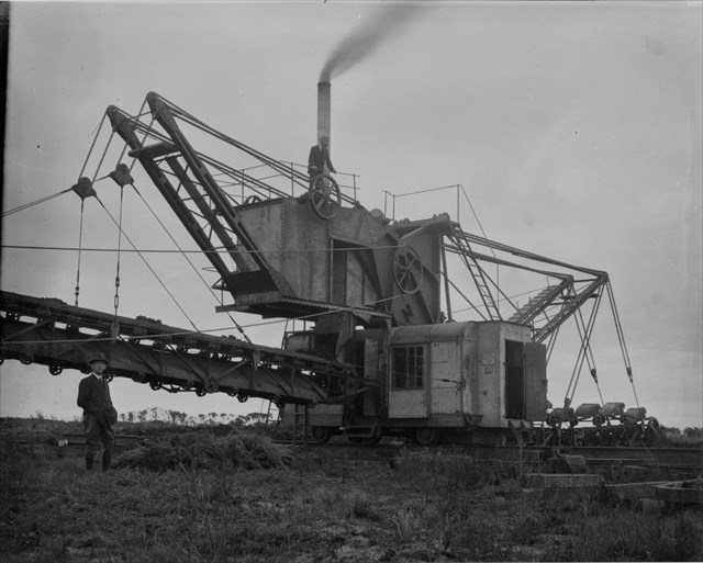
So, starting sometime in the 1870s, they dug huge, straight channels starting at Moody’s Inlet on Westernport bay, redirecting the path and increasing the flow of these rivers and creeks. The work continued until the 1950s.
Question 3 – What do you think the effect on the Koo Wee Rup swamp was of artificially increasing the flow of these rivers and creeks into Westernport Bay? (hint: have a look around you and see how much swampland you see now).
So, what does this all have to do with the raised bit of land that you find yourself standing on? Well, what you are standing on is an Arcuate Ridge (arcuate meaning bowed or curved shaped) which rises 5-8 meters above the surrounding plains. The western concave margin is very well defined and resembles an abandoned shoreline formed by the depositing of sediments. Check out the map below provided courtesy of Victorian Resources Online.
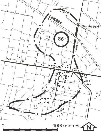
Question 4 – In your own words, tell me how you think this Arcuate Ridge was formed by the Cardinia Creek.
The current township of Cardinia was settled after the establishment of the school in 1911. Prior to this the township had been approximately 1 mile further north. The current Presbyterian church was built in 1915 and the Cardinia Public Hall was built in 1924. Of the remaining houses from this era, the house at 2416 Ballarto Rd with the Canary Island Palm trees was built around 1938.
Question 5 – Why do you think the current township of Cardinia was built at this exact spot. What advantages did positioning the town here have. Also, take a photo of one of the older buildings that I have mentioned in town that benefitted from the geology of this location.
And that’s about it. You have five logging tasks (questions), don’t forget the photo for the fifth one (it doesn’t have to have you in it, but it can if you are feeling particularly photogenic). You can claim the smilie straight away but make sure you send through your answers to the five logging tasks otherwise I will delete your find.
Hope you had fun, and enjoyed this earthcache.