Red Rocks Park, along the eastern slope of the Rocky Mountains, is named for the towering 300-foot sandstone rock formations within its 640 acres. The red rocks near the amphitheatre are called Creation Rock, Ship Rock and Stage Rock, and attract visitors from around the world. The giant rocks form the stage and seating area of a unique outdoor theater. There is not another amphitheatre in the world like the naturally formed one in Red Rocks Park.
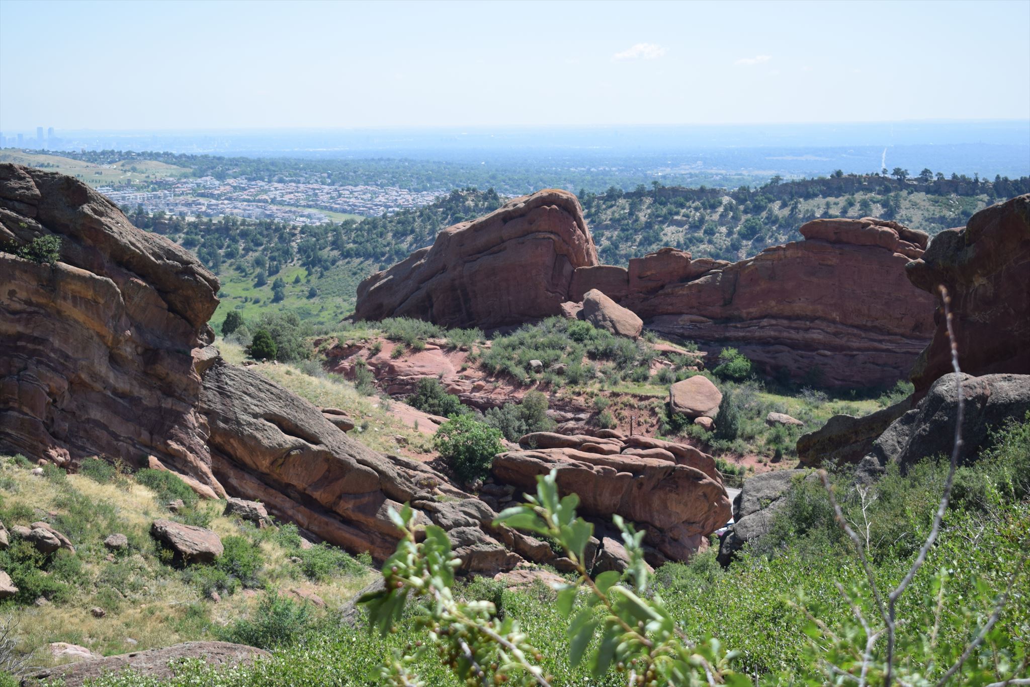
Fig. Red Rocks with view to Denver
On many rocks in the park we can impressively observe spheroidal weathering. This is a form of chemical weathering that affects jointed bedrock and results in the formation of concentric or spherical layers of highly decayed rock within weathered bedrock that is known as saprolite. When saprolite is exposed by physical erosion, these concentric layers peel (spall) off as concentric shells much like the layers of a peeled onion. Within saprolite, spheroidal weathering often creates rounded boulders, known as corstones or woolsack, of relatively unweathered rock. Spheroidal weathering is also called onion skin weathering, concentric weathering, spherical weathering, or woolsack weathering.
Spheroidal weathering is the result of chemical weathering of systematically jointed, massive rocks, including granite, dolerite, basalt and sedimentary rocks such as silicified sandstone. It occurs as the result of the chemical alteration of such rocks along intersecting joints. The chemical alteration of the rocks results in the formation of abundant secondary minerals such as kaolinite, sericite, serpentine, montmorillonite, and chlorite and a corresponding increase in the volume of the altered rock. When the joints within bedrock form a 3-dimensional network, they subdivided it into separated blocks, often in the form of cubes or rectangles, that are bounded by these joints. Because water can penetrate the bedrock along these joints, the near-surface bedrock will be altered by weathering progressively inward along the faces of these blocks. The alteration by weathering of the bedrock will be greatest along the corners of each block, followed by the edges, and finally the faces of the cube.
The differences in weathering rates between the corners, edges, and faces of a bedrock block will result in the formation of spheroidal layers of altered rock that surround an unaltered rounded boulder-size core of relatively unaltered rock known as a corstone or wollsack. Spheroidal weathering has often been incorrectly attributed solely to various types of physical weathering.
Frequently, erosion has removed the layers of altered rock and other saprolite surrounding corestones that were produced by spheroidal weathering. This leaves many corstones as freestanding boulders on the ground's surface. Often the spheroidal weathering, which created this corestones and the enclosing saprolite occured in the prehistoric past during periods of humid, even tropical climates. Frequently, the removal of the saprolite by erosion and exposure of corestones as freestanding residual boulders, tors, or other landforms occurs many thousands of years later and during vastly different climatic conditions.
Depending on local environmental conditions, spheroidal weathering of bedrock blocks defined by tectonically induced joints and fractures may result in the formation of prominent and well-defined Liesegang rings within these blocks. Liesegang rings are colored bands of cement observed in sedimentary rocks that typically cut-across bedding. These secondary sedimentary structures exhibit bands of minerals that are arranged in a regular repeating pattern.
These blocks typically consist of bedrock blocks (Liesegang blocks), which are bounded on their periphery by joints and fractures, and, in sedimentary rocks as here, bedding planes above and below. Each Liesegang block consists of a relatively unaltered core surrounded by concentric, alternating shells of iron-poor (intermediate shells) and iron-rich ('iron'shells) composition which make up the Liesegang rings. These iron-poor and iron-rich shells follow the configuration of the outer shape of the block and are sub-parallel to its sides. The iron-rich and iron-poor shells vary in degree of cementation. The degree of development of Liesegang rings as the result of weathering depends upon the spacing of the joint systems, groundwater flow, local topography, bedrock composition, and bed thickness.
To log this earthcache, please send the answers to the following questions to my account. ou do not need to wait for a log approval. If something is not correct, I will contact you soon.
1. At he listing coordiantes you are standing about 7 meter in front of a 8 x 4 meter great boulder (no trespassing sign to the right). Explain the typical characteristics of the woolsack weathering you can see.
2. How came the upper stone on its place?
3. Do you see shells with iron-poor (light brown till beige) and iron-rich (dark brown till red) layers on the great boulder?
Attention: Park rules (www.denvergov.org/parkrules) will need to be followed - e.g. stay on trail, no littering,etc.
Acknowledgement: I thank the Parks Permit Office Denver for the permission to let this Earthcache be published and the Geoaware for reviewing.
References: Wikipedia