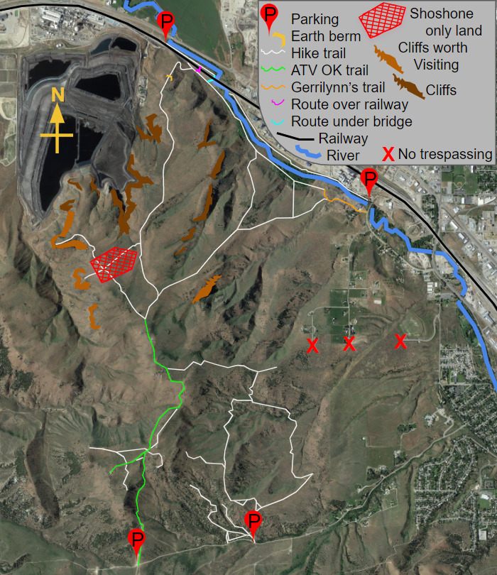
Not at the posted coordinates! You start there, taking a number from a T-post, then follow a series of photos toward the final area. Instead, you can perform a 180' rappel for an optional rappel intermediate stage that has the final coordinates inside (as well as bonus coordinates).
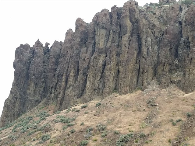
Caution: The terrain rating isn't given lightly here, this is a dangerous area. If you take the hike from the recommended parking Waypoint it is just over a 6 mile round trip so bring plenty of water. The view of 180' cliffs is well worth the hike. The rock is a little chossy and largely made up of rhyolite - an igneous rock that is strong but in weakly connected layers. Don't go testing the strength of the ledges by leaning over edges to look straight down, this isn't granite.
You have two options to learn the final cordinates:
Option 1: You can go to the posted coordinates, count the number of bumps in the white section of the t-post here, square it, and add that to both the north and the west coordinates here: N 42° 53.174′ W 112° 31.648′ then go to the final.
Option 2: Go to the referenced 'big rappel bolts' point. Use the 2 bolts to rappel down about 30' and find the optional rappel intermediate stage container and find the coordinates inside. From there you an finish the rappel and hike to the top going east around the cliff band, or ascend back up. This optional intermediate stage does have bonus coordinates inside it as well.
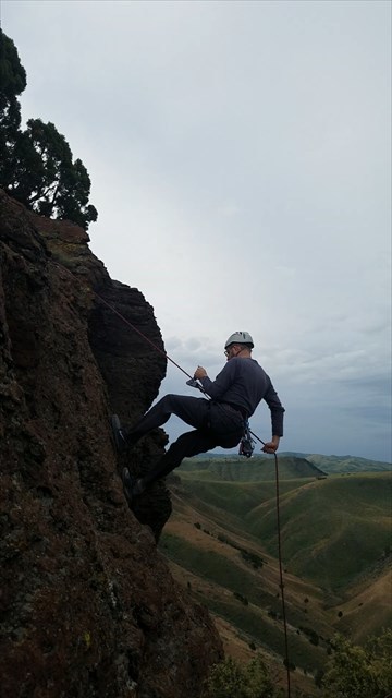
As far as gear, this is terrain 5 and I recommend bringing rappelling and ascending gear so you can make the approach to the final completely roped up. Then if you trip, slip, tumble, and keep falling you'll be ok. It is possible to just walk to the final without being roped up by taking a route 20 feet longer, so if you don't have climbing gear, this is still attainable, just know that I recommend being anchored in some way for safety. the gallery has a photo of the recommended equipment and the tree used as the anchor. I used a cordalette anchor around the only tree, then beaner blocked the rope, allowing rappelling and ascending using a grigri. This way you can safely get down to ground zero and return on the same line using a mechanical assist (make sure to back tie backup knots - grigris are only an assist.
Accessing the start of the trail.
Getting to the start is tough, but you've got some options:
- Easiest option is to use a 4x4 vehicle with high clearance and take the ATV approved trail from Trail creek, up along the line of radio towers. Beyond the last radio tower, you'll encounter Simplot land and motorized vehicles are prohibited even where not posted. Driving there will compromise access for everyone, so park at the northmost radio tower and stroll to ground zero, happy you've avoided hiking from the valley floor.
- Next easiest option is to Park by Simplot and cross over the railway. After speaking with union pacific, while their official policy is that hikers cannot cross at undesignated spots, they completely understand exceptions, like this spot. Be smart, look both ways, and stay safe. Should a train be stopped over the tracks, which has happened half the time for me, you can cross under the bridge using a 1' wide ledge. This ledge will likely be underwater during spring through mid summer. Judgement call, again, be safe and consider waiting or using an alternative route.
- A local farmer, Gerrilynn has granted permission to walk through her farm and access the trails at the Abraszewski parking area. She asks that we be leave all gates closed and simply climb over the metal gate. Don't scare the animals, they can spread over a huge area if startled and be a real pain to gather. Despite permission, this one feels the most socially uncomfortable.
- Lastly, you can park along trail creek road and hike the long way. The views are more rewarding but this is the furthest hike option.
- We cannot access the trails at Karen Rd, Neva Rd, Facer Mountain View Dr, nor the currently unnamed stub off N Gathe Rd.
Directions
This series of photo directions will guide you from the posted coordinates to the intermediate stage where you'll find coordinates to the final:
Start: Head west at this 'T' junction. From the view shown above it looks like you are turning right.
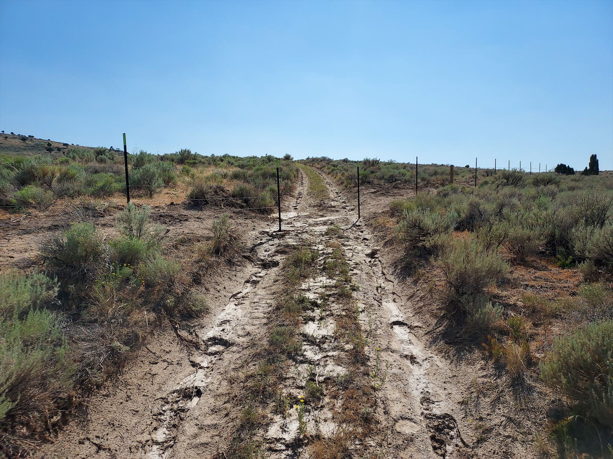
The fence ahead denotes a Shoshone Bannock only area. Stay out of the fenced area, heading right to follow the fence.
Keep following the fence and heading west.
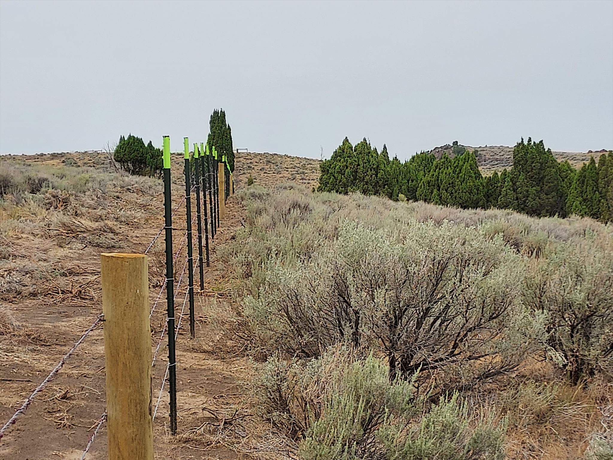
At this gated entry, take the trail to the right, heading north west. You still don't enter the fenced area.
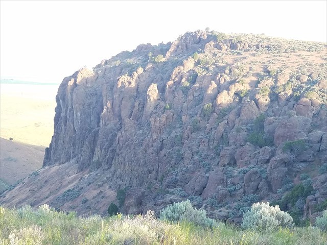
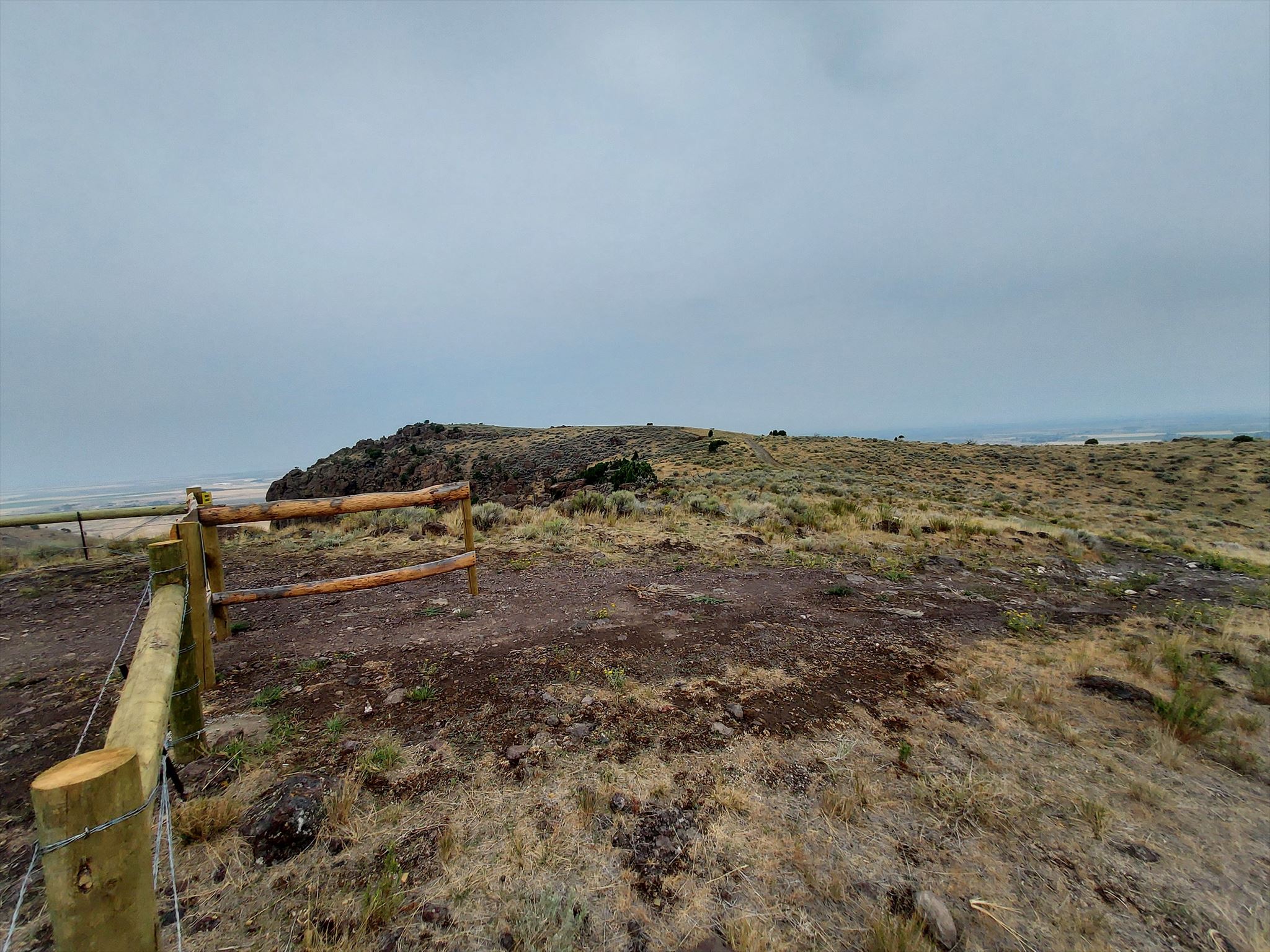
To the left you can see a glipse of some impressive cliffs, though the best is out of sight around the corner. Continue forth.
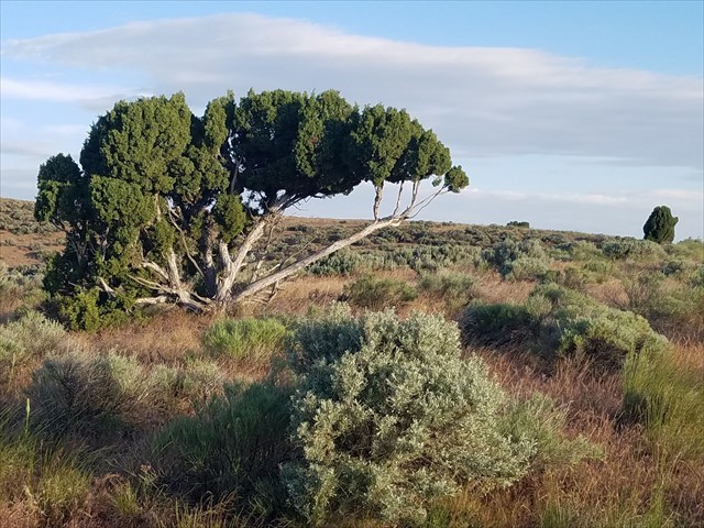
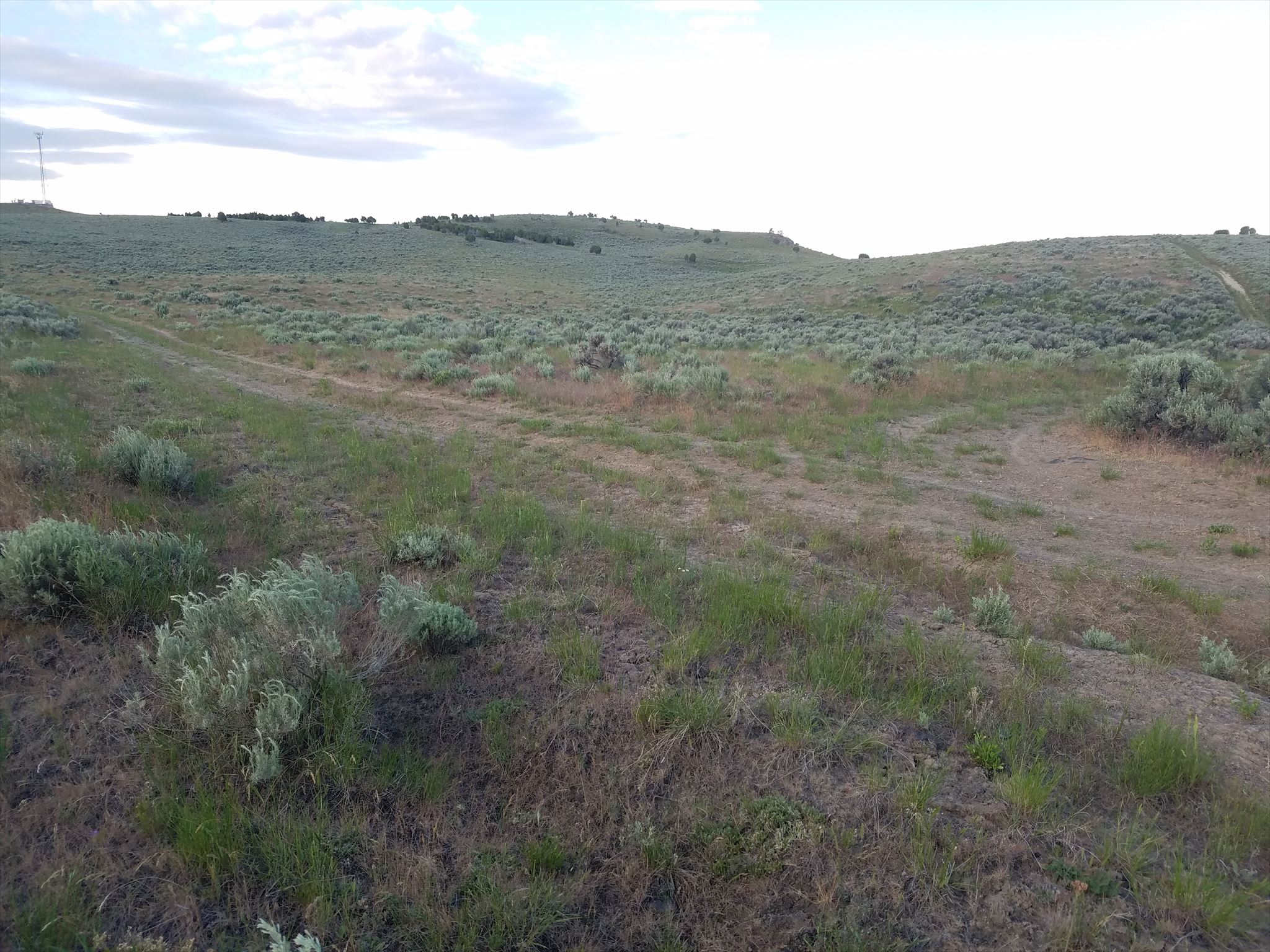
A distinctive tree on the left to reassure you of your current bearing. Keep following the trail as it sweeps to the left.
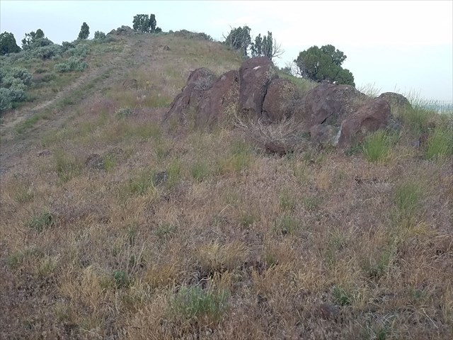
You will pass by this little row of boulders to your right.
This geocache was placed with BLM permission. Following the recent land swap, Simplot has approved this geocache to remain available. Hikers and geocachers have express permission to use the area. Stay away from the equipment and gypsum deposit stacks (giant dark gray mounds) and you should be find.
There is a fenced off section only for members of the Shoshone-Bannock Tribes. The Fort Hall Reservation doesn't begin until west of w112°32.000 Longitude, but please stay out of that fenced area all the same. The arrangement between the tribes and Simplot is likely what keeps this mountain available for hiking to the rest of us.
Please be very careful at the final area; much like walking on a sidewalk beside a busy road, you are safe if you are conscious of your footwork to avoid tripping. Make sure to place both containers back as you found them. As always, try to go with a friend or let someone know where you're going.