
The Tuia Mātauranga GeoTour is about having fun discovering the history of Aotearoa New Zealand by finding sites of significance in local communities from early Pacific voyaging and migration, European settlement to present day. The interaction between people, and people and the land have provided a rich history that the GeoTour invites you to explore.
---
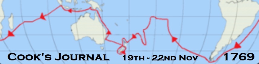
[Entering the Firth of Thames, North Island, New Zealand]
Sunday, 19th. ”At 1 p.m. a breeze sprung up at East, which afterwards came to North-East, and with it we steer'd along shore South by East and South-South-East, having from 25 to 18 fathoms Water. At 1/2 past 7, having run 7 or 8 Leagues since Noon, we Anchor'd in 23 fathoms, not choosing to run any farther in the Dark, having the land on both sides of us forming the Entrance of a Streight, Bay or River, lying in South by East, for on that point of the Compass we could see no land. At daylight A.M., the wind being still favourable, we weighed and run under an Easy sail up the inlet, keeping nearest the East side. Soon after we had got under Sail 3 large Canoes came off to the Ship, and several of the people came on board upon the very first invitation; this was owing to their having heard of our being upon the Coast and the manner we had treated the Natives. I made each of those that came on board a small present, and after about an Hour's stay they went away well Satisfied. After having run 5 Leagues from the place where we Anchor'd last night our Depth of Water gradually decreased to 6 fathoms, and into less I did not choose to go, and as the wind blew right up the inlet and tide of flood, we came to an Anchor nearly in the middle of the Channell, which is here about 11 Miles over, and after this sent 2 Boats to sound, the one on one side and the other on the other side.”
Monday, 20th. “Moderate breezes at South-South-East and fair weather. At 2 p.m. the boats return'd from sounding, not having found above 3 feet more water than were we now lay; upon this I resolved to go no farther with the Ship but to examine the head of the Bay in the Boat, for as it appeard to run a good way inland, I thought this a good opportunity to see a little of the interior part of the Country and its produce. Accordingly at daylight in the morning I set out with the Pinnace and Long boat accompanied by Mr. Banks, Dr. Solander, and Tupia. We found the inlet end in a River, about 9 miles above the Ship, into which we Enter'd with the first of the flood, and before we had gone 3 Miles up it found the Water quite fresh. We saw a number of Natives and landed at one of their Villages, the inhabitants of which received us with open Arms. We made but a Short stay with them but proceeded up the river until near Noon, when finding the face of the country to continue pretty much the same, and no alteration in the Course or stream of the River or the least probability of seeing the end of it, we landed on the West side in order to take a View of the lofty Trees which Adorn its banks, being at this time 12 or 14 Miles within the Entrance, and here the Tide of Flood runs as strong as it does in the River Thames below bridge.”
Tuesday, 21st. “After Landing as above-mention'd, we had not gone a hundred yards into the woods before we found a Tree that girted 19 feet 8 inches, 6 feet above the ground, and having a Quadrant with me, I found its length from the root to the first branch to be 89 feet; it was as Streight as an Arrow and Taper'd but very little in proportion to its length, so that I judged that there was 356 Solid feet of timber in this Tree, clear of the branches. We saw many others of the same sort, several of which were Taller than the one we measured, and all of them very stout; there were likewise many other sorts of very Stout Timber Trees, all of them wholy unknown to any of us. We brought away a few specimens, and at 3 o'Clock we embarqued in order to return (but not before we had named this river the Thames, on account of its bearing some resemblance to that River in England) on board with the very first of the Ebb. In our return down the river, the inhabitants of the Village where we landed in going, seeing that we return'd by another Channell, put off in their Canoes and met us and Trafficked with us in the most friendly manner immaginable, until they had disposed of the few Trifles they had. The tide of Ebb just carried us out of the narrow part of the River into the Sea reach, as I may call it, where meeting with the flood and a Strong breeze at North-North-West obliged us to come to a Grapnel, and we did not reach the Ship until 7 o'Clock in the A.M. Intending to get under Sail at high water the Long boat was sent to take up the Kedge Anchor, but it blow'd so strong that she could not reach the Buoy, and the gale increasing soon obliged us to vear away more Cable and Strike Top Gallant Yards.”
Wednesday, 22nd. “Winds at North-North-West. The A.M. fresh Gales and hazey with rain; the remainder, moderate and Clear. At 3 p.m. the Tide of Ebb making, we took up our Anchors and got under Sail and ply'd down the River until 8 o'Clock, when we again came to an Anchor in 7 fathoms, muddy bottom. At 3 a.m. weigh'd with the first of the Ebb and keept plying until the flood obliged us to anchor again. After this I went in the Pinnace over to the Western Shore, but found there neither inhabitants or anything else worthy of Note. At the time I left the Ship a good many of the Natives were alongside and on board Trafficking with our people for such Trifles as they had, and seem'd to behave as well as people could do, but one of them took the 1/2 hour glass out of the Bittacle, and was caught in the very fact, and for which Mr. Hicks, who was Commanding Officer, brought him to the Gangway and gave him a Dozen lashes with a Catt of nine Tails. The rest of the people seem'd not displeased at it when they came to know what it was for, and some old man beat the fellow after he had got into his Canoe; however, soon after this they all went away.”
Read Cook’s journal entries to answer the questions below and find where the cache is hidden. The cache is at S 37 AB.CDE E175 VW.XYZ
AB How many miles wide did Cook calculate the Firth of Thames to be?
C How far up river did Cook estimate they travelled? Use the first digit.
D How many boats did Cook’s party take to explore the river?
E How many miles up river had they travelled when they found the water to be fresh?
V How many large canoes visited the ship as they sailed down the Firth of Thames?
W What time did they set off to return to the Endeavour after exploring up river?
X They measured the girth of a tree to be 19 feet and how many inches?
Y How many boats did Cook take to explore the Western Shore?
Z How far from the river mouth was the Endeavour anchored?
---
To be able to complete this Geotour and receive your special geocoin, remember to take a note of the codeword on the log book of the cache. This will need to be recorded in your passport which can be downloaded from here. If the passport is unavailable for any reason just keep a note of the codeword and try again later.