BEFORE logging your find, you MUST answer the questions below under "5. Share your results", preferably via the Geocaching message center (or "message" from the app). Found it logs without answers will be deleted without warning. You can learn more about logging an earthcache at the Geocaching Help Center.
If the tunnel is closed, it is possible to make observations from either entrance.
This is an EarthCache. An EarthCache is a special geological location people can visit to learn about a unique feature of the Earth. There is no physical container at this location. In order to claim this as a find you must think and act like a scientist:
1. Ask a question (I've already done this for you!)
2. Do background research (scroll down for information and links for further exploration)
3. Construct a hypothesis (a theory that explains)
4. Make observations at the posted coordinates (test your theory)
5. Analyze the data and draw a conclusion
6. Share your results (by sending answers to the cache owner via Geocaching message center)
Are you ready to science? Let's go!
1. What are the origins of Sehome Hill?
This earthcache will help you understand how Sehome Hill came to be.
2. Background
The Chuckanut Formation in northwestern Washington (named after the Chuckanut Mountains, near Bellingham), its extension in southwestern British Columbia (the Huntingdon Formation), and various related formations in central Washington (including the Swauk, Roslyn, Manastash, and Chumstick) are fluvial sedimentary formations of Eocene age, deposited from about 54 Ma (millions of years ago) to around 42 to 34 Ma. The nature of the deposits and included plant fossils indicate a low-lying coastal plain with a subtropical climate; the nature of the sediments indicates metamorphic sources in northeastern Washington.
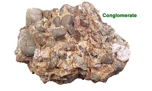
The Chuckanut and related formations "are all composed predominantly of fine- to medium-grained sandstones with lesser amounts of interbedded shale, conglomerate, and coal." [1]
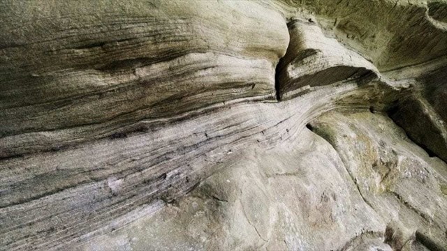
Chuckanut sandstone

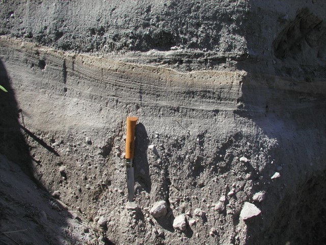
Shale layers
The original Chuckanut/Huntingdon/Swauk formation appears to have been deposited as a single unit in a large basin, and subsequently separated by faulting. The original extent of the formation is unknown, parts having been uplifted and eroded away, and the current extents largely covered by volcanic and glacial deposits.
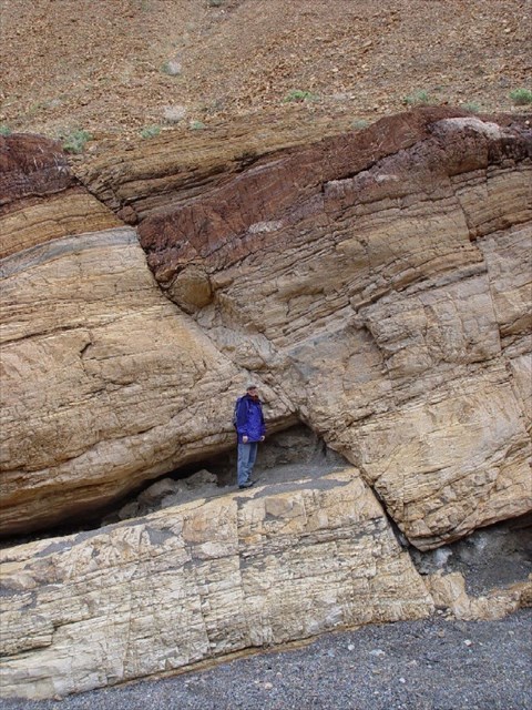
Fault layers
Glacial deposit
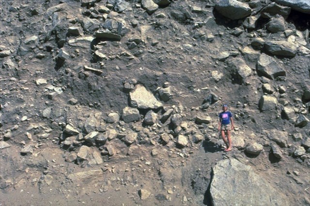
Volcanic deposit
3. Could this area be an exposed part of the Chuckanut Formation?
What would you expect to find here if it is part of the Chuckanut formation? (hint: sandstone and layers of other materials such as shale, conglomerate, or coal, and possibly evidence of faulting and/or uplift). Would you expect to find here if it is not part of the Chuckanut formation? (hint: volcanic and glacial deposits)
4. Now head to the posted coordinates, and make observations to test your hypothesis
What you see at the posted coordinates is a tunnel cut by hand for a road that existed here from 1923 until it was closed to traffic in 1967. The cut exposed a geologically interesting cross section. Inspect the tunnel walls for evidence for and against your theory. While the tunnel is occasionally blocked for safety reasons, it is still possible to make excellent observations at either entrance.
5. Share your results
Now share the results of your earth science inquiry by sending me answers to the following questions. The Geocaching message center is preferred but email is also ok. Scientists normally share their results with the entire scientific community, so that others can verify (or sometimes disprove) their work. This is Geocaching though, so please do not share the answers in your log!
- Do the tunnel walls appear to be primarily sandstone, or some other material such as volcanic or glacial deposit?
- Do you see layers of any other material(s), such as shale or conglomerate?
- Do you see any evidence of faults (breaks in layers or angled layers)?
- Based on your observations, do you think Sehome Hill is an exposed part of the Chuckanut formation?
If you have trouble answering these questions, you may wish to refer to the example images above.
Resources
[1] Source: https://en.wikipedia.org/wiki/Chuckanut_Formation, retrieved 02/Sep/2019. Quote attributed to Frizzel (reference 6)
- https://nwgeology.wordpress.com/
- http://www.wwu.edu/share/geology.html
- https://washingtonstategeology.wordpress.com/2017/10/18/new-poster-folds-and-fossils-of-the-chuckanut-formation/
- http://www.dnr.wa.gov/Publications/ger_washington_geology_1997_v25_no3.pdf
- https://en.wikipedia.org/wiki/Chuckanut_Formation
- https://pubs.er.usgs.gov/publication/ofr791149
- https://www.revolvy.com/page/Sehome-Hill-Arboretum
This earthcache is placed with permission from the Sehome Hill Arboretum Board of Governors