Le col de Perty à 1 302 mètres d'altitude relie Saint-Auban-sur-l'Ouvèze à l'ouest et Orpierre à l'est. Le tour de France a emprunté le col à 5 reprises ; le col est également emprunté par le rallye Montecarlo. Il offre un panorama extraordinaire que nous voulons humblement mettre en avant avec cette petite cache Multi.
This cache offers a great spot that we want to show you with this little multicache.
La cache se réalise en 2 étapes
The cache is composed of 2 steps
- Au cordonnées de la cache, trouvez la borne SOS orange représenté sur la photo . Sur la photo waypoint1, un nombre a 4 chiffres a été caché en rouge. Retrouvez ce chiffres. Les deux premiers chiffres (que l'on appelera AB) permettront de trouver les coordonnées Nord du Waypoint suivant et les deux suivants (que l'on appelera CD) permettront de trouver les coordonnées Est.
Find the orange SOS box represented on the picture . Find the 4 digits number that we hid with red color. AB is the first 2 digits and CD is the other 2 digits. Use them to find the coordinates of the next step.
UPDATE: la borne ayant disparu, nous mettons le Waypoint2 en point visible.
The SOS box disappeared, we are making the second waypoint visible.

- Rendez vous au coordonnées N 44 17.279-AB E 005 33.096-CD. Sur place admirez le panorama. Une fois que vous avez bien profité de cette vue imprenable, il faut répondre aux deux questions suivantes pour accéder aux coordonnées finales.
Go to coordinates N 44 17.279-AB E 005 33.096-CD . There you can find a great spot with an amazing view. Answer 2 questions to find the final coordinates.
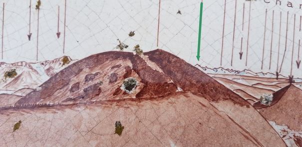
- Coté Nord, retrouvez la photo waypoint2-N et trouvez l'altitude (XXXX) de la flèche verte de la photo. Vous trouverez les coordonnées Nord de la boite finale en faisant N 44 17. (3358-XXXX)
On the north side, find the altitude of the green arrow . North coordinates of the final spot are N 44 17. (3358-XXXX)
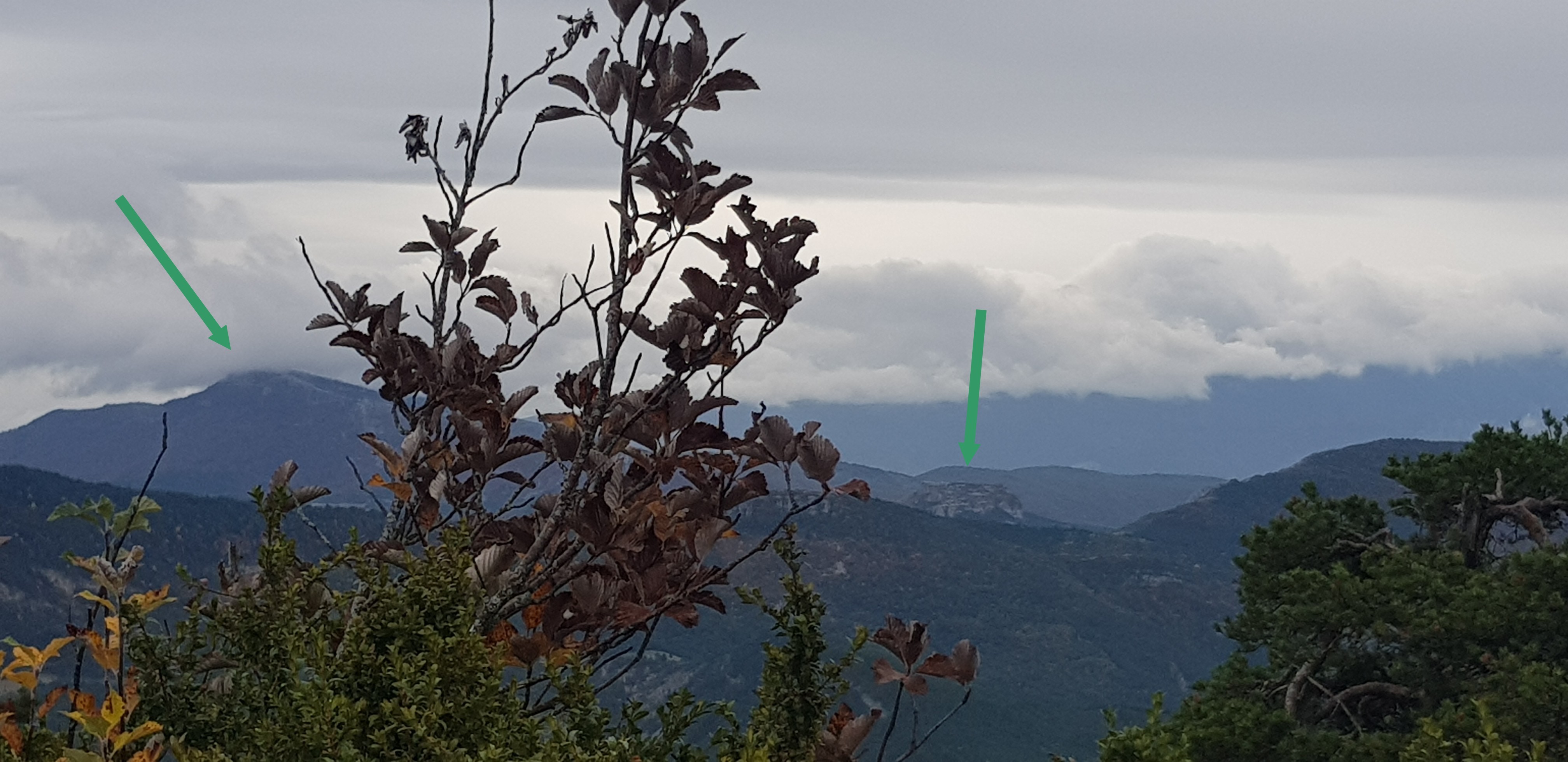
- Coté Sud, retrouvez les 2 lieux représentés par des flèches vertes sur la photo waypoint2-S. Entre ces 2 lieux, il y a un col. relevez l'altitude LMNO de ce col. Les coordonnées Est de la boite finale sont E 005 33.NMO
On the south side, find the 2 spots represented with the green arrows . Between them both, there is a peak . Note the altitude LMNO and find the Est coordinates of the final box. E 005 33.NMO
- Rendez-vous ensuite aux coordonnnées finales que vous venez de trouver . La cache se trouve au pied d'un buis à proximité du sentier.
Go the the final spot and find the cache at the bottom of a buxus near the path.
En espérant que la balade vous aura plu. 
We hope you enjoyed the cache

Vous pouvez valider votre solution d'énigme avec certitude.