Philae Temple at the Cataract of the Nile
A cataract, translated as "waterfall", is a rock barrier of the Nile characterized by rapids. These are not real waterfalls. Some are characterized by white water, but in most other places the water flows much calmer and shallower. They are flat, jagged stretches in the Nile. At the middle course of the Nile there are several cataracts. Some of them have been dammed up in the meantime, but they are still obstacles for navigation:
at low tide because of the hidden cliffs and unclear narrow rock gullies and at high tide due to the rapid current.
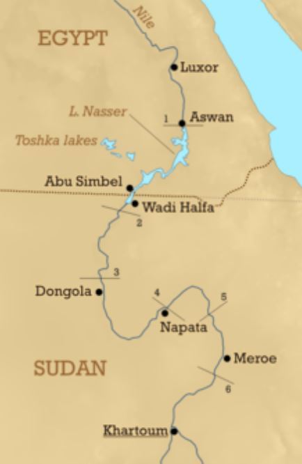
There are six of these classical cataracts in the Nile only one of them is in Egypt, near Aswan.
The six cataracts oft he Nile:  |
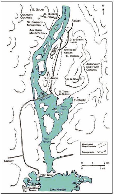
The first cataract and the dams:  |
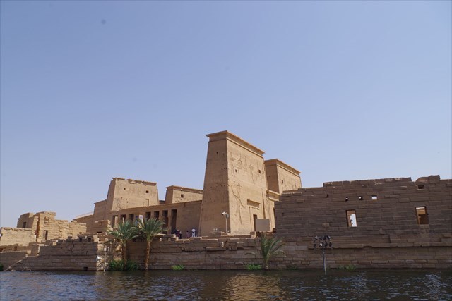
Near the first cataract there is the temple of Philae with its very interesting history.
Originally the various buildings were built on the island of Philae, which is the largest of the three islands at the southern end of the first cataract.
With the completion of the Aswan dam (the old Aswan dam) in 1902, the level of the Nile rose to such an extent that the island of Philae was almost completely under water for 10 months of the year (from January to July). The visit of the site was possible only under greatest difficulties and the island was partly dry only during the opening of the locks of the dam. Since the construction of the new high dam of Aswan (Sadd el-Ali) in the years 1960 to 1971, the Nile has become a reservoir between old and new dam. Since then, the Temple of Isis has been constantly under water up to half the height of the pylons. This made a visit impossible and damaged the building substance.
Only in the year 1972 in connection with a rescue operation for Nubien's monuments the move from Philae to the higher area of the island Agilika (somewhat northwest of Philae) was carried out. The temple was sawn into blocks of 2 to 25 tons and rebuilt at the new location true to the original. From 1977 to 1980 the "move" lasted and since 1979 the temple complex of Philae is on the list of the UNESCO world cultural heritage sites.
The Philae Temple:  |
On the googlemaps picture of today, one can still partly guess the flooded island Philae under the Nile water:
To log this Earthcache, please answer the following questions and send us the answers via MessageCenter:
1. Explain how the cataracts were created!
2. Discolorations on the rock of the building substance of the Philae Temple are clearly visible. One can still see today where the water once rose to. Estimate how many meters the pylons were under water.
3. At waypoint WPV N 24° 01.576 E 32° 53.077 you get an interesting view over the nile. What do you see?
4. At the waypoint WPO N 24° 01.537′ E 32° 53.063′ you will find an object. What is it about?
5. Take a photo of the object at the WPO with you and/or your GPS device and attach it to your log!
6. What is middle of the sanctum of the Isis temple and what material is it made of?
Please note:
You can log this EC as found after you sent us the answers to our questions via the Message Center.
You don't have to wait for our answer. If something is wrong, we'll let you know!
If you want to "mark" the cache before sending the answers, you are welcome to leave a note and then change it to a found later (after sending the answers).
Enjoy our earthcache, the nile and the Philae Temple!