Bluestem Falls Er🌎sion EarthCache
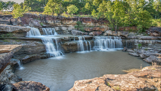
Bluestem Falls is located at Bluestem Lake near Pawhuska, OK. This waterfall is formed by the lakes spillway and has transformed over time since the lake was first created in 1958. If you catch these falls when the spillway is overflowing, the water cascading down can be quite breathtaking!
As this is an EarthCache, there is no container to find. Instead, this EarthCache will focus on the extensive erosion in the rock layers caused by the spillway. Let's get started!
To get credit for this EarthCache, be sure to complete the logging tasks at the bottom of this page.
Geology of the area
This part of the state is dominated with mostly marine shale with interbedded sandstone, limestone and coal. As you look around the falls, you can't miss the layers upon layers of rock in which this area is composed. When Bluestem Lake was created in 1958, this area was set up as a spillway for when the lake became too full. Fortunately for visitors to the lake, the water began eroding at the rock layers and formed the beautiful display you see before you.
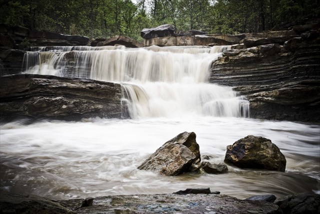
Photo by TravelOK.com
What happened here?
Downcutting is a geological process by hydraulic action that deepens the channel of a stream or valley by removing material from the stream's bed or the valley's floor. The speed of downcutting depends on the stream's base level which is the lowest point to which the stream can erode. Sea level is the ultimate base level but many streams have a higher "temporary" base level because they empty into another body of water that is above sea level or encounter bedrock that resists erosion.
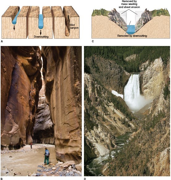
Downcutting Erosion
A concurrent process called lateral erosion refers to the widening of a stream channel or valley. When a stream is high above its base level, downcutting will take place faster than lateral erosion; but as the level of the stream approaches its base level, the rate of lateral erosion increases. This is why streams in mountainous areas tend to be narrow and swift, forming V-shaped valleys, while streams in lowland areas tend to be wide and slow-moving, with valleys that are correspondingly wide and flat-bottomed.
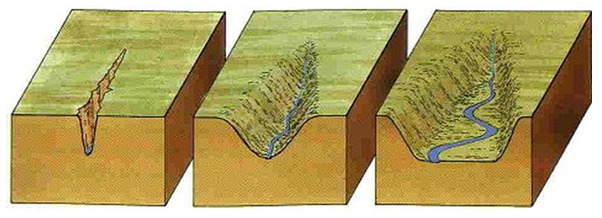
Lateral Erosion
One thing you might also notice is these falls have a stair-stepping look to them. Stair-stepping occurs when one layer is eroded faster than another one causing the falls to drop to the next more-resistant layer. For example, the shale and limestone layers (3-4 Mohs) here are being eroded faster than the sandstone layers (6-7 Mohs) causing the stair-step look.
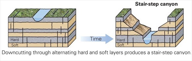
Stair-stepping
To Get Credit For This EarthCache
Copy the questions below and send your answers via geocaching messages.
- DO NOT post the answers in your log.
- Group answers are fine, just let me know who all was there.
- Note: The photo task is a requirement for each account claiming a find. See acceptable EarthCache logging tasks effective June 10th, 2019. If you don't want to post the photo with your log, you may send it to me with your answers instead.
- Please send the answers in a timely manner or it may result in the deletion of your log (no offense intended).
Logging Tasks
1| The name of this EarthCache: Bluestem Falls Er🌎sion
2| In your log, provide a photo of yourself at the falls.
- If you prefer, the photo can be of a personal item here instead. Just make the photo unique to you and your visit. Feel free to have fun with this!
Walk to both Reference Points and answer the following questions from your observation:
3| Looking from Reference Point 1 (Top of Falls) to Reference Point 2 (Bottom of Falls), estimate how deep the erosion has cut down through the rock layers.
4| Based on your estimate and observations, do you believe the falls have reached their "base level" or will it continue to go deeper?
5| Looking from Reference Point 2 (Bottom of Falls) southward (after the bend), which do you see more evidence of: downcutting or lateral erosion? Why do you think that?
Optional: I'd love to see other photos you took from your visit here!
*IF YOU ENJOYED THIS EARTHCACHE,
CONSIDER GIVING A FAVORITE POINT!*
Sources:
Permission for this EarthCache was granted by the City of Pawhuska.