Power 🌎f Water EarthCache

To get credit for this EarthCache, be sure to complete the logging tasks at the bottom of this page.
Before We Begin:
- Martin Park Nature Center is open daily from 5am to 6pm, with extended hours to 9pm from April 1st through September 30th.
- This park has 2.5 miles of woodland trails with trail maps set up throughout.
- The safest route to the waypoints is to start at the bridge and take the trail to the east around the creek.
- Even though you may be tempted to go off trail, the edges of the bank up top are unstable so please be careful.
- This is a wildlife park so you may come in contact with wild animals or bugs. Just like anytime you are outdoors, use caution and be aware of your surroundings.
- The park practices a Leave No Trace policy.
- Be sure to check out the other EarthCache in this same park: Red Dirt C🌎ncretions.
As this is an EarthCache, there is no container to find. Instead, this EarthCache will focus on the effects of the stream on the banks as it passes through.
Let's get started!
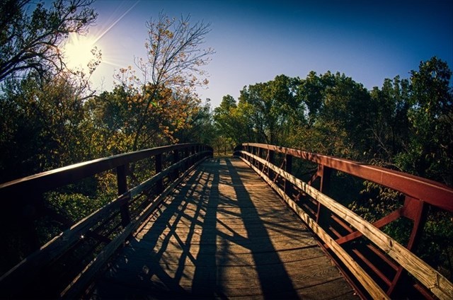
As you look along the path of this creek, you'll notice some interesting things occuring along the bank. The bridge at the posted coordinates in particular showcases one of the features this EarthCache will focus on.
Causes of Mass Wasting
Mass wasting occurs when the gravitational pull acting on a slope becomes too much for the hill or edge of a canyon to resist. Therefore, anything that erodes or impedes the slopes ability to resist this force may become one of the causes of mass wasting. For example, increased slope steepness will make a hill more prone to mass wasting simply because gravity has an easier time pulling materials down a steep slope as compared to a gentle slope.
Too much water or rainfall will also weaken a hillside's ability to resist gravity. This is an example of too much of a good thing. A little bit of water actually makes it easier for soil particles to bond together and keep the slope intact. However, if there is too much rain or water, then the soil particles lose this bond and break apart.
If the slope has decreased vegetation, then it will be more prone to mass wasting because it does not have the protective plant covering above ground or the soil anchoring roots system below ground. Also, disruptive events, such as earthquakes, can cause sections of slope to detach due to the violent shaking that occurs.
Photos taken on the bridge at different times showing effects of mass wasting.
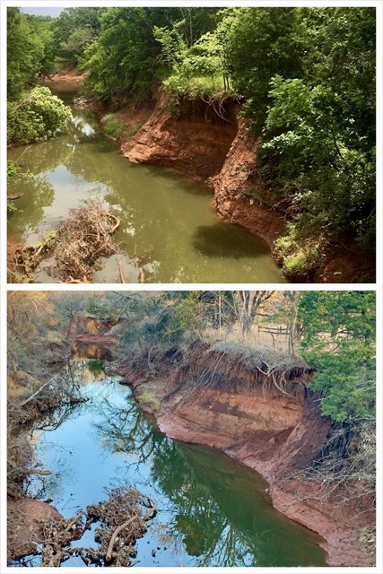
Slumps
A slump is a type of mass wasting that results in the sliding of materials along a curved surface. In a slump, a portion of the slope moves down a short distance. It's almost like when you stand up straight and tall, and then slump your shoulders forward as if you're too tired to hold up your shoulders. In fact, if you were to look at an actual slump, it might appear to you as if the slope just got tired of holding up that section and let it slip down.
A slump is sometimes referred to as a rotational slide because a portion or block of the slope 'slides' down as it 'rotates' around an axis parallel to the slope. A slump can occur as a single unit or as a number of slumps grouped together, and they form when the base of the slope or hillside is eroded or cut away. For instance, water or waves may undercut a slope, removing the physical foundation holding up the rocky material. Without a base, the block of the hill goes 'kerplunk' and slumps down.
Slumps can also be blamed on human activities. For example, if a road crew cuts away the base of a hill to make room for a road, the structural stability of the slope could be weakened, resulting in a slump.
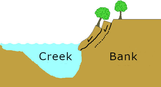
Undercutting
Undercutting is an erosional process caused by successive waves (at all intensities) washing against the shoreline. The more intense the pounding of the waves, the quicker the undercutting will occur, leading to mass wasting. As the shoreline is undercut deeper and deeper, the ability to support the shoreline and debris above it is weakened, eventually leading to a slump or a shoreline fail, where the weight of the debris falls forward, towards the water. Undercuts can be recognized by exposed roots below the soils surface or an overhanging cliff of rock or soil.
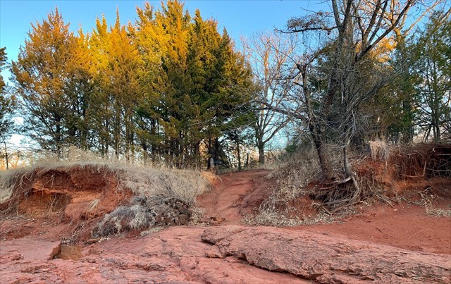
This is where you will enter the creek area.
To Get Credit For This EarthCache
Copy the questions below and send your answers via geocaching messages.
- DO NOT post the answers in your log.
- Group answers are fine, just let me know who all was there.
- Note: The photo task is a requirement for each account claiming a find. See acceptable EarthCache logging tasks effective June 10th, 2019. If you don't want to post the photo with your log, you may send it to me with your answers instead.
- Please send the answers in a timely manner or it may result in the deletion of your log (no offense intended).
Logging Tasks
1| The name of this EarthCache: Power 🌎f Water
2| In your log, provide a photo of yourself on the bridge with the creek behind you.
- If you prefer, the photo can be of a personal item here instead. Just make the photo unique to you and your visit. Feel free to have fun with this!
3| Summarize the differences between a slump and an undercut.
Examine the banks of the creek at both Reference point #1 and #2 and answer the following question from your observation:
4| Reference #1: Is this a slump or an undercut? Explain how you came to that conclusion.
5| Reference #2: Is this a slump or an undercut? Explain how you came to that conclusion.
Optional: I'd love to see other photos you took from your visit here!
*IF YOU ENJOYED THIS EARTHCACHE,
CONSIDER GIVING A FAVORITE POINT!*
Sources:
Permission for this EarthCache was granted by the staff at Martin Park Nature Center.