This is a come and go as you wish event! NO NIGHT CACHING, DAWN TO DUSK ONLY!!!
Falling Waters Trail Map
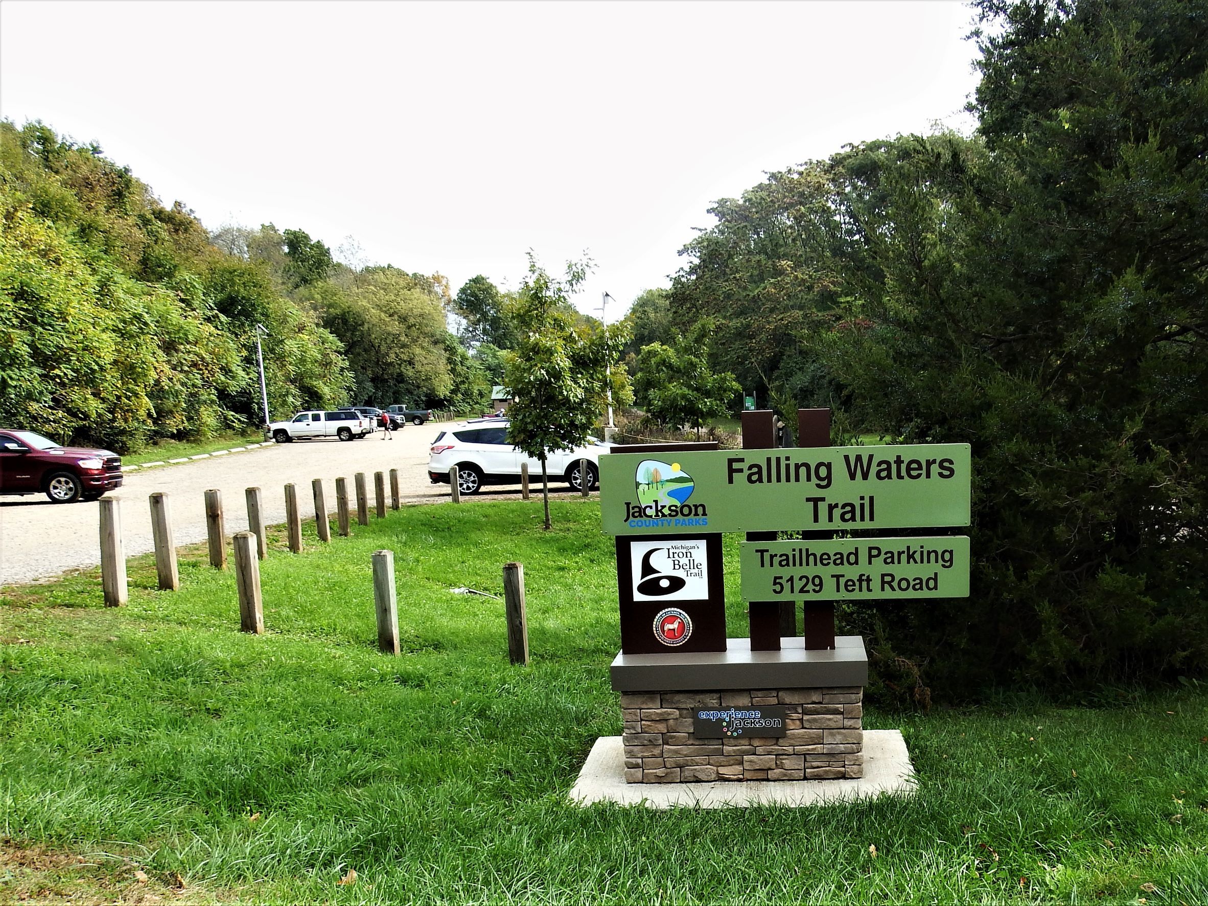
Falling Waters Trail
One of Michigan's most popular rail-trail destinations!
Connecting the Village of Concord with the City of Jackson, the trail was built on an abandoned stretch of the Michigan Central Railroad. The 10.5-mile, 12-foot-wide paved trail is ideal for walking, running, or biking. As it travels through natural springs and lakes that form the headwaters of four major Michigan rivers.
At the western trailhead in Concord, the trail crosses over the Kalamazoo River where you can view a great expanse of wetlands filled with abundant wildlife. At the mid-point of the trail, stop, relax, and enjoy the natural beauty of the picturesque Lime Lake. This is a trail you will want to visit time and time again to experience the seasonal changes in scenery.
Point-to-Point Distances
Weatherwax Dr.Trailhead (Parking) to Reynolds Rd. | 3.3 Miles
Weatherwax Dr. to Teft Rd. Trailhead |(Parking) 6.5 Miles
Weatherwax Dr. to Concord Trailhead (Parking) | 10.5 Miles
Weatherwax Dr. to Sparks Foundation County Park | 1.75 Miles
Weatherwax Dr. to Grand River Arts Walk | 5.0 Miles
Coppied from the Jackson County Parks webpage. Falling Waters Trail | Jackson County, MI
This event gives you a chance to get out in the fall and visit a Rails to Trails park you may not have been too yet. Located in a country setting near Lime Lakes this trailhead and parking area puts you in the middle of the trail making it easy for you to go whichever direction you wish. Come out to meet other cachers and enjoy the area.
Rumer has it that a cache or two may publish in the area after 9pm on the 16th so if you want to get in some caching check then to see what pops up.
This Event is part of a limited release of Community Celebration Events to celebrate 20 years of geocaching. Geocachers hosted events between May 2, 2020 and December 31, 2020. Learn more about Community Celebration Events on the Geocaching Blog.