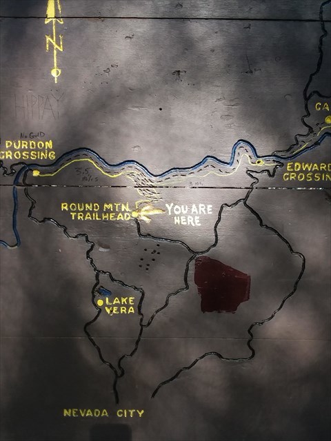
The Geocache is not hidden at the given coordinates. It is hidden along the trail down to the river. The given coordinates are a good place to get started.
I had trouble finding this spot, because Google Maps wants to take you through an unfriendly neighborhood with street name signs like "go away" and "do not enter", privately maintained roads. Eventually I found the best access route to the Round Mountain Yuba River Trail access.
From Nevada City, take North Bloomfield to Lake Vera Purdon Road, turn right on Rock Creek road, Stay on that until you reach Hudson Way. Take that to Deerhaven way, then Trailhead road. Rock Creek road turns into a dirt road, but I had no trouble staying in 2 wheel drive and had to navigate around a boulder or 2. Probably not a good idea after a rain storm.
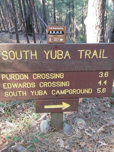
From the trailhead, this is a good route to take if you want to hike the 1000 feet elevation down to the river instead of the crazy roads down to Purdon crossing and Edwards crossing. Great workout! If you hike the mile downhill to the river, each of those distances will be less.
The cache is hidden right along the trail, in a 12 foot stump (update: behind the 12 foot stump on a log about 4 feet off the trail), at an elevation of 2763 feet on my garmin and my phone Anyways, you don't need the coords for this one, should be an easy find. Start hiking downhill and keep your eyes open!