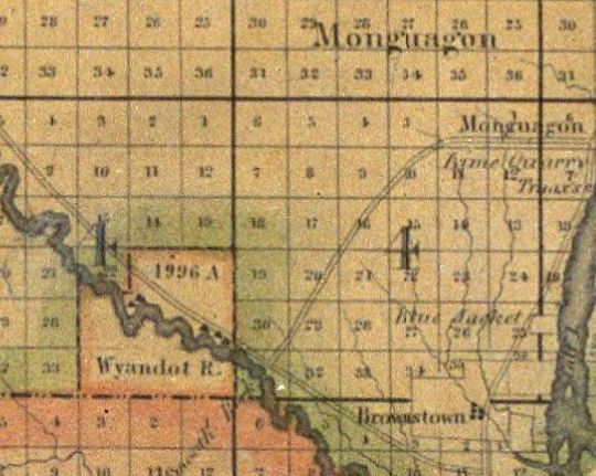
On September 20, 1818, the Wyandot Indians ceded their territory in Brownstown (RA#95) and Maguagua (RA#96) townships to the United States government in the Treaty of St. Mary's. The treaty established a 4,996-acre reservation in the southeast corner of Huron Township on the Huron River. Some of the signers of the treaty were: Lewis Cass, Ronesass or Honas, Haunsiaugh Boyer, Ronaess or Racer, and Ronioness or Joseph. The Wyandot Indians lived on this reservation until 1842 when the Treaty of Upper Sandusky ceded The Huron Reserve territory back to the United States Government. They agreed to be relocated onto an estimated 150,000 acres of land to the west of the Mississippi River. It was a journey fraught with illness, skirmishes, and tragedy...but that is another story.
Wyandot is pronounced "WHY-an-dot." It comes from their tribal name, Wendat, which means "peninsula people." Huron was the French name for the Wyandot tribe. It means "wild boar" in French. The French thought that the Mohawk haircuts of the Huron warriors looked like the bristles on a wild boar's neck.
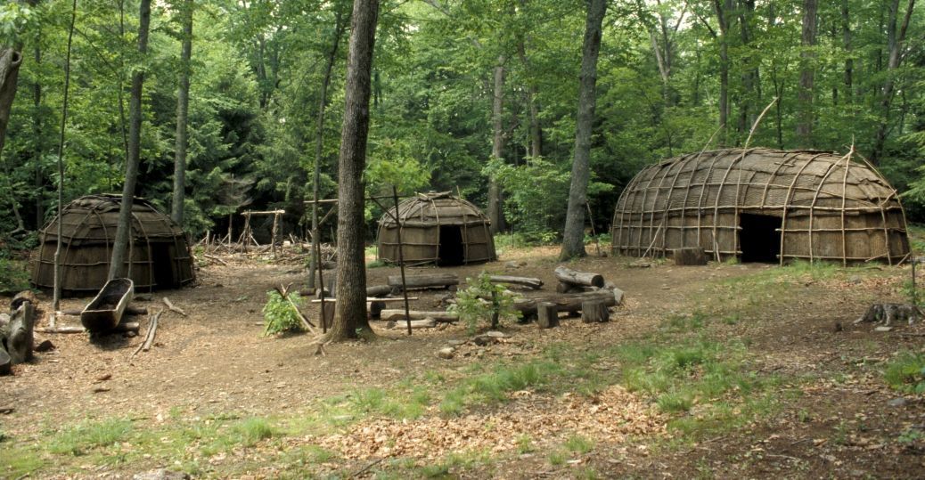
The Wyandot Indians lived in villages of longhouses, which were large wood-frame houses covered with sheets of bark. One Wyandot house could be 150 feet long, and an entire clan lived in it--up to 60 people!
The Wyandots had an even division of power between men and women. Wyandot men were in charge of hunting, war, and diplomacy. Wyandot women were in charge of farming, property, and family. Men made political decisions for the tribe, and women made decisions for the clans. Only men could be chiefs, but only women could vote on who got to be the chief.
While you are in the park be sure to visit the Nature Center and especially look at the mural in the lobby and informational exhibits that depicts this history.
The Cache: The cache is a medium-sized lock & lock hidden along the Long Bark trail. A Metroparks Geocaching permit has been filed with the Southern District Interpretive Services Supervisor and is on file at the park office.
This Geocache is one of twelve that were launched in association with the 20 Years of Geocaching in Oakwoods GC8JZM1 Celebration event. The theme of this series is The History and Features of Oakwoods
| This cache is located within Oakwoods Metropark, a part of the Huron-Clinton Metropolitan Authority park system. A Metropark Vehicle Entry Permit is required: Annual Permit $40. Senior(62+) Permit $29. Daily Permit $10.
For general information please call 810-227-2752 or 800-47-PARKS. Or visit our website at www.metroparks.com.
All park rules and regulations apply. Park in parking lots only. Check the Metroparks website for park hours.
|