Notice: "Cache seekers assume all risks and responsibilities involved in seeking this earthcache." “Just because it is there, doesn’t mean you have to seek the cache!” Don’t let earthcaching control you, but rather you control earthcaching.
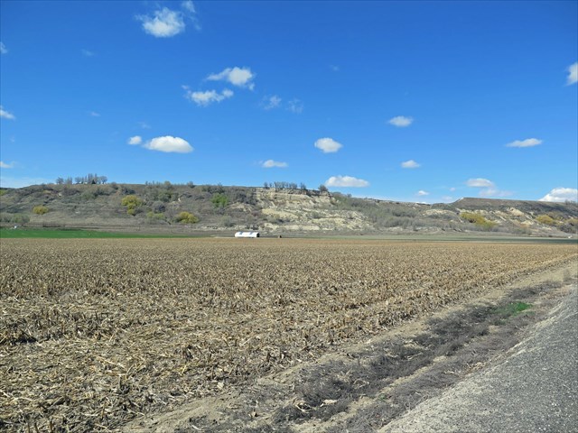
There is no need to leave your vehicle. All observation may be completed at parking location. Even though the slide is stable, it is on private property. Please don't access the slide.
Basin City: Ringold Formation.
A landslide on May 13, 2006 in the Ringold Coulee 5 miles west of Basin City, Washington still covers a section of Road 170 but exposed the Ringold Formation and the Missoula Flood debris.
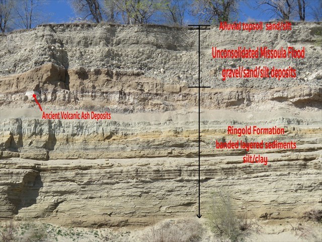
The Ringold Formation and Missoula Flood Debris.
The Basin City landslide exposed the structure of Basin Hill and tells the story of the Columbia Plateau. During the Miocene epoch 14-17 million years ago, the earth opened up and lava poured out of the ground covering 81,000 sq mi to the depth of 2 miles. This basalt layer is called the Columbia River Basalt Group. Then, ancient Columbia and Snake River with small streams laid down sediment and created a broad lake deposits to the depth of 500 feet deep from 3-8 million years ago. These clay-silt layered deposits are call the Ringold Formation, named after a nearby 1917 one room school house in Franklin County. Next, came the Missoula Flood waters 13-15,000 years ago depositing cobblers, pebbles, sand and silt over the clay-silt deposits. Later, the Missoula flood waters flowing around the north east end of Saddle Mountain would carve out the Ringold Coulee channel to the depth of 100 feet. Finally, the area was topped off by a thin layer of alluvial sand silt topsoil. The landslide exposure was caused by water leaching from the irrigation canal and irrigation crop sprinklers above the slide. The water over time leached through the Missoula Flood deposits and then traveled vertical and horizontally through the Ringold clay-slit deposit destabilizing the hanging valley overlooking the coulee.
To log this Earthcache; Please send a private message to me with answers to the following questions.
1. At Ground Zero/Final/ Parking: Observation of the landslide scarp
Describe the thickness and structure of A) the top soil, B) the Missoula Flood debris and C) the Ringold Formation sediment layers.
2. Ringold Formation: Sediment Layers
What is the total depth of the Ringold Formation sediment layers as per the reading and what created these layers.
3. Ground Water
Is there any evidence at ground zero of continued irrigation leakage? If so, describe.
Optional:
You may upload a photo to the page of any local wildlife, unique vegetation or geology in the area.