When I go to a new hiking area, it's always SO helpful to me when I know parking & trailhead info, and what trails are available, and how far the hikes are for all the trails. I got to thinking that other people would be grateful for this valuable information also, so I've decided to create some caches that will help others, like it does me. I am going to publish a series of caches with all the information that I can find to help hikers to make informative decisions. I hope these caches help you!
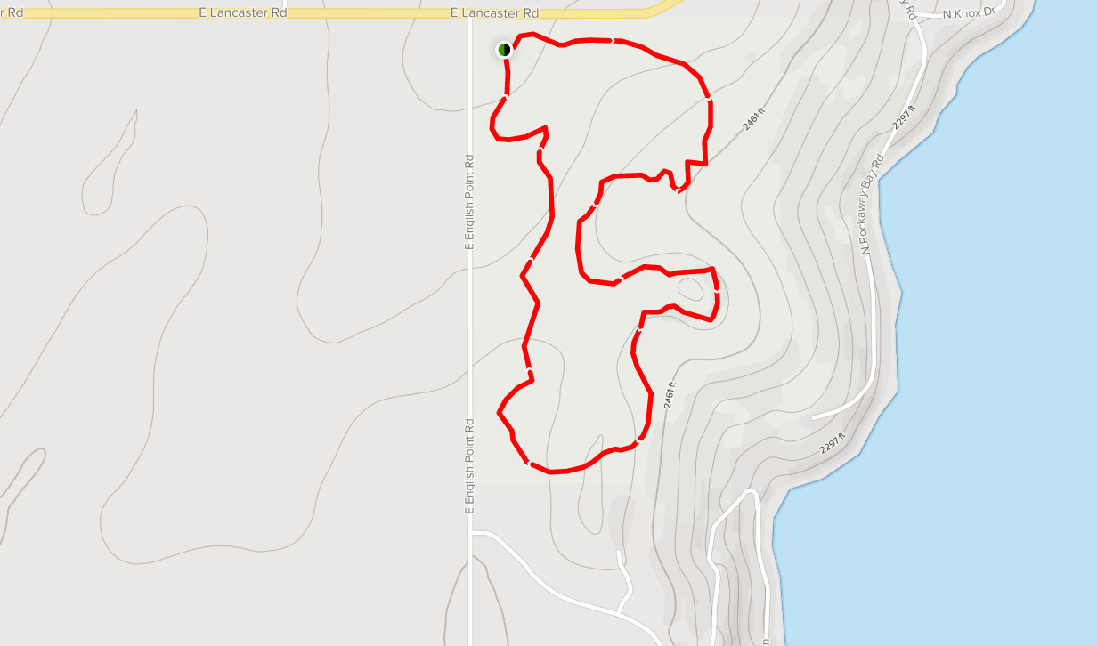
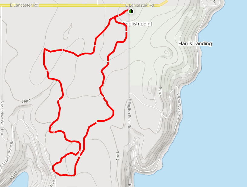
The English Point trail system includes easy loops through forest terrain on the west side of Hayden Lake. The trail system is split into 2 parcels by English Point Rd. The RED and GREY LOOPS are on the east side of the road, and the YELLOW, GREEN and BLUE LOOPS are on the west side of the road. These trails are accessible year-round and are used for hiking, trail running, biking, horseback riding, snow shoeing and cross-country sking. Dogs are also able to use these trails but must be kept on leash. The Red trail (1.6 miles) is mostly for hikers, with limited access for horses and no access for mountain bikers. The Yellow Trail (3.4 miles) is open to all non-motorized traffic.
Parking is free here. It's a pretty big parking lot, but don't enter it too fast, as it is full of big lakes...I mean, potholes! There is a vault toilet at the parking area.
Parking Lot is at: N 47 47.246 W 116 42.619
English Point RED LOOP Trail is a 1.6 mile moderately trafficked loop trail that features a lake and is good for all skill levels. There is a smaller GREY LOOP that is .8 miles, as well as other trails crisscrossing the main trails throughout the area. There are trail maps and arrows at the junctions and all along the trails.
English Point YELLOW LOOP Trail is a 3.4 mile heavily trafficked loop trail that features a great forest setting and is good for all skill levels. There are also 2 smaller loops within the yellow loop. There is a BLUE LOOP that is shortest, at .8 miles, and a GREEN LOOP that is longer, at 1.8 miles. There are trail maps and arrows marking the trails at junctions and all along the trail system.
MY OTHER HIKING CACHES:
Priest Lake
Priest Lake2
Missile Site
Hawk Hill
Farragut State Park
Antoine Peak
Liberty Lake
Pend Oreille County Park
Dishman Hills
Iller Creek/Rocks of Sharon
McKenzie
Palisades Park
Round Lake
Slavin