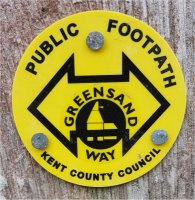
The Greensand Way is a long-distance path of 108 miles (174 km) going from Ham Street in Kent to Haslemere in Surrey. The trail was opened on 15 June 1980 and is jointly managed by Surrey and Kent Councils.
It follows the Greensand Ridge along the Surrey Hills and Chart Hills. This section which travels to the west is mostly rural, passing through woods with many great views. Further to the east there are fruit orchards and hop farms.
Brockhill Wood and Stubs Wood are classified as Sites of Special Scientific Interest (SSSI), the caches are all placed close to the existing paths. I would like to thank Sundridge with Ide Hill Parish Council for allowing this geocache to be placed on their land.
Please see GSW W1 for more information on the series and loops.
Pass through the gate and follow the path around the edge of the wood, after 150 m the path divides. The path to the right will take you up the hill to this cache which is just off the route of the Greensand Way. After collecting this cache you can collect two more which are on a loop in Brockhill Wood, I can recommend walking this loop which does not descend the hill and has some loverly views.