You have found your next adventure! Thank you for joining us for the “Visit Centre County” GeoTour as we show you some of our most favorite caching locations to include state parks, beautiful vistas, and historical points of interest! Our team of GeoTour planners have worked very hard to put together various cache types to keep the GeoTour interesting and challenging; however, no geocache should be beyond a 3/3.5 for terrain or difficulty! We are pleased to show you around our County and hope that you will enjoy the GeoTour and complete your passport to collect your custom GeoTour Geocoin (there is a minimum number of caches required to receive the coin)!
If you will caching with some young ‘uns, we have a Jr. Geocaching Passport available for children, 12 yrs. And under, with special prize for their hard work too! Caches will be marked as “family-friendly” and should correlate to the Jr. Geocaching Passport.
Download your “Visit Centre County” GeoTour passport and/or you Jr. Geocaching Passport or pick-up paper copies at the following coordinates: N40° 48.879; W 077° 51.274 (Happy Valley Adventure Bureau). You’ll return your passport to the Happy Valley Adventure Bureau when complete and collect your prize if you meet the minimum requirements!
The “Visit Centre County” GeoTour is brought to you by Centre Region Parks and Recreation, the Happy Valley Adventure Bureau, and Groudspeak, Inc. We are pleased that you’ll be joining us in Happy Valley soon! Bring on the Adventures!


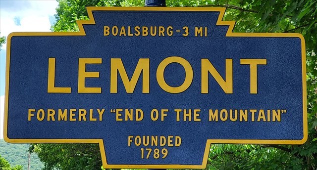
Welcome to Lemont (End of the Mountain)
History
The village of Lemont, a significant picturesque commercial village of the late nineteenth century according the National Register of Historic Places, is situated at the southwestern end of Nittany Mountain and grew as the result of the busy intersection of several early roads in Centre County due to the obstacle imposed by Nittany Mountain, which was a considerable obstacle to transportation in the 1800’s.
Convinced of the location's settlement possibilities, Moses Thompson who was a farmer, businessman, industrialist and owner of the Centre Furnace iron works, immediately invested in its commercial potential. In 1868, he erected a sizable stone building and along with his son, John I. Thompson, Jr., and opened the private banking firm of Thompson and Company. In 1869, Moses purchased the 1,200-acre tract of land originally settled by David Whitehill in 1789 and laid out his street plan in 1870. He knew that the roads provided accessibility, which in turn provided excellent opportunities for commerce. His son, John I. Thompson, Jr., named the village "Le Mont," in appreciation of its picturesque setting at the end of Nittany Mountain. ("Le Mont" is a French phrase meaning "The Mountain"). The area had previously been known by a variety of names including Elmwood, Edenville, Centreville, and most commonly, "End of the Mountain."
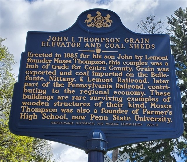
The development of the railroad further enhanced Lemont's growth as a community. The Lewisburg, Centre, and Spruce Creek Railroad Company, incorporated in 1853, had been slowly expanding westward with plans to eventually connect with the Bald Eagle Valley Railroad Company line in Bellefonte, which ran to Tyrone. The completion of the railroad connection in 1885 further enhanced commercial activity in Lemont, much of it directly connected with transportation. Thompson and Company erected a large side for unloading farm machinery, as well as for loading grain, fruit, hay, and livestock brought in for shipment by local farmers. A coal yard was provided for the receiving and storing of coal shipments, as well as a grain elevator for seasonal grain storage. Lemont also served as the only railroad access point for people traveling to and from the nearby Pennsylvania State College, creating a sizable increase in passenger traffic.
Lemont quickly achieved prosperity, as can be seen in the attractive architecture of the period, and in the new businesses that were established.
The end of the 1920's saw the beginning of Lemont's decline as a transportation and commercial center. Rapid improvements in automobile travel and the increasing numbers of automobiles in use soon outmoded the main road through the village. It was finally rerouted at Centre Furnace in 1928, completely bypassing Lemont.
Today Lemont's buildings and street plan remain as bonds to the transportation factors which influenced the development of the community and its early settlement history.
The Lemont National Register Historic District contains eighty-one principal structures, thirty-three outbuildings, and one barn. Of the eighty-one principal structures, twelve are intrusive to the character of the district. Of the twelve, one is a two-story church-related building and one is a two-story apartment building. The remainder are one-story, post 1950's residences.
Cache
The Lemont Historic District is home to many historic homes and businesses, but we have decided to bring you to probably the most iconic location in Lemont:
The John I. Thompson Grain Elevator and Coal Sheds
Aka “The Granary”
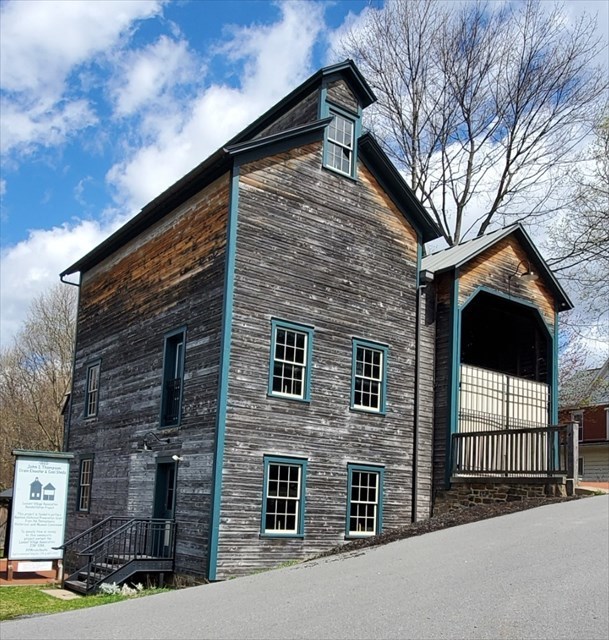
This structure is a true Centre County, Pennsylvania, historic landmark and the last remaining wooden grain elevator in Pennsylvania, which is slowly being restored by the Lemont Village Association (LVA).
Built in 1885 by Moses Thompson, the Granary helped distribute locally grown agricultural products by way of the railroad. The grain elevator was used to store grain that was sold to local residents or shipped by railroad cars to surrounding areas, while the railroad building was used as a place for trains to deposit coal.
This isn’t just your typical traditional ammo can cache. This cache will require you to play a little game in field to:
- Gain access to the locked logbook
- Retrieve the codeword required for the Visit Centre County Geotour passport
I highly encourage you to have a seat at one of the nearby picnic tables to play the game. The instructions are located within the cache container.
Once you have completed the game and retrieved the information necessary to complete the cache, please return everything back to its original location within the cache itself so that others may enjoy and be able to complete the cache as well.
We encourage you to take more time walking through our quiet little village and taking in some more of the history. Below are a couple links which will provide you with some additional information:
Lemont Village Association
Lemont Historic District Map
Cache has been placed with permission by:
LEMONT VILLAGE ASSOCIATION