
***THIS IS AN EARTHCACHE***
***There is no container at the posted coordinates***
***You will need to submit answers to the questions below in order to claim this geocache as a find.***
Please obey all rules & regulations at the site and stay within the designated areas for public visitation. There is no need to leave the publicly-accessible area to successfully claim this EarthCache. Dogs must be leashed at all times. And, as always, please practice CITO: Cache In, Trash Out!
***NOTE: There is an entry fee to visit this location. Children under 5 and all residents of Freeport, Maine are free.*** I realize the fee might deter some people from wanting to visit the EarthCache, but the beauty and uniqueness of the location are well worth it!
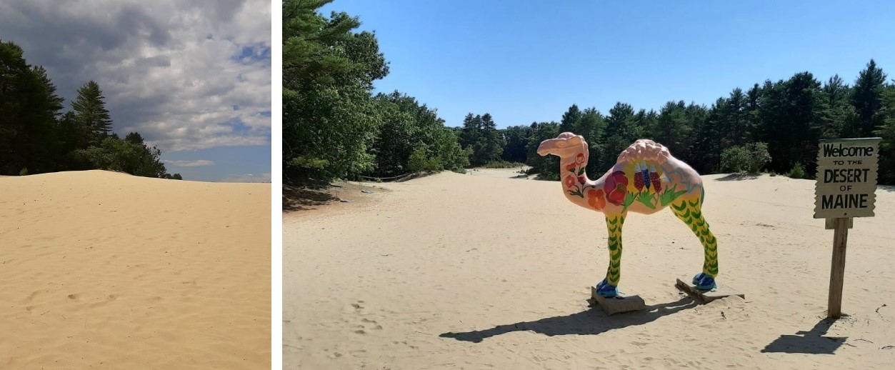
While the story of human interaction with the Desert of Maine goes back a couple of centuries, involving many myths and legends, the geology of the location goes back many thousands of years.
Maine has experienced at least four "ice ages" (periods during which accumulated snow from higher latitudes became so compacted as to slowly flow across the land under its own weight, advancing as glaciers) during the Pleistocene epoch (the most recent one million years of Earth's history). During each of these events, which may have lasted 70,000 years or more, enormous ice sheets advanced across the land, scraping away soil and rocks, carving and reshaping the landscape beneath. After the most recent period of glaciation (or "ice age") ended and the ice gradually melted away, strong winds blowing across the barren lands would sweep sand downwind forming sand dunes in typical desert fashion. Sand dunes in this region were eventually covered in a layer of topsoil, allowing trees and other vegetation to gain a foothold. But this layer was thin and susceptible to erosion once people settled here and allowed poor farming practices, overgrazing by farm animals, etc.
Written in the sands:
Winds produce both sand dunes and sand ripples in a similar fashion. Wind currents push individual sand grains from place to place, commonly rolling them along for very short distances or moving them in short hops that have rolling starts and stops. For grains lifted by the wind, the hops begin with sand leaving the surface at a steeper angle than the impact angle which ends the hop. The low-angle impact tends to scatter other grains, either rolling them a bit or causing them to begin their own hops. This combination of grains creeping and hopping along moves sand downwind over time. Grains get jammed up for a variety of reasons, forming tiny accumulations of a few grains.
Once this happens, the accumulations tend to grow, in part because the tiny heaps of grains create calmer "shadow" areas just downwind where other grains accumulate. This leads to greater wind exposure of the upwind part of the heap and more erosion of newly deposited grains from that area. Some of the grains get moved to the downwind side, accumulating in the shadow area.
This results in a general profile for many ripples of a gentle slope on the upwind side and a steeper face downwind. The upwind slope also tends to be longer than the steeper downwind side and the crest of the ripple tends to be oriented perpendicular to the wind. It is thus often possible to examine a group of ripples and figure out the rough direction the wind was blowing when it built them.
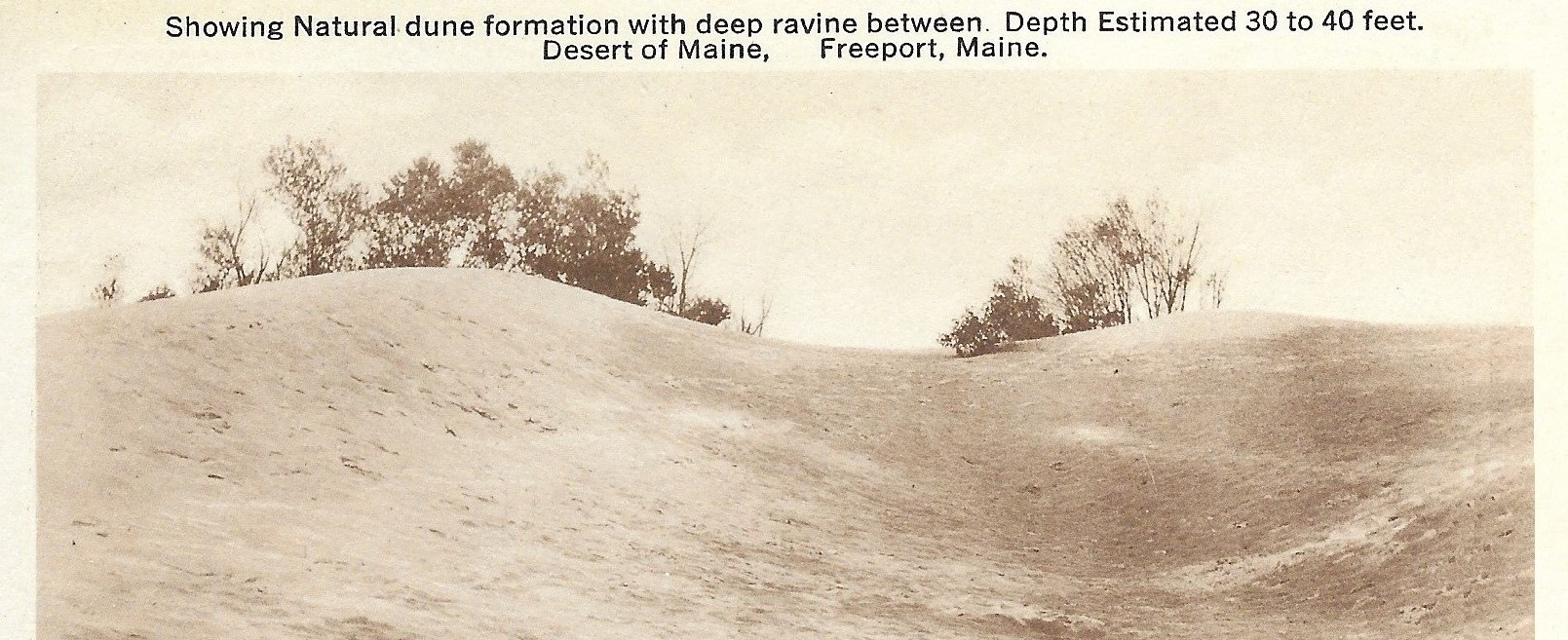
ABOVE: Post card, ca. 1930s.
Over the decades the management of the property has evolved, but the beauty of the Desert of Maine remains.
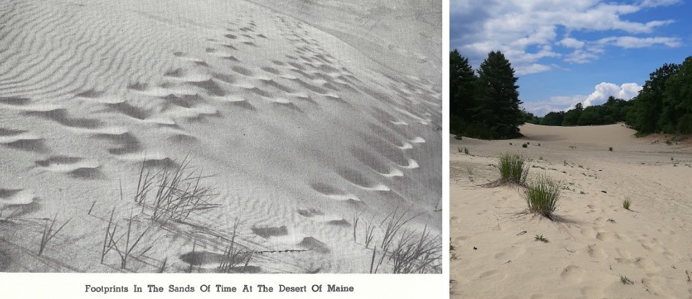
ABOVE: Footprints, yesterday and today.
- - - - - - - - - -
In order to claim this cache as a "find," please perform/answer the following:
1). Send me an email or message with "Desert of Maine" or "EarthCache" as the Subject, and tell me how many are in your group.
2). Considering the process by which ripples in the sand are created, and from observing the dunes around you, do you feel there is a predominant direction in which the winds blow, or does the direction vary?
3). Given what you've observed and learned of the Desert of Maine, do you think the desert will get larger or smaller over time, and why?
4). (Optional) When you post your online log, include a photo of you, your group, your GPS, or something you find interesting from the Desert of Maine. (Please don't post any photos of the informational signs which may reveal answers to any of the questions above).
Answers to EarthCache questions should be sent to the Cache Owner BEFORE you log the cache. If you are unable to send the answers remotely, then technically you should wait until after you do send the answers before logging the cache. However, I'm willing to be flexible, providing you still send the answers within a reasonable amount of time. Logs without an accompanying email or message having been sent to the Cache Owner (or without responding to pending questions from the C.O.) will be deleted with no further notice.
Note: The Desert of Maine is open seasonally from mid-May through the end of October. The trails may be available for walking/hiking outside of that period at the owners' discretion. But keep in mind that you may not be able to observe the characteristics of the site when it's covered in snow.
Thanks for taking the time to visit this EarthCache! Grateful acknowledgement is given to the Heestand family, current owners of the Desert of Maine, the Maine Department of Agriculture, Conservation and Forestry, and Alex Lear of the Portland Press Herald who has featured the Desert of Maine in at least two articles. 😀
- - - - - - - - - -
| I have earned GSA's highest level: |
 |
- - - - - - - - - -
* * * Congratulations to S-Ray for being FTF! * * *