This cache marks the boundary of the Village of Boyceville, on what was the only road into town from the east. If you study the 1915 map, you will see that the road went straight east from here, crossing the railroad tracks. That old route is long gone.

At the time this cache was placed, Google Street View showed the Village of Boyceville sign. Perhaps one will be put up again someday!
Part of the Boyceville-Wheeler “Old Roads” series.
Old maps can be fascinating! Our family has a battered 1915 plat book for Dunn County that has probably been in the family since it was new. You might think that our current roads more or less follow along the routes laid out by the pioneers – until you really look at an old map! In the map montage shown here, you won’t find State Highway 170 at all – the idea of a state highway did not even exist until 1917 when Wisconsin enacted the first numbered highway system in the world. Highway 170 was not extended west of Wheeler until 1947! Maybe there were too many marshes to cross? Instead, there were two routes, only one of which survives today.
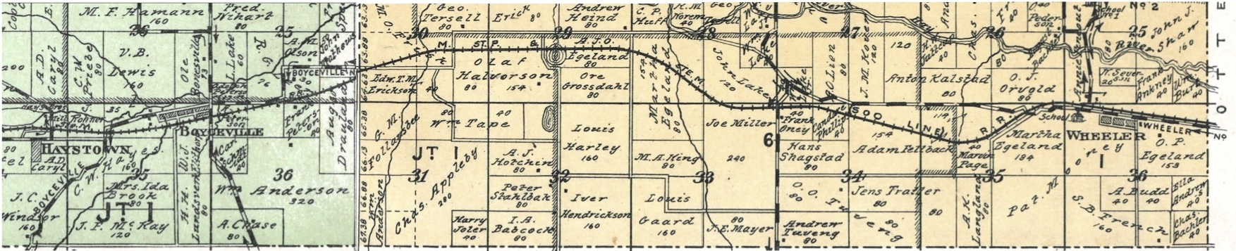
As you work your way along this series of mostly easy park and grabs, take a moment to look around and compare today’s view to the 1915 map. Some roads from 1915 vanished seemingly without a trace, unless you are an archeologist.