Ilkley West Ramble #12: High Way along The Street
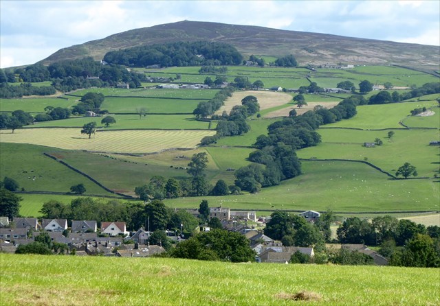
This is the 12th in a series of 28 caches which will take you on a memorable ramble through some fine, varied West Yorkshire countryside immediately west of Ilkley and south of Addingham. The southern half of the ramble traverses Addingham Moorside.
See Ilkley West Ramble #1: Intro & Start for maps, background info on the trail, and parking waypoints.
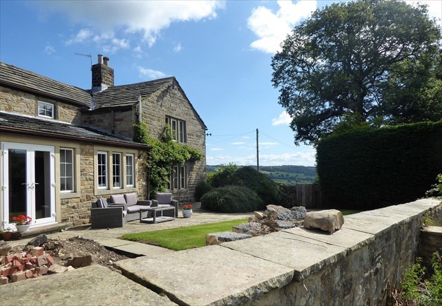
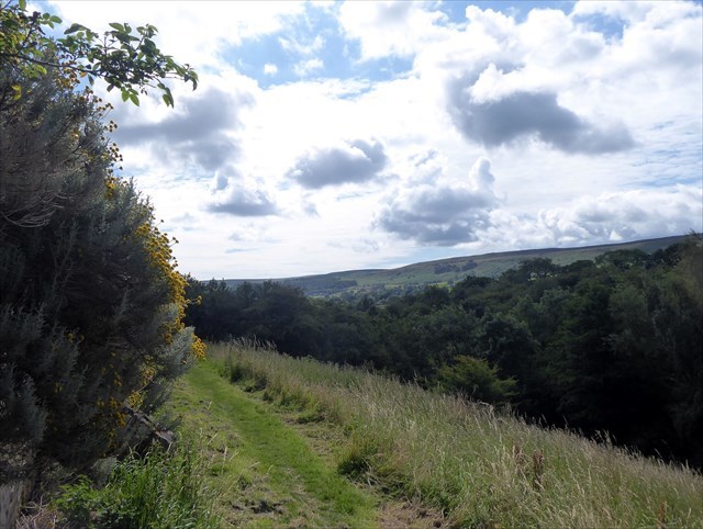
From IWR #11, continue heading west along the fence/tree line heading for the stone building ahead. Pass through the small wooden waymarked gate and across the south side of Street (farm) to the location of the cache, a camo-taped 35mm film canister.
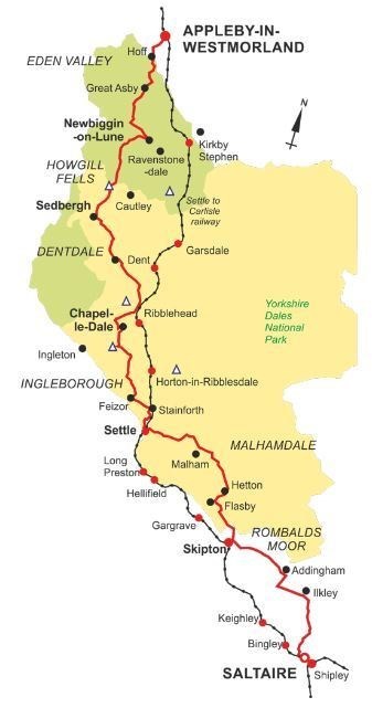
The High Way: you will have noted a short distance after leaving IWR#11 another trail joining from the left through a wooden gate after ascending some steps. This is the (A) Dales High Way (DHW) - not to be confused with the Dalesway which runs along the Wharfe a little north of here) - 'an exhilarating 90 mile walk across the glorious high country of the Yorkshire Dales'.
It runs from Saltaire to Appleby-in-Westmorland and the walk is often combined with a 'breathtaking train ride along England's most beautiful railway'. See here for a video of the walk. This section (Saltaire to Skipton) is one of six each of which could be done in a day by 'seasoned walkers' - the first two in particular might be too long for many people.
Along this stretch it is coming north from Windgate Nick up on Addingham High Moor descending through Addingham Moorside and joining the IWR route up to the A65 footpath junction, before heading across the A65 and west along part of the AEG cache series route (continuing to follow 'The Street' Roman road) and then down into Addingham. See Gallery for a map and profile of this part of the DHW.
The house is shown as Street on some maps and Street Farm on others and is named after the Roman Road which passes through here - but more about this in IWR#13 . . .