An oxbow lake is a U-Shaped lake that forms when a wide meander of a river is cut off, creating a free-standing body of water. These lakes form when a river creates a meander, due to the river's eroding bank. After a long period of time, the meander becomes very curved, and eventually, the neck of the meander becomes narrower and the river cuts through the neck during a flood, cutting off the meander and forming an oxbow lake.
An 1876 map of the area clearly shows the river heading straight South before making a curve to the West and looping to the East again.
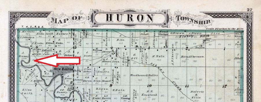
In 1883 the river still shows the westward curve
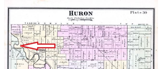
By 1925 the river has changed course forming the Oxbow lake

The Cache: The cache is a small container hidden along the Iron Belle Trail.
This cache is located in Lower Huron Metropark. A Metroparks vehicle permit is required for entry to the parks: $10 daily pass, $40 annual pass, $29 annual seniors pass. All park rules and regulations apply. Please park in parking lots only.
For general information please call 810-227-2752 800-47-PARKS, or visit www.metroparks.com. Dogs on a leash are allowed in this section of the park The hours for the park are dawn to dusk.
A Metropark geocaching permit has been filed and approved by Kevin Arnold (Southern District Interpretive Supervisor).