
The Tuia Mātauranga Pōkai Whenua GeoTour follows the footsteps of early explorers of Aotearoa New Zealand taking you to places where leaders of the past searched for food, resources and ways to adapt and survive in this new land.
Use the Pōkai Whenua GeoTour as your classroom to explore the stories of the past, in the present, to preserve what is unique in Aotearoa New Zealand for the future.
Collect the codewords to get the Geocoin puzzle pieces.
To be able to complete this GeoTour and receive your special Geocoin collectable, remember to take a note of the codeword placed in the cache. This will need to be recorded in your passport which can be downloaded here .
63 of the 150 Pōkai Whenua GeoTour caches will contain a randomly placed special FTF token (a replica of the Tuia Mātauranga GeoTour commemorative coin). This is yours to keep! If you find more than one, you might consider leaving it for the next person who finds the cache.
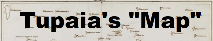
When we started researching Pacific navigation in 2019, one of the most fascinating stories we came across was that of Tupaia’s “map”. Tupaia’s map is among the most important artefacts to have come from late 18th-century European–Indigenous encounters in the South Pacific region. Initially thought to be unreadable, this map has only very recently been understood (Jan 2019 article in The Journal of Pacific History, “The Making of Tupaia’s Map”).
Tupaia was the Tahitian high priest and navigator on board Endeavour who played a pivotal role in mediating between Māori and the crew of the Endeavour on its visit to New Zealand in 1769. Tupaia was nobly born in the Society Islands on the island of Ra’iatea, about 1725. He was tall, handsome, strong, athletic and extraordinarily intelligent, all of which qualified him to be one of the select few taught at the greatest marae in all Polynesia, Taputapuatea on Ra’iatea. After consecration as a tahua, or priest, with star navigation as his speciality, he did a three-year cadetship graduating as an honoured wayfinder. (See GC8DC4R TMGT – Tupaia).
During his voyage with Cook in 1769-70, and in conjunction with Cook and members of his crew he drew a chart of the islands of the Pacific. The map depicted a ‘sea of islands’ extending for more than 7,000 km from Rapa Nui in the east to Rotuma in the west and more than 5,000 km from Hawai‘i in the north to Rapa Iti in the south.
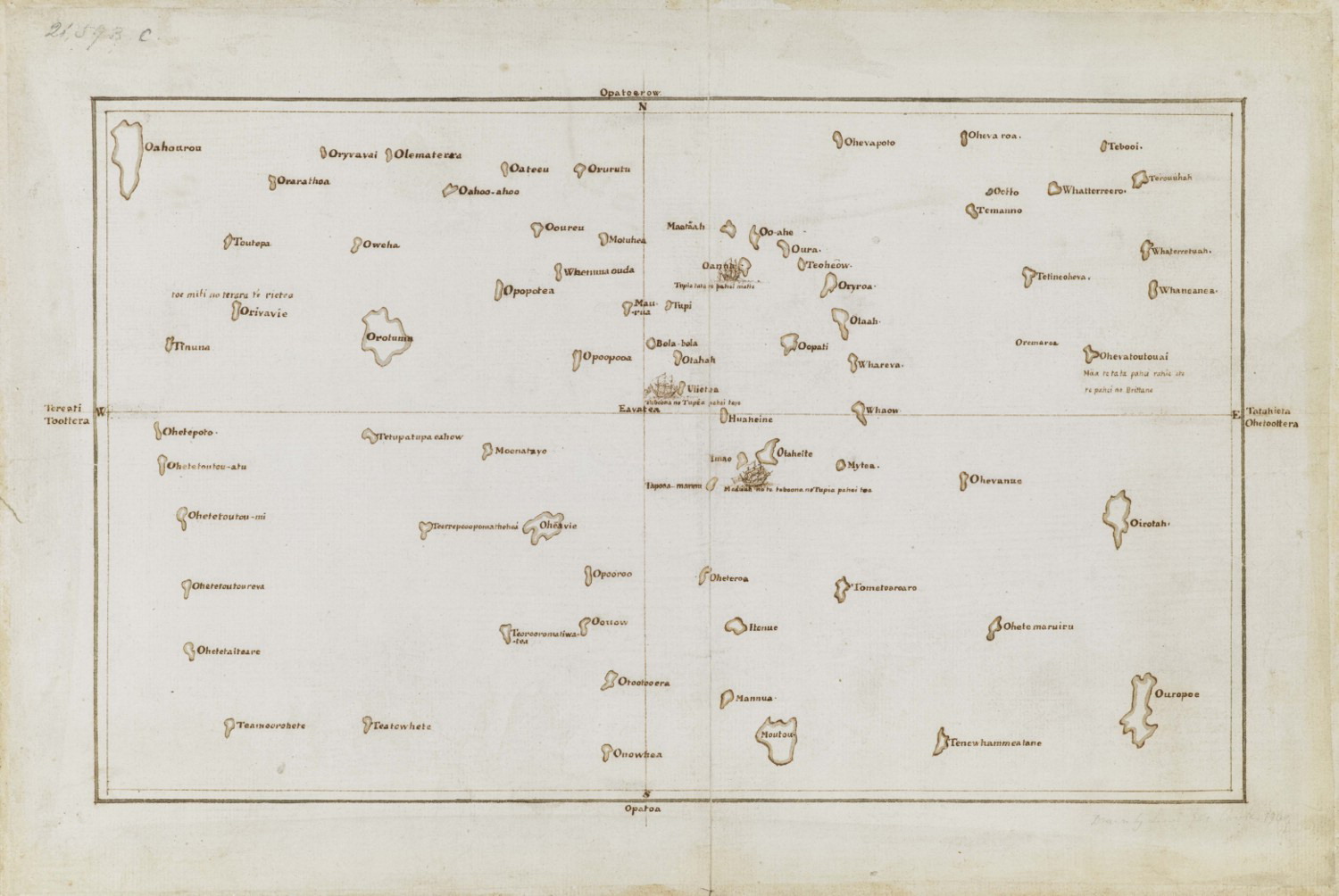
However this map was not drawn up in the way Europeans would understand, with north, east, south and west points. Instead at the centre of Tupaia’s map was his home island and the word ‘Avatea’ meaning ‘noon’.
Tupaia’s map has posed a riddle for most of its academic history. The German naturalist Johann Reinhold Forster, travelling with the Resolution on Cook’s subsequent voyage, praised the chart as a ‘monument of the ingenuity and geographical knowledge of the people in the Society Isles’. Yet even he could offer only partial information with respect to the islands the map actually depicts. Others thought Tupaia had been showing off, and that many of the islands had simply been made up. There has been heated debate among historians and anthropologists about the capability of ancient Polynesians to carry out purposeful navigation across the Pacific.
The secret of the "legendary" map has finally been unlocked. After six years of research, two German professors believe Tahitian navigator Tupaia's map of the Pacific, once thought to be "unreadable," was "fully understandable". Lars Eckstein and Anja Schwarz discovered that the map made a lot of sense. "It was meant to be read and we just had to figure out how to do it," Schwarz said.
To begin understanding the map, the researchers had to put their minds in the "Polynesian way of navigating". According to Eckstein, when compared to Europeans, the Polynesians took a very different approach to travelling and mapping where they were in the world.
"Europeans abstract space, they objectivise it, externalise it and fix it. They then measure it with the invisible lines of latitude and longitude, measure where you are and then travel," he said.
Polynesians imagined a world where "people didn't move", but the "world moved around them", Eckstein said. "If you know your bearings, the sea will throw out the island from the horizon and bring it to you. You see how completely opposite those kinds of world views are? The idea with Polynesian navigators is that the world is not fixed, the world constantly moves," he said.
To understand the map you need to acknowledge the distinct Oceanic knowledges of navigation and wayfinding that Tupaia would have brought to the drawing table, and to abandon the idea of a chart abiding exclusively by European mapping conventions.What Tupaia was attempting to do with his map, was to translate the complexities of his Oceanic knowledge into conceptual and representational models he thought James Cook, Joseph Banks and other European navigators would understand.
The researchers first used a list of islands written down by Tupaia, which he listed in the order the Endeavour sighted them. They then numbered the islands in that order, and translated the numbers onto Tupaia's map, and that was the "magic moment", Eckstein said. "What seems to be chaotic, suddenly resolves into some form of order.
Tupaia used the word for noon at the centre of his map, because he had observed the daily ritual of taking bearings on the Endeavour at noon. Using the Polynesian approach to navigation, the researchers came up with the theory that every island on the map was in fact the centre, in Tupaia's view.
"From the centre, you can get your bearings by looking at noon. The European north was the noon [Avatea] on the map, and you could calculate the bearings by using the island and pointing to the map's centre," Eckstein said. By using this technique, the map's bearings could be figured out.
A full understanding of Tupaia’s Map shows the vast geographical knowledge held by master navigators of the Society Islands at the time, the result of centuries of purposeful navigation in the region. The map is also testament to the extent to which this highly specialized knowledge could be shared across cultural boundaries, despite all difficulties of communication, when Tupaia joined the Endeavour’s crew in 1769 on James Cook’s first voyage to the Pacific. More than anything else, it attests to the great subtlety and sophistication of Tupaia’s skills as cultural go-between and mediator between knowledges.
For further explanation see here
The cache is NOT at the posted coordinates.
There are 3 ways you could navigate to the Final:
1. In the traditional Polynesian manner of Tupaia. This would require years of studying the sea, the sky and nature all around you. (Not recommended for a First To Find attempt).
2. In the manner of Cook’s first voyage. This would involve starting at the posted coordinates and moving east until you come across the cache.
3. Using modern technology. Put the following coordinates into your GPS and go to
S38 04.446 E175 01.106.
The cache is hidden in a location with a beautiful view of the Kāwhia harbour, the final landing place of the ancestral waka Tainui. This spot can be busy at times, but most people will be facing the other way looking at the view. Please be discrete.
In keeping with the conservation theme of this Geotour, all our caches and logbooks are made of recycled materials, or items we had on hand already.