ITA: Lungo il fiume Tanaro, tra i comuni di Verduno e Polenzo, si trova la Spiaggia dei Cristalli. Arrivati alla spiaggia si possono notare diversi strati di rocce: argille, calcari e cristalli di gesso. Le rocce più antiche sono costituite da strati alternati di argille e calcari nerastri e sono ricche di fossili marini (pesci, molluschi, foraminiferi) che indicano la presenza di un antico mare profondo. Guardando verso gli strati più in alto tuttavia, i fossili diminuiscono fino a scomparire del tutto, poco sotto il primo banco di cristalli di gesso, ad indicare l’instaurarsi di condizioni ambientali non adatte alla vita e che documentano l’inizio del Messiniano (5-7 milioni di anni fa) nel bacino piemontese. La brusca comparsa dei cristalli gesso, registra un drammatico cambiamento ambientale e climatico, denominato “crisi di salinità del Messiniano” del quale si hanno testimonianze in molte parti d’Italia (Piemonte, Emilia Romagna, Sicilia). A causa dell’instaurarsi di un clima caldo e arido, legato alla chiusura dello Stretto di Gibilterra per cause geologiche, l’acqua marina del Mar Mediterraneo, che a quei tempi si estendeva fino in queste zone, ha avuto una fortissima evaporazione e i sali disciolti nell’acqua, rimasti sul fondale, sono andati a formare estesi livelli di cristalli di anidrite, gesso selenite e salgemma.
Nella Spiaggia dei cristalli di Verduno si possono osservare 2 banchi di gesso selenitico, costituiti da cristalli geminati a forma di “V”.
Trattandosi di una spiaggia lungo un fiume, prima della visita è opportuno accertarsi delle condizioni del fiume Tanaro, in quanto l’accesso può diventare pericoloso durante i periodi di piena. Alcuni tratti della successione messiniana esposti sulla riva destra del Tanaro, proprio di fronte alla Spiaggia dei cristalli, sono sommersi per gran parte dell’anno.
Domande per il permesso di loggare:
1. Quali strati di rocce si possono osservare?
2. Come viene denominato un drammatico cambiamento ambientale e climatico?
3. Come si sono formati i livelli di cristalli?
4. Di che forma sono i banchi di gesso selenitico?
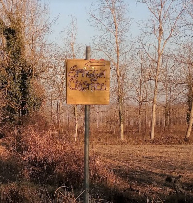
5. Quale struttura si può vedere in lontananza a sinistra della spiaggia?
6. Allega alle risposte una foto della spiaggia (anche senza viso)
Dopo aver inviato le risposte potete loggare direttamente come FOUND IT. Se le risposte fossero sbagliate vi contattò per ulteriori chiarimenti. Se loggate senza prima di aver dato le risposte, il log verrà cancellato senza alcun preavviso.Per favore non scrivere le risposte nel log, ma inviale attraverso un messaggio privato.

ENG: Along the Tanaro river, between the municipalities of Verduno and Polenzo, is the Spiaggia dei Cristalli. Once at the beach you can see several layers of rocks: clays, limestone and gypsum crystals. The most ancient rocks are made up of alternating layers of clay and blackish limestone and are rich in marine fossils (fish, molluscs, foraminifera) which indicate the presence of an ancient deep sea. Looking towards the higher layers, however, the fossils decrease until they disappear completely, just below the first bank of gypsum crystals, indicating the establishment of environmental conditions not suitable for life and documenting the beginning of the Messinian (5 -7 million years ago) in the Piedmont basin. The sudden appearance of gypsum crystals records a dramatic environmental and climatic change, called the "Messinian salinity crisis" of which there is evidence in many parts of Italy (Piedmont, Emilia Romagna, Sicily). Due to the establishment of a hot and arid climate, linked to the closure of the Strait of Gibraltar due to geological causes, the sea water of the Mediterranean Sea, which at that time extended to these areas, had a very strong evaporation and dissolved salts in the water, remaining on the bottom, they went to form extensive levels of anhydrite, gypsum selenite and rock salt crystals.
In the beach of the Verduno crystals it is possible to observe 2 banks of selenitic gypsum, consisting of twin crystals in the shape of a "V".
Since this is a beach along a river, before the visit it is advisable to check the conditions of the Tanaro river, as access can become dangerous during periods of flood. Some sections of the Messinian succession exposed on the right bank of the Tanaro, right in front of the Crystal Beach, are submerged for most of the year.
Questions for permission to log in:
1. What layers of rocks can be observed?
2. What is a dramatic environmental and climate change called?
3. How did the crystal levels form?
4. What shape are the selenite gypsum benches?
5. Which structure can be seen in the distance to the left of the beach?
6. Attach a photo of the beach (even without a face) to the answers
After sending the answers you can log in directly as FOUND IT. If the answers were wrong I contacted you for further clarification. If you log in without first giving your answers, the log will be deleted without notice. Please do not write replies in the log, sent a private message.