On the 1888-1913 Ordnance Survey map, a roman road is clearly shown at this location. But was this really what it was?
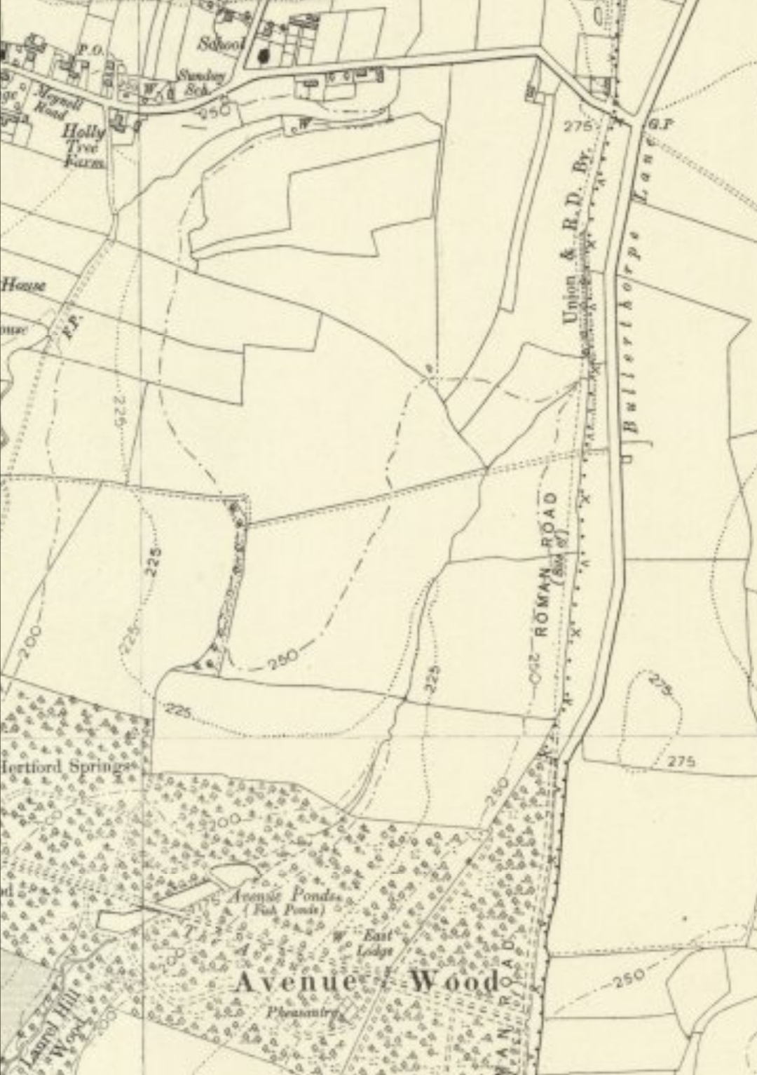
The route of "Rikenildstrete" was recorded by English chronicler Ranulf Higden in 1344, described as going from St. Davids in South Wales, through Hereford, Birmingham, Lichfield, Derby, Chesterfield and York, to the Tyne estuary. In 1720, the cartographer John Warburton included a Roman way he marked as “Rickeneild Street Way” running through Chesterfield, Rotherham, Woodlesford, and on to Boroughbridge as part of his Map of Yorkshire. In his book Roman Roads in Britain, Ivan Margary believes the feature, a section of embankment up to 4ft high alongside Bullerthorpe Lane (formerly Street Lane), to be a surviving portion of Roman road.
However, subsequent excavations show the feature to be part of the rampart of the linear earthwork Grim’s Ditch. And the discovery of a direct road between Templeborough and Thorpe Audlin has (probably) solved the mystery of Ricknild Street.
The West Yorkshire Grim's Ditch (there are several in the UK!) is a linear earthwork consisting of a substantial bank with a deep, rock-cut ditch on its east side. It lies to the east of Leeds and the known remains extend northwards for approximately 3.5 km, from just north of the River Aire at Gamblethorpe Farm, Swillington, to Cock Beck on Whinmoor. Grim's Ditch still survives in several places as a visible earthwork.
The most likely context for the construction of Grim's Ditch has always been thought to be as a defence for the British kingdom of Elmet, and in particular its major centre, Leeds, against the advance of the Anglo-Saxons in the early 7th century AD. However, preliminary results from excavations of a section of Grim's Ditch at Colton suggest that the ditch was open during the Roman period. Both the bank and ditch can be seen for most of a 1.8 km stretch, extending from the A1-M1 link road at the south edge of Avenue Wood, Temple Newsam, to the A63 at Colton. Lengths of ditch are also visible at Gamblethorpe Farm, and at the base of a scarp south of Barrowby Road, Austhorpe. The remaining known course of Grim's Ditch is not a visible earthwork, but it has been located by means of excavation and geophysical survey. The size and extent of Grim's Ditch implies a considerable expenditure of time and labour, and also suggests a degree of social organisation at the time of its construction.
You're looking for reasonably-sized test tube style container, hidden at the co-ordinates given. Thanks to roadsofromanbritain.org and Historic England for the information. Placed (with kind permission) as part of a loose series of caches across the Temple Newsam Estate. Placed with kind permission of Temple Newsam Estate. Operculo Rubrum. Benediximus.
Congratulations to 0RIN0C0 for the FTF.