Le Poljé du lac des Taillères
Le lac des Taillères se situe dans une vallée fermée appelée un « poljé » qui est une dépression karstique à fond plat fermé par des versants rocheux plus ou moins escarpés de type calcaire.
Dépression fermée : poljé
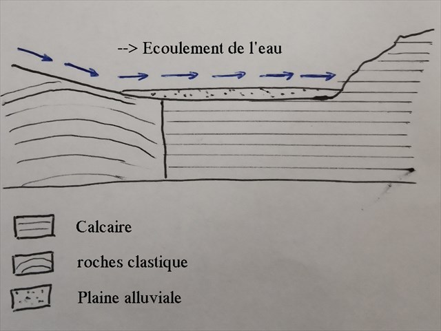
Le lac est alimenté par des filets d'eau de pluie, et des sources individuelles dans le lac lui-même ; il n'a pas de gros affluent apporteur de flux.
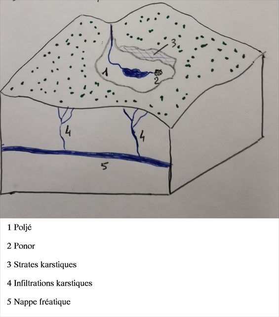
Les eaux du lac sont évacuées par trop plein par un trou au fond du poljé appelé « ponor ».
Vous vous trouvez devant un ponor qui a été aménagé.
Les eaux du lac par trop plein s'écoulent dans ce ponor et empruntent un réseau sous-terrain avant de rejoindre 6km plus au sud la source karstique de l'Areuse.
Pour loguer cette earthcache, envoyez moi vos réponses pour les questions suivantes par messagerie
-Expliquez avec vos propres mots ce qu'est un ponor.
-Combien de kilomètre à vol d’oiseaux parcours l’eau avant de ressortir.
-Expliquez pourquoi à votre avis ce ponor a été aménagé.
-Une photo prise aux coordonnées du listing est biensur appréciée.
Loguez cette cache "Found it" et envoyez-moi vos propositions de réponses soit via mon profil, soit via la messagerie geocaching.com (Message Center), et je vous contacterai en cas de problème.
The Polje of Lac des Tailleres
Lac des Taillères is located in a closed valley called a "poljé" which is a flat-bottomed karst depression closed by more or less steep limestone-type rocky slopes.
Closed Depression: polje
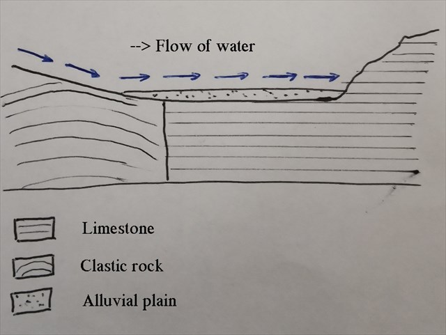
The lake is fed by trickles of rainwater, and individual springs in the lake itself; it does not have a large tributary providing flow.
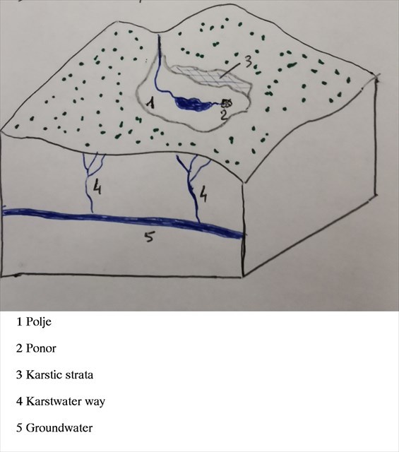
The waters of the lake are drained by overflow through a hole at the bottom of the poljé called "ponor".
You are in front of a ponor which has been fitted out.
The waters of the overflow lake flow into this ponor and take an underground network before reaching the karst source of Areuse 6km further south.
To log this earthcache, send me your answers to the following questions by messaging
-Explain in your own words what a ponor is.
-How many kilometers as the crow flies the water before exiting.
-Explain why in your opinion this ponor was fitted out.
-A photo taken at the coordinates of the listing is of course appreciated.
Log this "Found it" cache and send me your suggested answers either via my profile or via geocaching.com messaging (Message Center), and I will contact you in the event of a problem.