The Tuia Mātauranga Pōkai Whenua GeoTour follows the footsteps of early explorers of Aotearoa New Zealand taking you to places where leaders of the past searched for food, resources and ways to adapt and survive in this new land.
Use the Pōkai Whenua GeoTour as your classroom to explore the stories of the past, in the present, to preserve what is unique in Aotearoa New Zealand for the future.
Collect the codewords to get the Geocoin puzzle piece.
To be able to complete this GeoTour and receive your special Geocoin collectable, remember to take a note of the codeword placed in the cache. This will need to be recorded in your passport which can be downloaded here
|
63 of the 150 Pōkai Whenua GeoTour caches will contain a randomly placed special FTF token (a replica of the Tuia Mātauranga GeoTour commemorative coin). This is yours to keep! If you find more than one, you might consider leaving it for the next person who finds the cache.
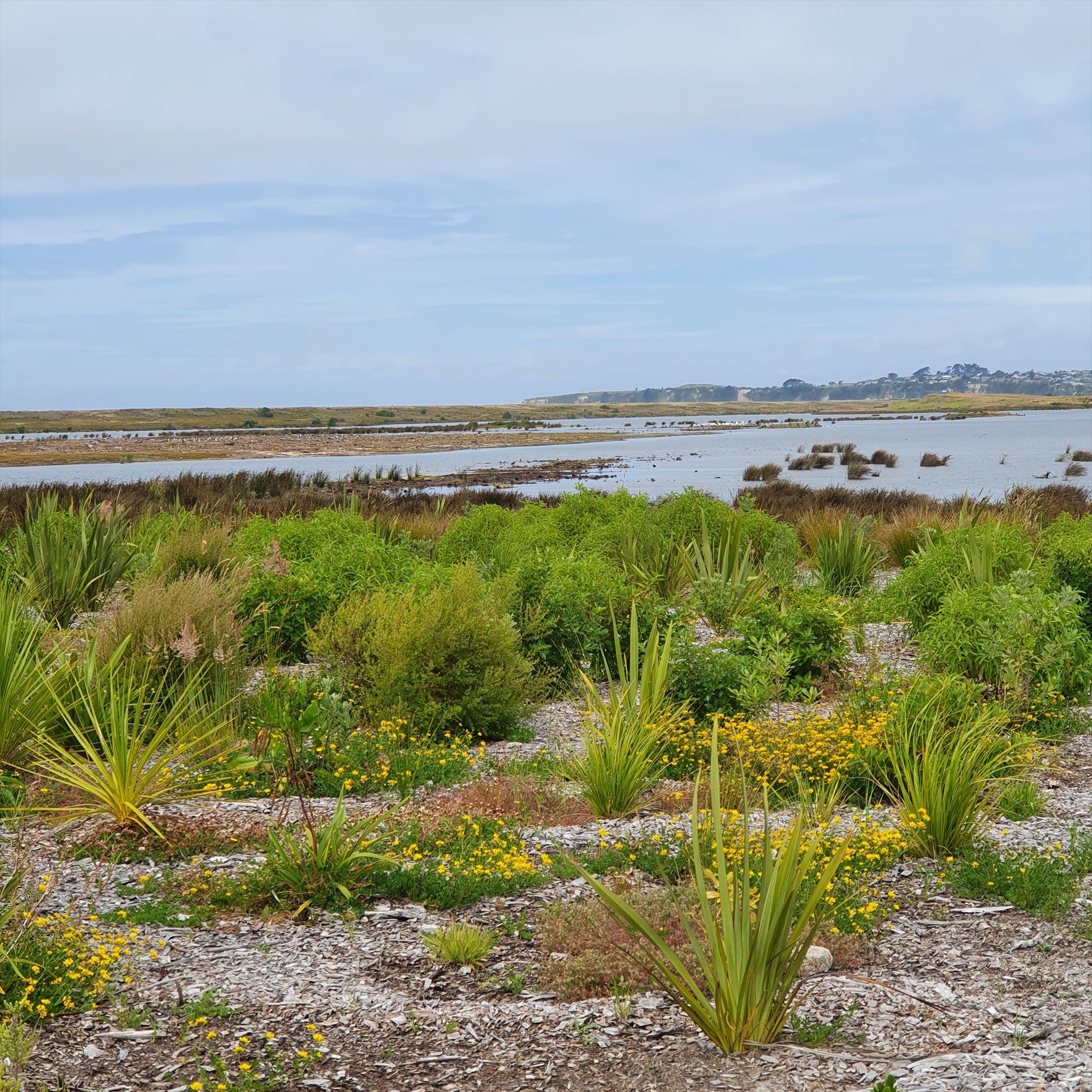
The Kaituna River was diverted in 1959 to enable the land to be drained and farmed. This caused a significant loss of estuary and wetlands which in turn upset the ecosystem, greatly reducing the fish, birdlife and estuarine plants. Tangata whenua and local residents became very concerned about the health of the estuary and had called for a re-diversion for nearly 20 years. In June 2020 this re-diversion was completed. Earlier 22 hectares of Ngāti Whakaue and Tapuika owned land was converted into wetlands, providing new breeding and feeding grounds for birds and fish. This is part of the re-creation of 70 hectares of wetland beside the Kaituna River, with a further 120 hectares planned by 2029. With the re-diversion now finished 45 hectares of shallow water and salt marsh have been restored. The health of the estuary is already showing signs of improvement. Almost all of the algal mats that were clogging and removing oxygen from the estuary sediments are now gone. The number and variety of shell fish and marine life is up. There is a reduction of mud in the upper estuary.
Wetlands help to absorb flood water and keep streams and rivers clean by filtering run-off. They also provide habitat for many threatened native plants and animals. This extended reserve area contains a small remnant of a once vast wetland beside the lower Kaituna River. It is one of the largest remaining wetlands in the region but much smaller than the original taonga (treasure) that was prized for its abundance of tuna (eels), harakeke (flax) and kaihikatea forests.