
Location:
Welcome to the extinct volcano Mt Buninyong. In order to complete this Earthcache you will need to walk from the parking spot and follow the “crater walk” to reach the crater of Mt Buninyong. The walk is approximately 1 km and will require a moderate amount of fitness to complete.
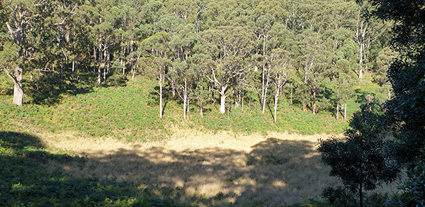
Mt Buninyong is known as a composite lava and scoria cone. This is because it consists of both lava and scoria. The scoriaceous component is built up into a volcanic cone which is breached on the north-western side. The cone rises to a height of 745 m above sea level and has local relief of over 200 m. The flanks of the cone slope at angles up to about 35°. This is the angle of repose of loose scoria at which the latter could be supported without collapse at the time of eruption.
The scoria cone of Mt Buninyong was produced by an explosive eruption, whereas its associated lava flows are the result of much quieter, effusive eruptions. The difference between an explosive eruption and an effusive one is commonly the proportion of gas in the erupting magma (molten rock). The lava flows had little gas – except for the initial stage of the second eruption which breached the scoria cone – and cooled to form coherent bluestone. Similar bluestone is a common material in early colonial buildings and gutters in the area.
Geology is an historical science, and it is important to determine the relative age of geological materials and events. In the case of Mt Buninyong, recent work proposes an age of about 200,000 years (200 ka). This most likely makes Mt Buninyong the youngest volcano in the Central Highlands other than Mt Franklin (Larnebarramul), near Daylesford (≤130 ka). It also means that Mt Buninyong is one of a number of cones and craters in the Central Highlands and the Victorian Volcanic Plains that testify to an increase in volcanic activity in the Newer Volcanic Province between about 200 ka and 100 ka.
At this location you will find a sign headed "The making of a mountain". Once you have the answers to these questions please send them to the geocacher McAdies and log your find. Any logs without answering these questions will be deleted.
NOTE! please don't send your answers to the Ballarat GeoTour account, but instead send to McAdies
Questions
- Using the sign as a reference point approximately how far across in meters from this point is the cone now? Do you think it would be larger or smaller than when the eruption occurred and why?
- Does the shape of Mt Buninyong have a traditional volcanic shape or is one side of the crater higher than the other? Why is this the case?
- Take a photo (selfie) in the crater or with the crater in the background. If you do not want to be in the photo a photo with your caching name on it with the crater in the background would suffice. (Please do not take a photo with the information board in it!)
Ballarat GeoTour:
This cache is placed as part of the Ballarat GeoTour. This GeoTour was made possible after receiving a grant from VicHealth as part of their Reimagining Health grants in 2020. To discover more caches in the Ballarat GeoTour please visit: https://geocachingvictoria.com.au/ballarat-geotour
