Undermillbeck - The Tump
According to www.hill-bagging.co.uk there are about 17,000 Tumps in the UK, 704 of which are in Cumbria and about 6 in the Winster Valley. A Tump is a hill which is separated from adjacent tops by a height difference of at least 30 metres on all sides.
This is a visit to a Tump in the Winster Valley. It’s in Open Access Land (OAL) so there’s no need to go asking the land owner for permission to climb his tump.

The easiest access is from the east where the OAL meets the lane near Mitchelland Farm. Follow the track by the wall until it fizzles out, to avoid a fenced area and the gorse. See map route in gallery.
There is a stone wall separating the two halves of Undermillbeck Common with only one crossing point, where the wall is broken and you can duck under the fence. See marked trail head. Believe me, I have walked that wall from top to bottom and that is the only crossing place.
There is better walking on the west side of the Common and of course 2 geocaches. Its possible to design some circular walks using the break in the wall. The footpath north to Lindeth is delightful
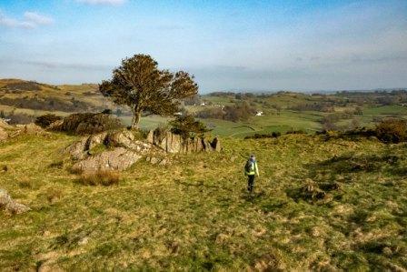
The cache is in a screw top pot at the summit where you can log the cache and bag the tump.