This cache is one of 31 caches - part of the WGA IAT Series - hidden to highlight Wisconsin's Ice Age Trail. See the bookmark list for all of the geocaches included in this series!
The Timberland Hills Segment traverses both Burnett and Barron Counties. It follows mostly ski and snowshoe trails on hilly terrain through the Timberland ski areas, passing some scenic small lakes and wetland areas along the way. Hikers should watch closely for the yellow blaze signs. This portion of the trail is quite hilly, often steep and may have wet areas at the bottoms of the hills. It continues on through a fine stand of white pine and over a bridge. On the east side of this section, hikers will follow a narrow track alongside some wetlands and beaver ponds, passing by a Leopold bench overlooking a scenic pond. The trail finishes through a blueberry patch and down a steep hill ending near a log fish carving.
This cache is a short hike near one of the oldest geocaches active in Wisconsin GC841 VIK-01, hidden in April 2001.
Burnett County Forest 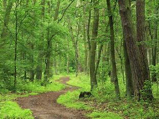 The Burnett County Forest was established in 1932 and covers more than 111,000 acres today. Through investment and management by the county with assistance from the Wisconsin Department of Natural Resources, the lands have recovered from past destructive fires and failed farms and matured into productive forests, rich in species diversity and natural features. This large-land base includes a broad variety of landscapes, forest vegetation, water resources, soils, and trails. ENJOY!!
Wisconsin's Last Glacier
Movement of the Laurentide Ice Sheet was shaped—to a certain extent—by the landscape. Highlands diverted the glacier into lobes (tongues or fingers of ice) that advanced into the lowland areas.
The Lake Michigan Lobe of the glacier flowed down the Lake Michigan lowland to central Indiana and Illinois. The Langlade, Wisconsin Valley, Chippewa, and Superior Lobes covered northern Wisconsin. The Green Bay Lobe flowed south in the Green Bay lowland, advancing over the east end of the Baraboo Hills and into both ends of Devils Lake gorge.
The edge of the Green Bay Lobe was probably a steep ice slope, perhaps several hundred feet high, littered with rock debris. Behind the steep slope, the ice surface probably rose very gently toward the center of the ice sheet, where the ice was thousands of feet thick.
The Ice Age National Scenic Trail is one of only 11 national scenic trails in the U.S. It is approximately 1,200 miles long and the entire trail is located within Wisconsin! The trail follows the edge of Wisconsin's most recent glacier and highlights many geological features along the way. The western terminus is located in Interstate State Park in Polk County and continues through a total of 30 counties with the eastern terminus located in Potawatomi State Park in Door County.

WISCONSIN GEOCACHING ASSOCIATION
The Wisconsin Geocaching Association (WGA) is a group of geocachers dedicated to promoting and protecting geocaching within the state of Wisconsin. The WGA organizes geocaching events, works with land owners/managers on geocaching policies, educates the public at large about geocaching, and facilitates communication between WGA members. To learn more about the WGA click on our logo below!
This cache placed by the WGA

|