Bald Hill is part of the Ronkonkoma Moraine, which runs east to west along the center of the Town of Brookhaven, and marks where the glacier which formed Long Island stopped its advance.
Moraines are glacial deposits of till (sediment) classified by their position relative to the glacial ice sheet. Moraines are formed of the sedimentary materials of varying sizes. Accordingly, they are poorly sorted and are essentially the sedimentary "dump" of material broken, dislodged, smashed, ground, and then deposited during the movement of glaciers. As a result of all this grinding & crushing, the till is often made up of rounded stones.
Moraines are described as terminal moraines, lateral moraines, medial moraines, or ground moraines and they form at the ends of the glacial sheet. The moraine that forms at the farthest extent of movement of the glacier is termed the terminal moraine. Lateral moraines are deposits of till that accumulate along the lateral margins (edges) of the glacial sheet. As different glacial sheets join, the corresponding fusion of lateral moraines forms a medial moraine. Ground moraines form from deposits beneath the glacial sheet.
Moraines are geomorphologic features that can last long after glacial melting, and moraines often form the base for varied and hilly landscapes in areas subject to periodic glaciation. Moraines can themselves be reshaped by subsequent glaciations; thus, moraine patterns are often used to determine the extent and pattern of glaciations from which further information regarding climate changes can be derived.
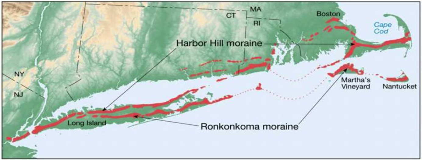
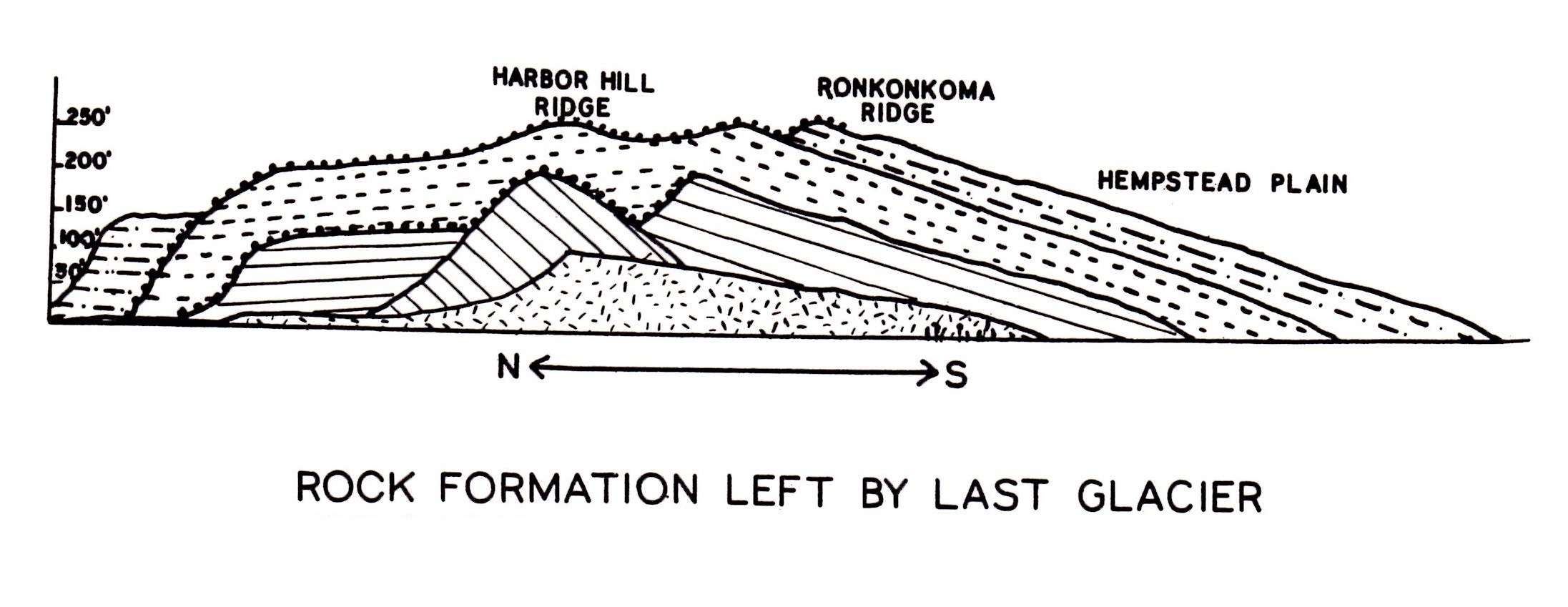
Long Island, is formed largely of four spines of glacial moraine, with a large, sandy outwash plain towards its barrier islands and the Atlantic Ocean. These moraines consist of gravel and loose rock left behind during the two most recent pulses of Wisconsin glaciation some 21,000 years ago (19,000 BC). The northern and most recent moraine, which directly abuts the North Shore of Long Island at points, is known as the Harbor Hill Moraine. The earlier formed and more southerly moraine, known as the Ronkonkoma Moraine, forms the "backbone" of Long Island; it runs primarily through the very center of Long Island, roughly coinciding with the length of the Long Island Expressway. The land to the south of this moraine to the South Shore is the outwash plain of the last glacier, much of which has been submerged as ocean levels rose in the post-glacial period. Part of this, known as the Hempstead Plains, supported one of the few natural prairies to exist east of the Appalachian Mountains.
The glaciers melted and receded to the north, resulting in the difference between the North Shore beaches and the South Shore beaches. The North Shore beaches are rocky from the remaining glacial debris, while the South Shore's are crisp, clear, outwash sand. The glaciers also formed Lake Ronkonkoma, a kettle lake.
Bald Hill is one of the highest points on Long Island at 320 feet above sea level. Dedicated on November 11, 1991, the Vietnam Veterans memorial includes a 100-foot high obelisk-shaped monument, painted red, white, and blue. The monument was constructed under the guidance of the Suffolk County Vietnam Veterans Memorial Committee.
To claim a find for this cache you must send a message to the cache owner with answers to BOTH OF the following questions:
(a) As you hike around Bald Hill, take a look at all the rocks - though much of the area has been landscaped, the area by the white pine tree at GZ and at many of the other tree bases show evidence of the natural make-up of the land. Remember this is really a big pile of rocks that was pushed along by glaciers. Find some of these glacier-ground rocks on your hike, describe & take a picture of them. What is the general make up of this till (is it rocky, sandy, mixture?) as seen at the cache coordinates?
(b) Of the 4 types of moraine mentioned above, what type of moraine is the Ronkonkoma Moraine and why?
(Optional) Post a picture of you or your GPSr at the monument.
Cache logs must have answers submitted within a month or the log will be deleted. Please, no spoiler photographs or postings. If one cacher submits answers for a group, please include all cacher names with the answers.
