!!THIS IS A LOW CELL SERVICE AREA. FOR THAT REASON, DIRECTIONS ON HOW TO FIND THE CACHE ARE BELOW. IT IS RECOMMENDED TO DOWNLOAD THE CACHE AND THE INSTRUCTIONS BEFORE VISITING!!
BERTHOUD FALLS
 Berthoud Falls crashes loudly 25 feet into a forested ravine.
The namesake of Berthoud Falls (the town located nearby) doesn't have an obvious connection to any waterfall on a map. But obviously it has a waterfall somewhere right? It’s named Berthoud Falls for a reason, but there is no official Berthoud Waterfall that exists in the eyes of the USGS. Tracing back the origins of the town, there are three main possibilities that I think exist:
A small cascade that is more of a gulch than a waterfall, located at 39°46'22.8"N 105°48'32.1"W. This one is what is recognized on the World Waterfall Database as the namesake of Berthoud Falls, but after visiting it I really don't think this is THE Berthoud Falls. These falls are a drainage gulch that drops a total of 1,200 feet down the mountainside and underneath US 40. Apart from being a long cascade, there aren't any major drops of more than 10 feet on any topographical maps. Since it is totally and completely fueled by melting snow, unless there is heavy runoff the "falls" is barely noticeable and isn't likely the namesake.
A union between an unnamed creek and Hoop Creek that may have a steep drop based on topographical maps. This isn't the "Berthoud Falls Cascades" that are further up US 40. Though it is a very pretty place to visit and marked on the database as "Hoop Creek Falls," there is already a cache there so you won't be seeing one of these up there. Instead, these falls would be deep within the forested mountainside and likely very difficult to get to. The approximate location for this falls is 39°46'51.3"N 105°47'06.2"W. This one is unlikely because it is a mile east of the actual township, and Hoop Creek almost completely dissapates before reaching the cvalley that the town sits in.
Of course, I think where this cache is holds the location to the real Berthoud Falls. I believe that this is the actual falls as it lies on the main creek that the town sits on (West Fork Clear Creek), is right next to the town's limits, and is the most powerful and constantly flowing waterfall out of the three. Here, the creek gushes and foams through a slotted canyon and shoots out like a cannon 25 feet, before carving its way deeper into a ravine. I have visited this spot multiple times and have always believed it is the true Berthoud Falls!
Anyways, here's how to get to this amazing place:
HOW TO FIND
First of all, you'll want to make your way to the Big Bend Picnic Area, a cute little place with tons of picnic benches and great views of the surrounding area. It's usually not that busy, at least when I've visited.
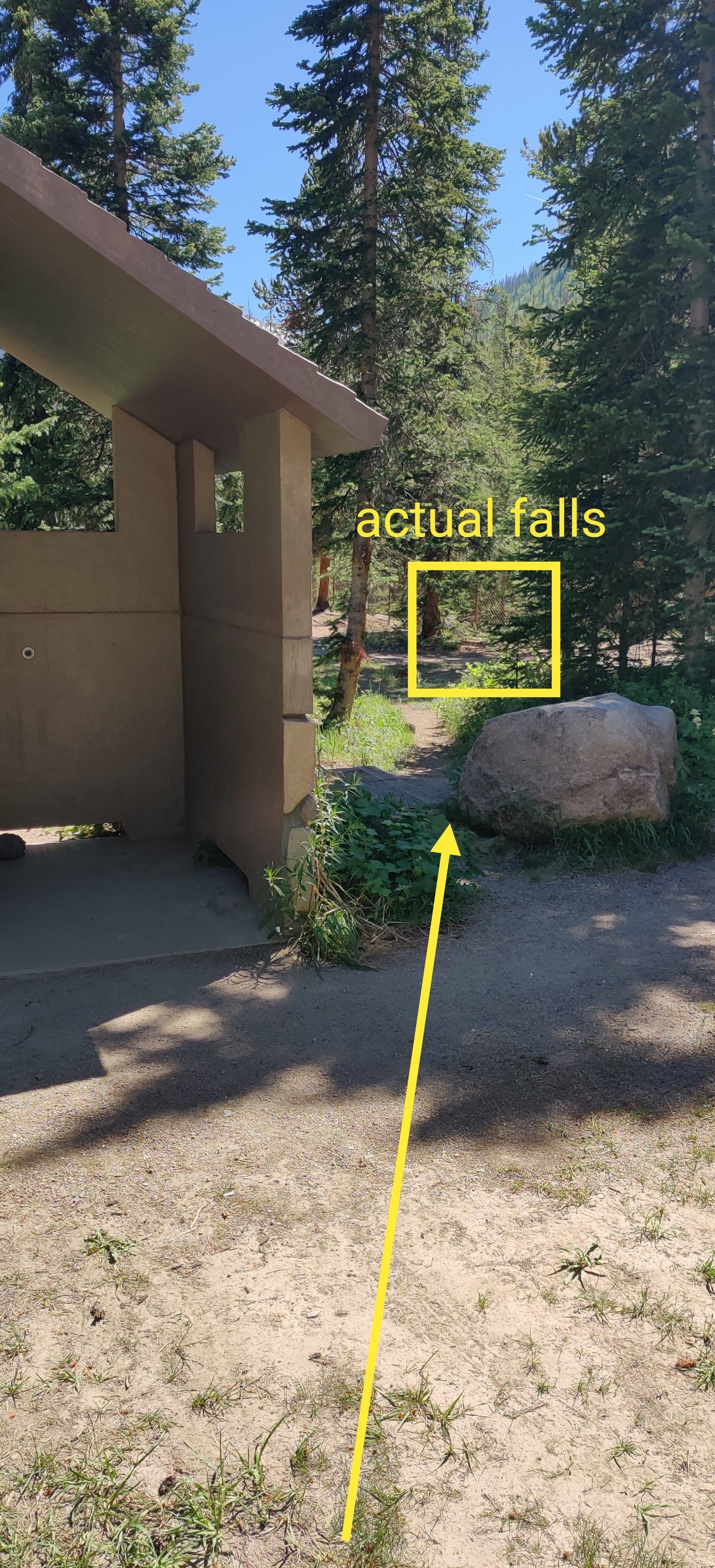
From the restrooms, head straight back to the fences. You'll hear rushing water and soon enough Berthoud Falls will be in front of you! This is the best (safe) view of the falls. The picture at the top of the cache page is the view you will have. I have seen people scramble to the bottom but never tried it myself. I think the fence is there for a reason.
There are two main drops, and you can see the second (admittedly much smaller) drop from the cache location.
Follow the gates downstream. Eventually they will end. There might be some muggles having a picnic out here so be stealthy!
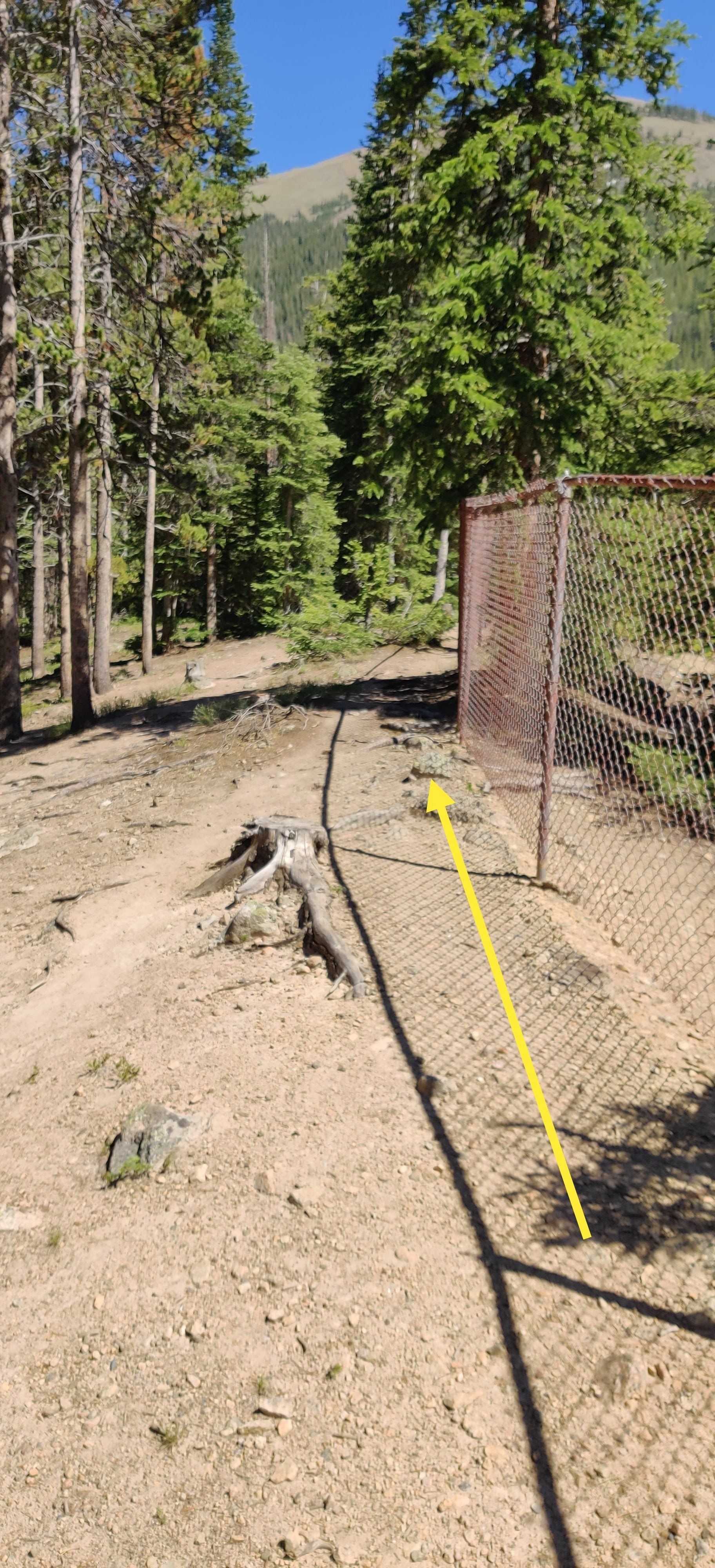
 Once the gates end follow the cliff around and make sure to stay back! The drops are sheer here.
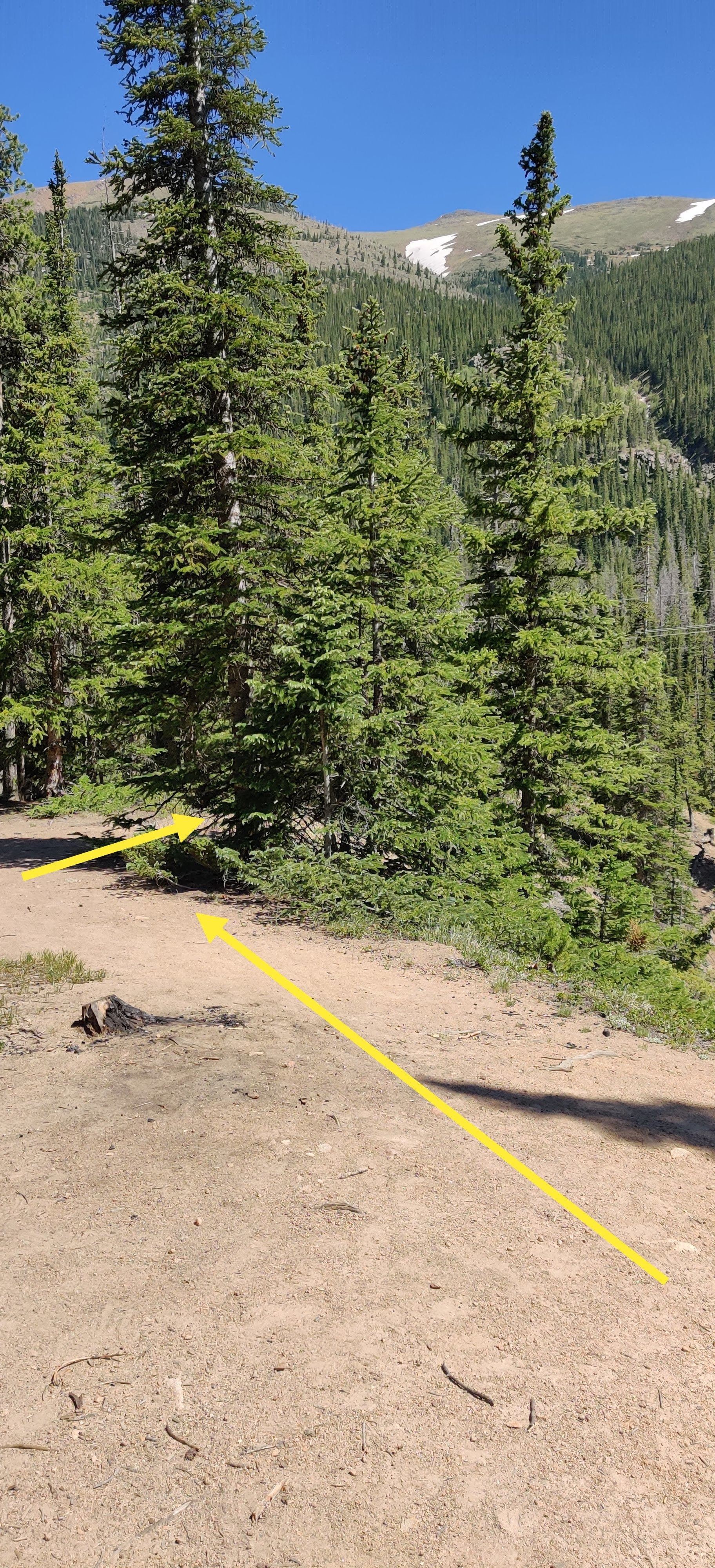
 Eventually you will make it to this tree/bush hybrid. This is the cache's location. It is underneath the tree and will definitely not be accessible if there is any snow. So plan accordingly!
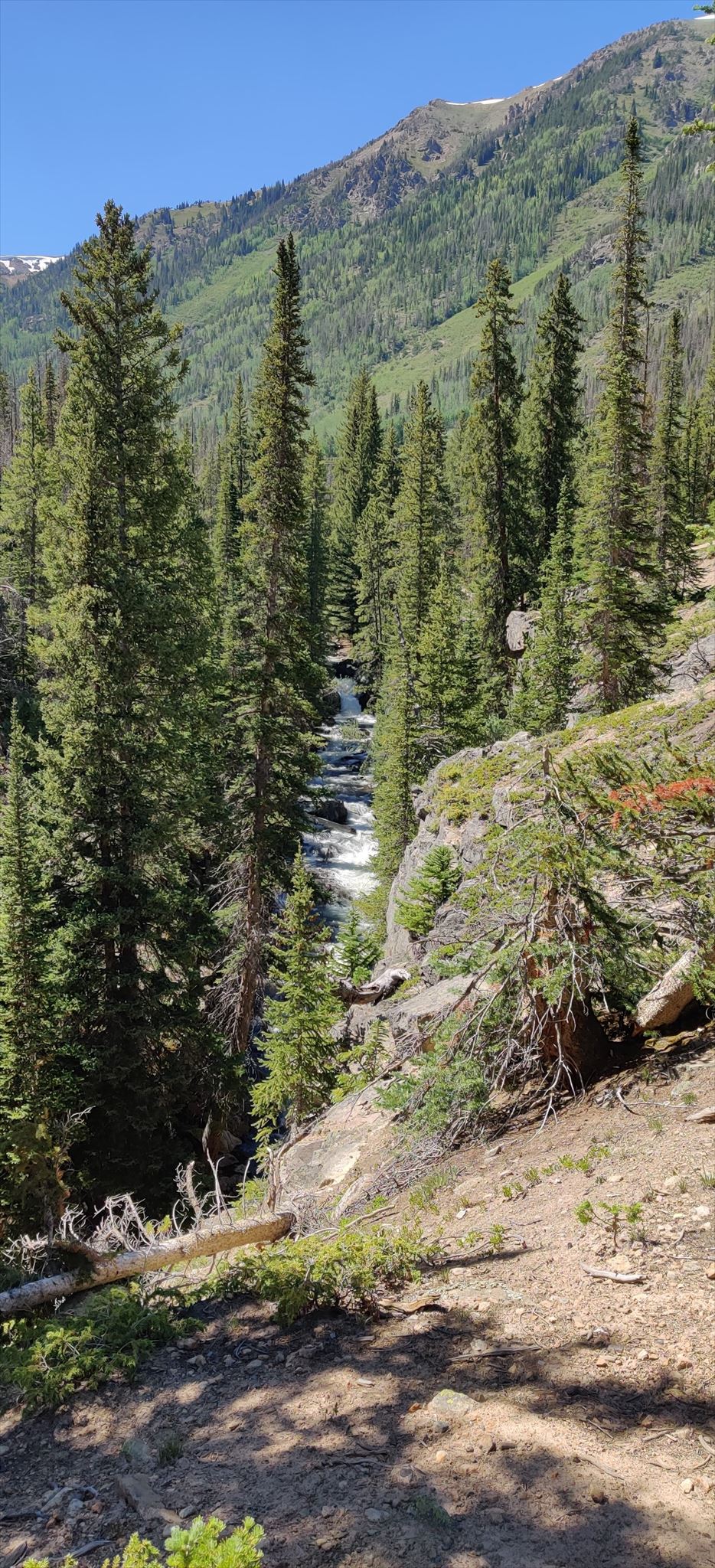 Views of the canyon + lower Berthoud Falls. You can see this view directly from the cache's location! Have fun!
This is one of the CO Waterfall Series caches, inspired by worldwaterfalldatabase.com and Marc Conly, author of Waterfalls of Colorado. Other caches in this series can be found here!