Cairn - Special OPOR
The cache, a black film canister, is hidden about 30m away from a large cairn on one of the several trails between the Cow and Calf area and White Wells, which passes above Rocky Valley/Ilkley Crags.
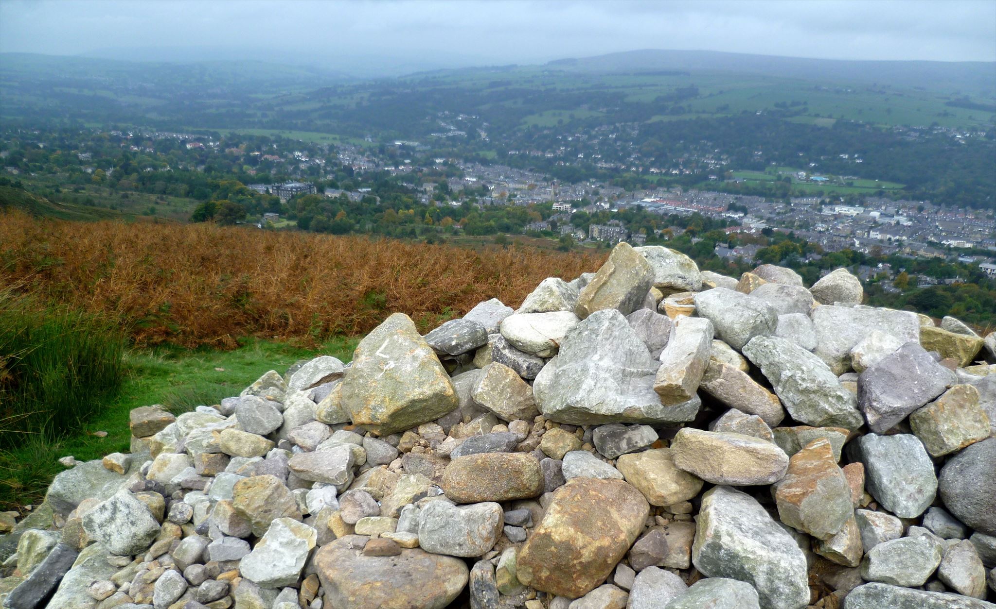
Why such a substantial stone structure should have been be built here is somewhat strange. It is not known to be a historic feature* or to mark a potentially confusing trail or indistinct trail junction. The main feature of its location is that of offers a fine of the Wharfe valley.

To find the cache, first click on the first image above to access the related jigsaw, completion of which will reveal the final coordinates and hint.
To reach the cache location: park at the Cow and Calf car park @ N 53 54.994 W 1 47.992 then after securing your cachemobile, make your way straight up to the top of the ridge then carry on across to the Blackstone Beck crossing @ N 53 54.863 W 1 48.407. Cross over the beck and proceed straight up the slope opposite following the path above Ilkley Crags and on to the cache location.

*The most noteworthy cairns on Rombald's Moor are scheduled ancient (Bronze Age) monuments - The Great Skirtful of Stones @ N 53 53.843 W 1 47.215 (see here, here and here) and The Little Skirtful of Stones @ N 53 54.162 W 1 47.453 (see here and here) to the south-east on Burley Moor.
Cairn (from middle Scottish Gaelic) means 'a mound of stones built as a memorial or landmark'. Cairns have been and are used for many purposes. They are often erected as landmarks, but since prehistory they have also been built and used inter alia as burial monuments; for defence and hunting; for ceremonial purposes (sometimes relating to astronomy); to locate buried items (such as caches of food or objects - or simply caches!); and to mark trails.

They are used (as may be the case here) as trail markers in many parts of the world, in uplands, on moorland, on mountaintops, near waterways and on sea cliffs, as well as in barren deserts and tundras.
They vary in size from small stone markers to entire artificial hills, and in complexity from loose conical rock piles to delicately balanced sculptures and elaborate feats of megalithic engineering. Cairns may be painted or otherwise decorated, whether for increased visibility or for religious reasons.

Different types of cairns exist from rough piles of stones to interlocking dry stone round cylinders. The most important cairns commonly used around the world are interlocking stone survey cairns constructed around a central survey mark about every 30 km on the tallest peaks across a nation. These physical survey mark cairn systems are the basis for national survey grids to interconnect individual land survey measurements for entire nations.
Placed at regular intervals, a series of cairns can be used to indicate a path across stony or barren terrain, even across glaciers. Such cairns are often placed at junctions or in places where the trail is not obvious to prevent hikers getting losing their way. They may also be used to indicate an obscured danger such as a sudden drop, or a noteworthy point such as the summit of a mountain.

Most trail cairns are small, usually being a foot or less in height. However, they may be built taller so as to protrude through a layer of snow. Hikers passing by often add a stone, as a small bit of maintenance to counteract the erosive effects of severe weather.
Modern cairns may also be erected for historical or memorial commemoration or simply for decorative or artistic reasons. One example is a series of many cairns marking British soldiers' mass graves at the site of the Battle of Isandlwana, South Africa.

In places with fantastic rock formations, such as the Grand Canyon, tourists often construct simple cairns in reverence of their larger counterparts.
By contrast, cairns may have a strong aesthetic purpose, such as in the art of Andy Goldsworthy. See the short video on the construction of the Strangler Cairn here, and click Rivers and Tides (2001) and Leaning Into The Wind (2018) for full-length documentaries on his amazing work.

Burial cairns and other megaliths (such as the Skirtful of Stones mentioned above) are the subject of a variety of legends and folklore throughout Britain and Ireland. In Scotland, it is traditional to carry a stone up from the bottom of a hill to place on a cairn at its top. In such a fashion, cairns would grow ever larger. An old Scottish Gaelic blessing is Cuiridh mi clach air do chàrn, 'I'll put a stone on your stone'.
In Highland folklore it is recounted that before Highland clans fought in a battle, each man would place a stone in a pile. Those who survived the battle returned and removed a stone from the pile. The stones that remained were built into a cairn to honour the dead. Cairns in the region were also put to vital practical use. For example, Dún Aonghasa, an all-stone Iron Age Irish hill fort on Inishmore in the Aran Islands, is still surrounded by small cairns and strategically placed jutting rocks, used collectively as an alternative to defensive earthworks because of the karst landscape's lack of soil.

In Genesis 31 the cairn of Gilead was set up as a border demarcation between Jacob and his father-in-law Laban at their last meeting.
Coastal cairns called sea marks are also common in the northern latitudes, and are placed along shores and on islands and islets. Usually painted white for improved offshore visibility, they serve as navigation aids and are indicated in navigation charts and maintained as part of the nautical marking system.
They are also used on land as sea cliff warnings in rugged and hilly terrain in the foggy Faroe Islands. In the Canadian Maritimes, cairns have been used as beacons like small lighthouses to guide boats, as depicted in the novel The Shipping News.

See here for more info on these special piles of rock.
The seemingly increasingly popular practice of building 'cairns' or balancing rocks for recreational, spiritual, artistic (etc) purposes to mark a visit to or passage through an area (and typically post the results on social media) is thoughtless and environmentally damaging.
Not only can it lead to an overabundance of rock piles, distracting from genuine cairns used as genuine navigational guides, it also conflicts with the Leave No Trace outdoor practice ethic which advocates for leaving the outdoors undisturbed and in its natural state.

Moving rocks promotes erosion by exposing the soil underneath, allowing it to wash away and reduce soil cover for native plants. Also, whenever a rock is disturbed, creatures may lose their home, as many insects and mammals burrow under rocks for protection and reproduction'.
See here for an interesting article on this undesirable activity.
And for geocache owners . . . if considering creating an OPOR* to hide your cache, please bear in mind these issues and minimise any potential adverse effects. *Obvious Pile Of Rocks.
