Welcome to another spinoff of the original Calgary History Tour. Like the original series, this cache is designed to give people a little snippet of history on the web page and then direct them to a real place that was part of that history. Calgary doesn't have a very long history, but as you will see, it certainly is interesting and often pretty colourful!
Glenmore Dam
Anyone living in Calgary today is likely quite familiar with the Glenmore Reservoir, a 3.84 km2 (950 acre) human-made reservoir that supplies Calgary with its drinking water. It’s a popular spot for boating and fishing, and if you’re lucky you may even see the S. S. Moyie sternwheeler take Heritage Park visitors out on a tour! There’s also a wonderful pathway circling the entire reservoir used by many walkers and bikers in the summer. But, the reservoir is not for swimming – entering the water or walking on the ice is a bylaw infraction. The forward-thinking project of the young and optimistic Calgary in the 1920s literally changed the landscape of the city forever, continuing to provide safe and clean drinking water to residents for over a century.
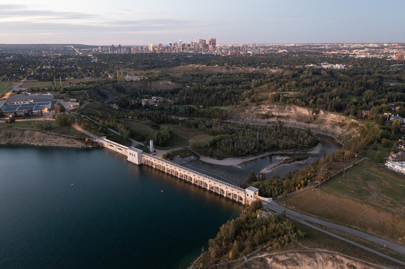 [Glenmore Dam as seen today. Source: Michael Grisdale, Canadian Dam Association]
Before the reservoir, Calgary’s first water utility in the 1890s was a private company supplying river water with no treatment. The City purchased this pumphouse in the year 1900, which had unreliable infrastructure and supplied silty, unclean water. Wanting a long-term solution, the City commissioned a study in 1928, and selected the Glenmore Dam and Reservoir proposal as the best option after a plebiscite in 1929.
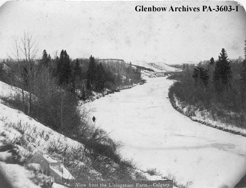
[Elbow River valley at the site of present-day Glenmore Reservoir. Source: Glenbow Museum and Archives]
However, this decision was not without controversy. Not only was the price tag expensive, but it would cause a large area of land to be flooded, most of which was land belonging to the Sarcee Nation, now known as the Tsuut’ina. The Sarcee land was surrendered and subsequently purchased by the City for $50/acre, while non-Indigenous lands were purchased for $111-400/acre. (N.B. The City breached the minimum sale price condition of $90-140/acre, and eventually paid a settlement in 2013 to the Tsuut’ina along with two other longstanding land sale disputes.)
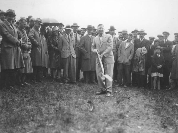
[Sod-turning ceremony in 1930. Source: Glenbow Museum and Archives NC-26-46]
The sod-turning ceremony for the Glenmore Dam took place on July 26, 1930. The city’s largest public works project in its history came at a much-needed time, giving relief work to thousands of Calgarians left unemployed due to the Great Depression. The water purification plant began construction in 1931 – an Art Deco style building using Medicine Hat brick, Tyndall limestone, and French marble. The treatment plant was operational on January 19, 1933, able to supply water for 200,000 Calgarians. The whole project – dam, pumping station, treatment plant and pipeline distribution system – cost $4 million, which is roughly $93 million when converted from 1933 to 2025 dollars.

[Glenmore Dam construction in 1931. Source: Calgary Herald archive photo]
Demand was underestimated, however, as the system was already struggling to keep up with Calgary’s 150,000 citizens in 1949. Expansions in 1957 and 1965 bolstered the water treatment capacity nearly fivefold from 127 million Litres/day to 630 million Litres/day. However, by 1972 the water need was too great for the Glenmore Dam to be the sole water supply for the city; a second water treatment plant was constructed at Bearspaw.
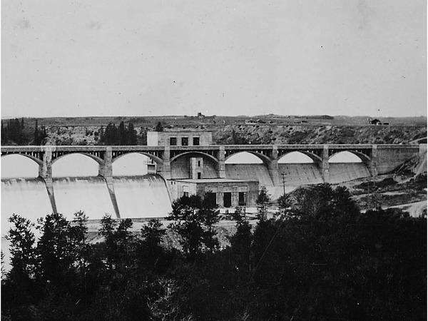
[Glenmore Dam shortly after opening, ca. 1933. Source: Glenbow Museum and Archives NA-2159-13]
The Glenmore Dam is 320 metres long, 20 metres high, and has a base width of 21 metres. Eleven arches support a road/walking path atop the reinforced slip-form continuous pour concrete dam. The dam is a gravity dam, meaning the weight of the dam itself provides the force needed to hold back the water. Extreme flooding in 2005 and 2013 caused water to pour over the top of the dam. Recent upgrades completed in 2020 added 2.5 metres to the height of the dam, amounting to 10 billion litres of extra capacity, and better spillway gates to allow sufficient controlled release for any future flooding events.

[Glenmore Dam spillway, ca. 2012. Source: City of Calgary Inventory of Evaluated Historic Resources]
The name Glenmore Reservoir is attributed to the original name of the area given from an early Calgary settler named Sam Livingston. Sam was born in Ireland in 1828 and immigrated to Canada in the early 1860s after a failed venture in the California gold rush. He moved to the site of the present-day reservoir in 1876, one year after Fort Calgary was established. Sam was a prominent local figure, often called “Calgary’s first citizen”, though the actual first documented European settler arrived 3 years prior to Sam. Sam called the location of his land Glenmore – Gaelic for “big valley”. Part of his house was preserved and resides in Heritage Park today.
Objective
To successfully log this cache, you must complete all of the following tasks (Note that the questions were updated January 2026 due to modernizing the informational signs):
-
At the time of writing, there are three signs at the posted coordinates (N 51° 0.120 W 114° 5.950). Answer the following:
-
Question 1: During the 2013 floods, Glenmore Dam operators had 10 hours to respond to the impending torrential rainwater. What specific action did they take to mitigate damage to the City of Calgary, and how did it affect the peak flow of the Elbow River?
-
Question 2: Which other infrastructure will significantly reduce the risk of the Elbow River from flooding?
-
Question 3: What is the name of the process that captures and removes silt, debris, and micro-organisms from the reservoir water?
-
Question 4: One step of the water treatment process is remove particles by filtration. What two types of media are present in the filtration beds?
-
Question 5: Make your way over to virtual stage 2 (N 51° 0.037 W 114° 5.861). There is a brown sign up high with a street address. What is the name of this building?
-
Question 6: Walk the entire length of the dam. How many semicircular cages cover the spillway gate pulleys? (One cage counts as spanning the floor to the ceiling.)
-
Task: post a photo of the reservoir and/or dam that includes yourself (or part of yourself, like a thumbs up), your GPS, or another geocaching item of your choice that identifies you as the photo taker.
Please message me the answers to the questions (do not post on your log). You must answer all 6 questions and post a photo as described. Failure to meet these strict criteria will result in a deleted log!
Virtual Rewards 3.0 - 2022-2023
This Virtual Cache is part of a limited release of Virtuals created between March 1, 2022 and March 1, 2023. Only 4,000 cache owners were given the opportunity to hide a Virtual Cache. Learn more about Virtual Rewards 3.0 on the Geocaching Blog.